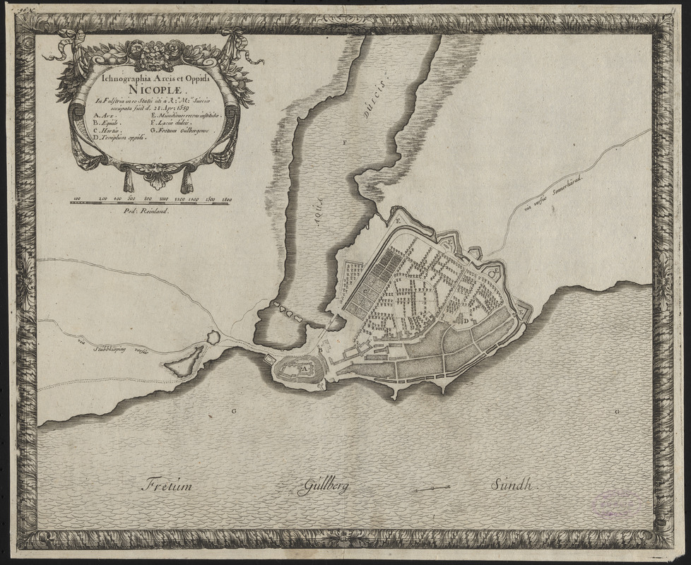
Ichnographia arcis et oppidi Nicopiae : in Falstria in eo statu uti a Ra. Mte. Sueciae occupata fuit d. 28. Apr. 1659
Item Information
- Title:
- Ichnographia arcis et oppidi Nicopiae : in Falstria in eo statu uti a Ra. Mte. Sueciae occupata fuit d. 28. Apr. 1659
- Contributor:
- Pufendorf, Samuel, Freiherr von, 1632-1694
- Cartographer:
- Dahlbergh, Erik Jönsson, greve, 1625-1703
- Publisher:
- Riegel, Christoph
- Date:
-
[1696]
- Format:
-
Maps/Atlases
- Location:
-
Boston Public Library
Norman B. Leventhal Map & Education Center - Collection (local):
-
Norman B. Leventhal Map & Education Center Collection
- Subjects:
-
Swedish-Polish War, 1655-1660--Maps--Early works to 1800
Nykøbing Falster (Denmark)--Maps--Early works to 1800
- Places:
-
DenmarkSjælland (region)Nykøbing
- Extent:
- 1 map ; 23 x 29 cm
- Terms of Use:
-
No known copyright restrictions.
No known restrictions on use.
- Publisher:
-
[Nuremberg] :
[Sumptibus Christophori Riegelij]
- Scale:
-
Scale approximately 1:8,695
- Language:
-
Latin
- Notes:
-
Oriented with north to the left.
Bar scale in "Ped. Reinland."
From Samuel von Pufendorf's De rebus a Carolo Gustavo Sueciae rege gestis commentariorum libri septem. Norimbergae : Sumptibus Christophori Riegelij, 1696. Many plates from this work are attributed to Erik Jönsson Dahlbergh.
"N. 96" --Upper left margin.
Includes references and decorative title cartouche and border.
Conservation of this piece was funded by Anna Kuznetsova-Schafer and Ronald Schafer.
- Notes (date):
-
This date is inferred.
- Identifier:
-
06_01_016409
- Call #:
-
G2070 .P84 1696
- Barcode:
-
30000006603535