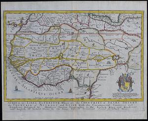
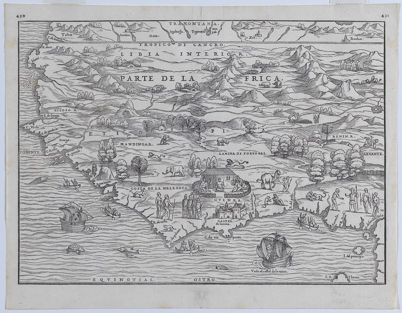
Illustrated map of parte de lAfrica
Item Information
- Title:
- Illustrated map of parte de lAfrica
- Creator:
- Ramusio, Giovanni Battista, 1485-1557
- Creator:
- Gastaldi, Giacomo, approximately 1500-approximately 1565
- Date:
-
1556
- Format:
-
Maps/Atlases
- Location:
-
Phillips Academy
Archives and Special Collections - Collection (local):
-
Map Collections at Phillips Academy
- Places:
-
West Africa (area)
North Africa (area)
- Extent:
- 1 map ; 32 x 41 cm
- Terms of Use:
-
We believe that this item has no known US copyright restrictions. Though not required, if you want to credit us as the source, please use the following statement, "From The Trustees of Phillips Academy." Doing so helps us track how our collection is used and helps justify freely releasing even more content in the future.
This work is in the public domain under a Creative Commons No Rights Reserved License (CC0).
- Scale:
-
Scale not given
- Language:
-
Italian
- Notes:
-
Title supplied by cataloger.
- Notes (date):
-
Date from item or accompanying material.
- Identifier:
-
2017_19