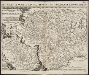
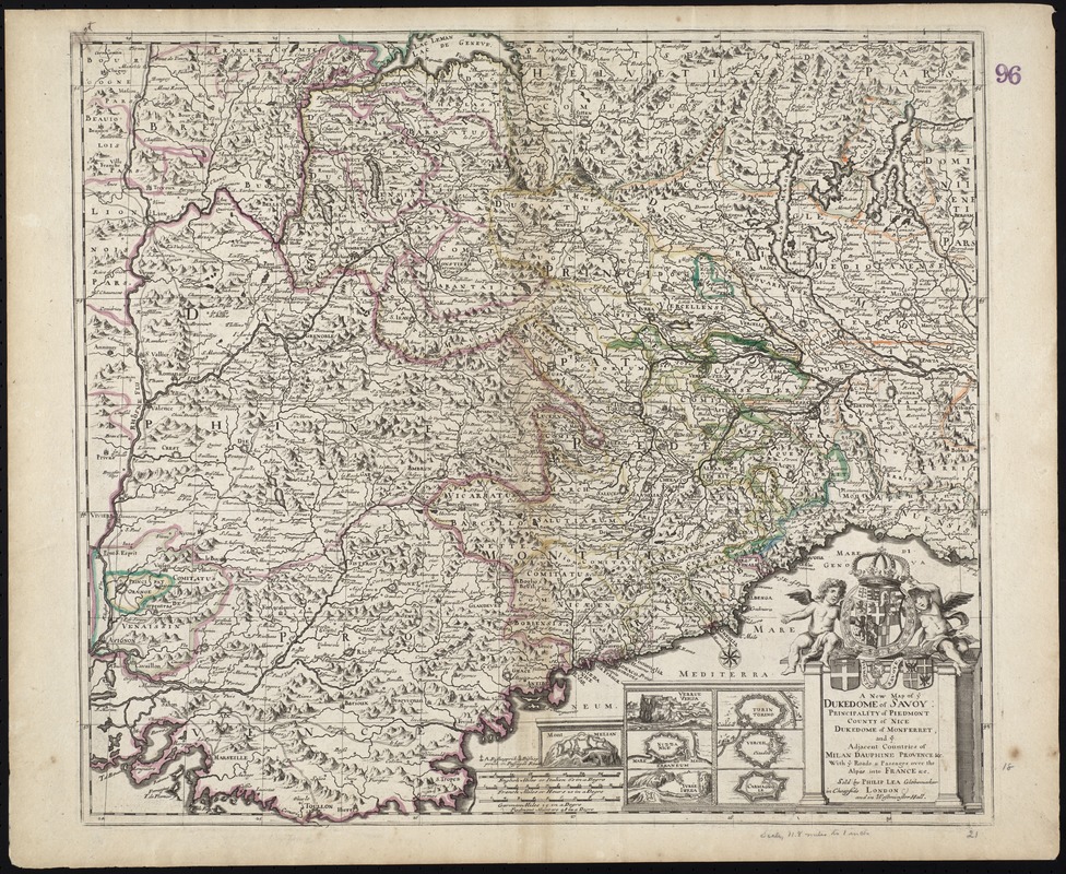
A New Map of ye Dukedome of Savoy, Principality of Piedmont county of Nice Dukedome of Monferret, and ye adjacent countries of Milan, Dauphine Provence &c. with ye roads & passages over the Alpes into France &c
Item Information
- Title:
- A New Map of ye Dukedome of Savoy, Principality of Piedmont county of Nice Dukedome of Monferret, and ye adjacent countries of Milan, Dauphine Provence &c. with ye roads & passages over the Alpes into France &c
- Title (alt.):
-
Collection of old maps
- Creator:
- Lea, Philip, fl. 1683-1700
- Date:
-
[1690]
- Format:
-
Maps/Atlases
- Location:
-
Boston Public Library
Norman B. Leventhal Map & Education Center - Collection (local):
-
Norman B. Leventhal Map & Education Center Collection
- Subjects:
-
Savoy (France and Italy)--Maps--Early works to 1800
Piedmont (Italy)--Maps--Early works to 1800
- Places:
-
Savoy (area)
ItalyPiedmont (region)
- Extent:
- 1 map : col. ; 48 x 54 cm.
- Terms of Use:
-
No known copyright restrictions.
No known restrictions on use.
- Publisher:
-
London :
Sold by Philip Lea Globemaker in Cheapside and in Westminster Hall
- Scale:
-
Scale [ca. 1:860,000]
- Language:
-
English
- Notes:
-
Relief shown pictorially.
Includes seven insets of citadels.
Cataloging, conservation, and digitization made possible in part by The National Endowment for the Humanities: Exploring the human endeavor.
Part of composite portfolio atlas with title "Collection of old maps."
- Notes (date):
-
This date is inferred.
- Identifier:
-
06_01_009281
- Call #:
-
G1015 .C65 1630
- Barcode:
-
30000003858194