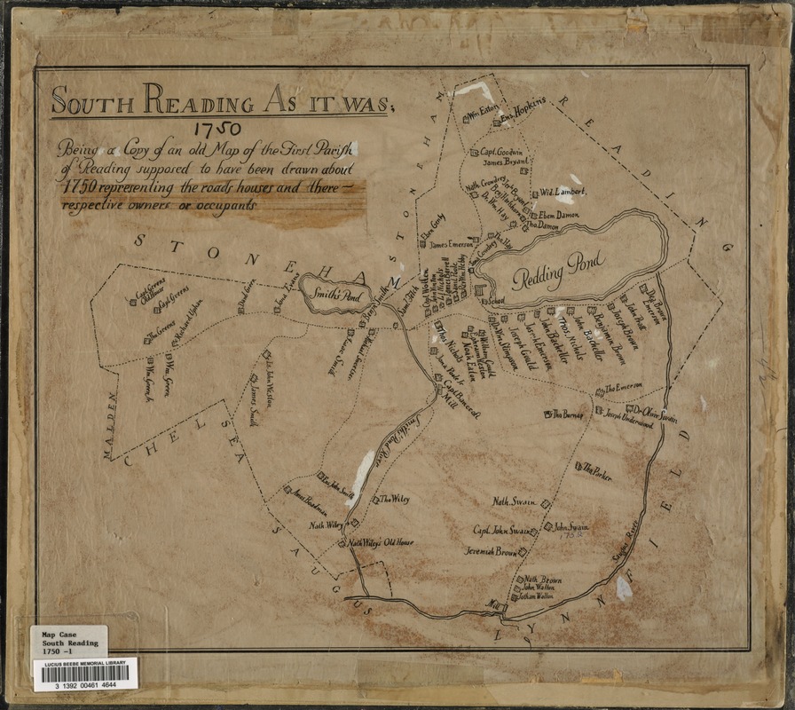
South Reading as it was : being a copy of an old map of the First Parish of Reading, supposed to have been drawn about the year 1750 representing the roads, houses and their respective owners or occupants
Item Information
- Title:
- South Reading as it was : being a copy of an old map of the First Parish of Reading, supposed to have been drawn about the year 1750 representing the roads, houses and their respective owners or occupants
- Date:
-
[1750]
- Format:
-
Maps/Atlases
- Location:
- Lucius Beebe Memorial Library
- Collection (local):
-
Lucius Beebe Memorial Library Historic Maps
- Places:
-
Middlesex (county)Wakefield
- Extent:
- 1 map : b&w, ink and pencil on paper, mounted on linen, some hand coloring ; 41 x 53 cm.
- Terms of Use:
-
No known copyright restrictions.
No known restrictions on use.
- Publisher:
-
[Wakefield?] :
[s.n.]
- Scale:
-
Scale [ca. 1:15,840]
- Language:
-
English
- Notes (date):
-
This date is inferred.
- Call #:
-
Local History Map Case South Reading 1750-1
- Barcode:
-
31392004614644


