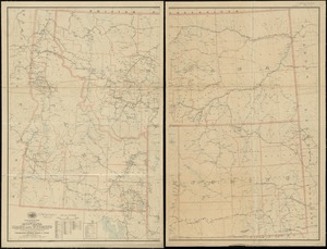
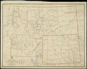
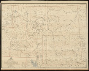
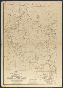
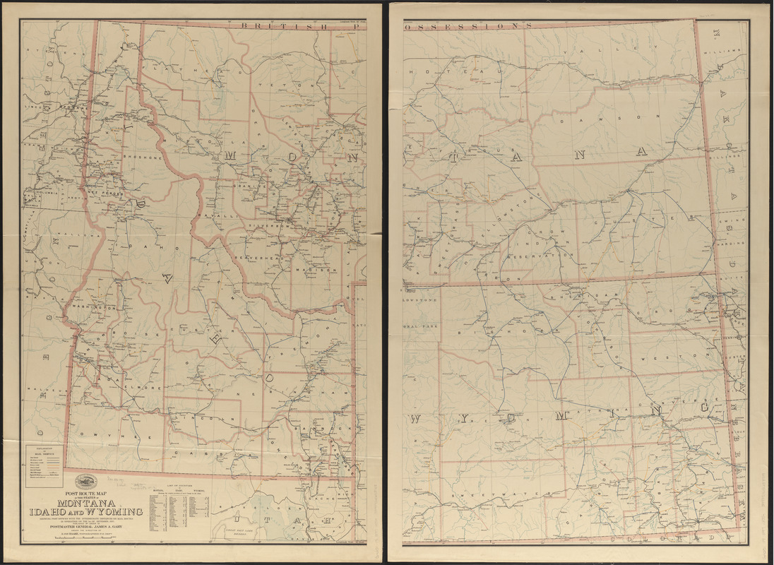
Post route map of the territories of Montana, Idaho, and Wyoming showing post offices with the intermediate distances on mail routes in operation on the 1st of September, 1897
Item Information
- Title:
- Post route map of the territories of Montana, Idaho, and Wyoming showing post offices with the intermediate distances on mail routes in operation on the 1st of September, 1897
- Publisher:
- United States. Post Office Department
- Contributor:
- Von Haake, A.
- Name on Item:
-
published by order of Postmaster General James A. Gary under the direction of A. von Haake, topographer P. O. Dept.
- Date:
-
1897
- Format:
-
Maps/Atlases
- Location:
-
Boston Public Library
Norman B. Leventhal Map & Education Center - Collection (local):
-
Norman B. Leventhal Map & Education Center Collection
- Subjects:
-
Postal service--Montana--Maps
Postal service--Idaho--Maps
Postal service--Wyoming--Maps
Montana--Maps
Idaho--Maps
Wyoming--Maps
- Places:
-
Montana
Idaho
Wyoming
- Extent:
- 1 map on 2 sheets : col. ; 102 x 134 cm., on sheets 109 x 74 cm.
- Terms of Use:
-
No known copyright restrictions.
No known restrictions on use.
- Publisher:
-
Washington, D.C. :
Post Office Dept.
- Scale:
-
Scale approximately 1:888,000
- Language:
-
English
- Notes:
-
Also shows counties, railroads, postal route beginnings and ends, frequency of mail service on each route, drainage, etc.
Includes index to counties.
- Identifier:
-
06_01_008933
- Call #:
-
G4251.P8 1897 .U55x
- Barcode:
-
39999065658708