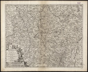
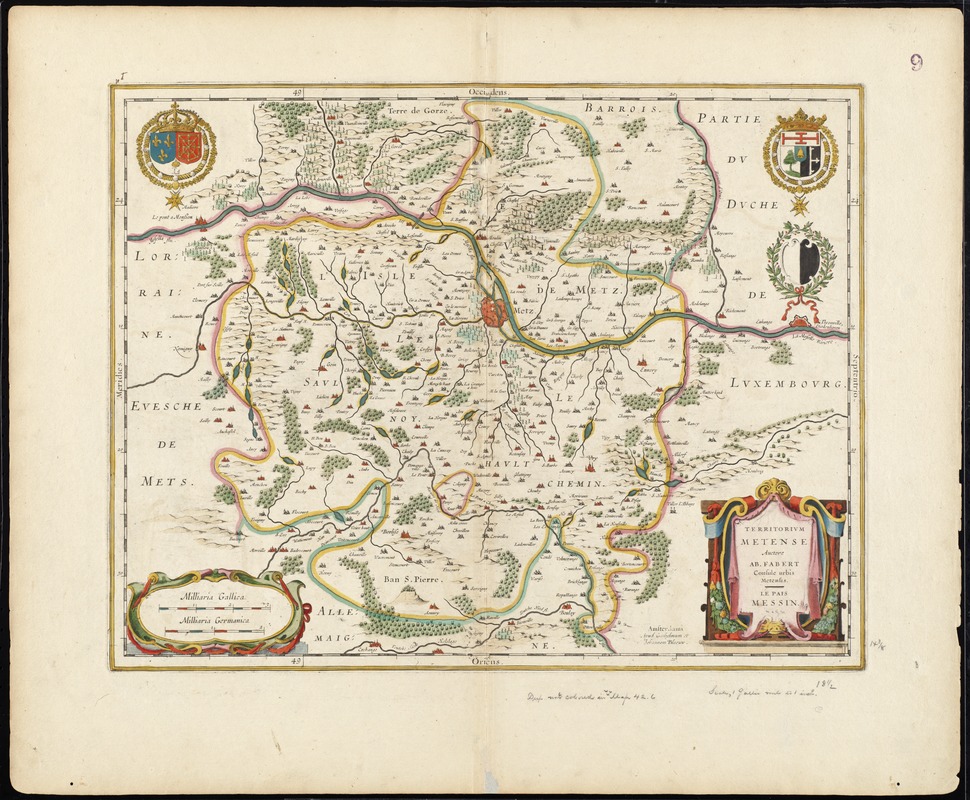
Territorium Metense = Le pais Messin
Item Information
- Title:
- Territorium Metense = Le pais Messin
- Title (alt.):
-
Pais Messin
Collection of old maps
- Creator:
- Fabert, Abraham de, 1599-1662
- Name on Item:
-
auctore Ab. Fabert consul urbis Metensis.
- Date:
-
[1633]
- Format:
-
Maps/Atlases
- Location:
-
Boston Public Library
Norman B. Leventhal Map & Education Center - Collection (local):
-
Norman B. Leventhal Map & Education Center Collection
- Subjects:
-
Lorraine (France)--Maps--Early works to 1800
Metz (France)--Maps--Early works to 1800
- Places:
-
FranceLorraine (former administrative division)
FranceGrand Est (region)Metz
- Extent:
- 1 map : hand col. ; 37 x 48 cm.
- Terms of Use:
-
No known copyright restrictions.
No known restrictions on use.
- Publisher:
-
Amstelodami :
Apud Ioannem Ianssonium
- Scale:
-
Scale [ca. 1:225,000]
- Language:
-
French
- Notes:
-
Map of the historical region surrounding Metz, in Lorraine, France.
Oriented with north to the right.
Verso is blank.
Text in French and Latin.
Cataloging, conservation, and digitization made possible in part by The National Endowment for the Humanities: Exploring the human endeavor.
Part of composite portfolio atlas with title "Collection of old maps."
- Notes (date):
-
This date is inferred.
- Identifier:
-
06_01_008694
- Call #:
-
G1015 .C65 1630
- Barcode:
-
30000003829861