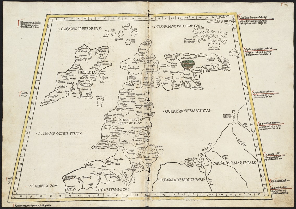
Prima Europe tabula
Item Information
- Title:
- Prima Europe tabula
- Creator:
- Ptolemy, 2nd cent
- Printer:
- Hol, Lienhart
- Date:
-
[1482]
- Format:
-
Maps/Atlases
- Location:
-
Boston Public Library
Norman B. Leventhal Map & Education Center - Collection (local):
-
Norman B. Leventhal Map & Education Center Collection
- Subjects:
-
British Isles--Maps--Early works to 1800
Ireland--Maps--Early works to 1800
- Places:
-
British Isles (area)
Ireland
- Extent:
- 1 map : col. ; 35 x 48 cm.
- Terms of Use:
-
No known copyright restrictions.
No known restrictions on use.
- Publisher:
-
Ulm :
Lienhart Hol
- Scale:
-
Scale [ca. 1:3,900,000]
- Language:
-
Latin
- Notes:
-
Title from verso.
Map of the British Isles, including Ireland, Scotland, England and Wales.
Relief shown pictorially.
Engraved on wood with place names in moveable type.
Includes names of places and natural features.
In margin: notes on latitude.
Appears in the author's Geographia. Ulm : Lienhart Hol, 16 July 1482.
Text in Latin.
Cataloging, conservation, and digitization made possible in part by The National Endowment for the Humanities: Exploring the human endeavor.
Atlas scanned by Internet Archive http://www.archive.org/details/cosmographia00ptol
- Notes (date):
-
This date is inferred.
- Identifier:
-
05_01_000201
- Call #:
-
G1005 .P7 1482
- Barcode:
-
30000003822393