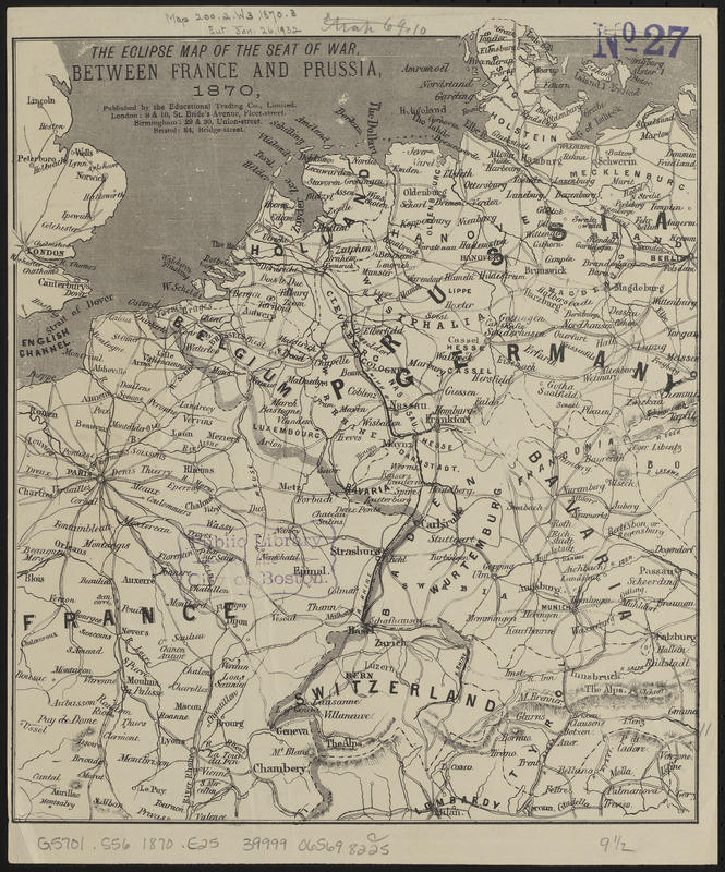
The eclipse map of the seat of war, between France and Prussia, 1870
Item Information
- Title:
- The eclipse map of the seat of war, between France and Prussia, 1870
- Publisher:
- Educational Trading Company
- Date:
-
[1870]
- Format:
-
Maps/Atlases
- Location:
-
Boston Public Library
Norman B. Leventhal Map & Education Center - Collection (local):
-
Norman B. Leventhal Map & Education Center Collection
- Subjects:
-
Franco-Prussian War, 1870-1871--Maps
Europe--Maps
- Places:
-
Europe
Europe
- Extent:
- 1 map ; 29 x 25 cm
- Terms of Use:
-
No known copyright restrictions.
No known restrictions on use.
- Publisher:
-
London :
Educational Trading Co., Limited
- Scale:
-
Scale approximately 1:3,800,000
- Language:
-
English
- Notes:
-
Relief shown by hachures.
- Notes (date):
-
This date is inferred.
- Identifier:
-
06_01_014013
- Call #:
-
G5701.S56 1870 .E25
- Barcode:
-
39999065698225


