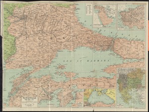
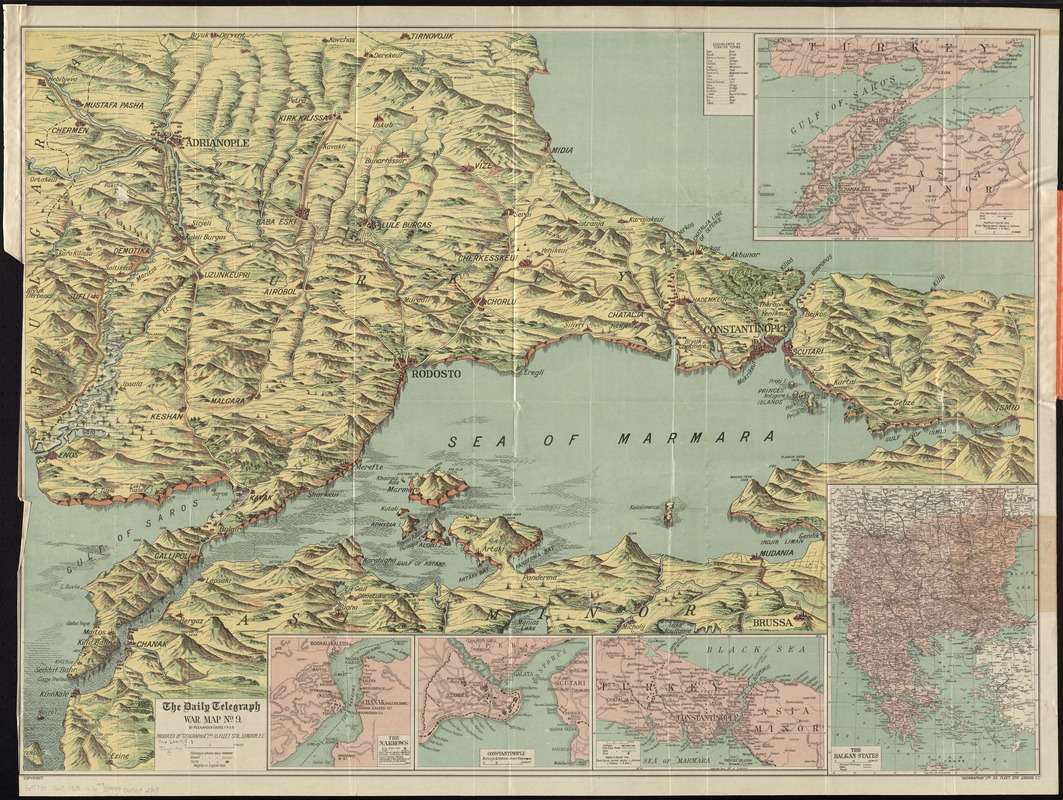
The Daily Telegraph war map no. 9
Item Information
- Title:
- The Daily Telegraph war map no. 9
- Title (alt.):
-
Daily Telegraph picture map of the Dardanelles, Bosporus including the whole of Turkey in Europe (no. 9)
- Title (uniform):
-
Daily telegraph (London, England)
- Creator:
- Gross, Alexander, 1879-1958
- Name on Item:
-
by Alexander Gross, F.R.G.S. ; produced by "Geographia" Ltd.
- Date:
-
[1915]
- Format:
-
Maps/Atlases
- Location:
-
Boston Public Library
Norman B. Leventhal Map & Education Center - Collection (local):
-
Norman B. Leventhal Map & Education Center Collection
- Subjects:
-
World War, 1914-1918--Turkey--Thrace, Eastern--Maps
World War, 1914-1918--Turkey--Maps
Thrace, Eastern (Turkey)--Maps
Marmara, Sea of (Turkey)--Maps
Turkey--Maps
- Places:
-
TurkeyTurkish Thrace (area)
Marmara Denizi
- Extent:
- 1 map : color ; 71 x 98 cm, folded in cover 21 x 13 cm
- Terms of Use:
-
No known copyright restrictions.
No known restrictions on use.
- Publisher:
-
London :
"Geographia" Ltd.
- Scale:
-
Scale approximately 1:340,000
- Language:
-
English
- Notes:
-
Shows railroads, roads, and forts; does not show campaigns.
Relief shown pictorially and by spot heights.
Insets: [Dardanelles] -- The Balkan States -- [Bosporus] -- Constantinople -- The Narrows.
- Notes (date):
-
This date is inferred.
- Identifier:
-
06_01_012048
- Call #:
-
G5701.S65 1915 .G76
- Barcode:
-
39999065692715