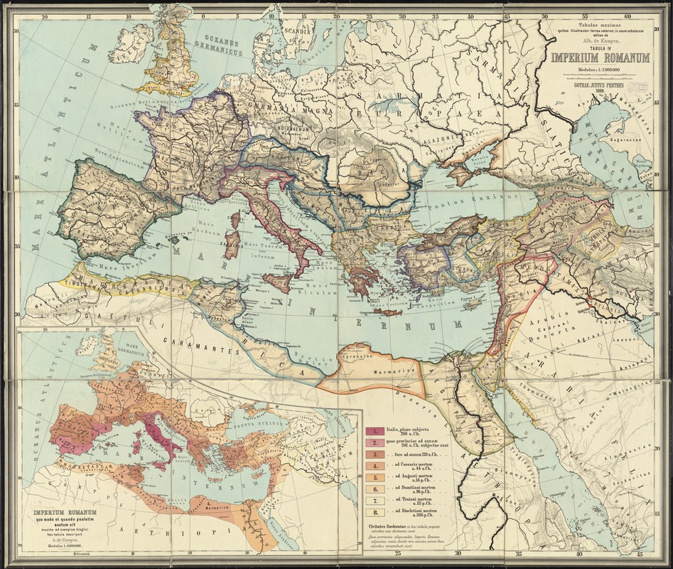
Tabulae maximae quibus illustrantur terrae veterum in usum scholarum
Item Information
- Title:
- Tabulae maximae quibus illustrantur terrae veterum in usum scholarum
- Title (alt.):
-
Tabula IV Imperium Romanum
Imperium Romanum
- Creator:
- Kampen, Albert van, 1842-1891
- Date:
-
1889
- Format:
-
Maps/Atlases
- Location:
-
Boston Public Library
Norman B. Leventhal Map & Education Center - Collection (local):
-
Norman B. Leventhal Map & Education Center Collection
- Subjects:
-
Geography, Ancient--Maps
Classical geography--Maps
Rome--Maps
Europe--Historical geography--Maps
Africa, North--Historical geography--Maps
Middle East--Historical geography--Maps
- Places:
-
Europe
North Africa (area)
Middle East (area)
Roman Empire
Europe
- Extent:
- 1 map : color ; 164 x 188 cm
- Terms of Use:
-
No known copyright restrictions.
No known restrictions on use.
- Publisher:
-
Gothae :
Justus Perthes,
- Scale:
-
Scale 1:3,000,000
- Language:
-
Latin
- Notes:
-
Relief shown by hachures.
Inset: Imperium Romanum quo modo et quando paulatim auctum sit maxime ad exemplum Sieglini hac tabula descripsit.
- Identifier:
-
06_01_012011
- Call #:
-
G6700 1889 .K36
- Barcode:
-
39999065691071