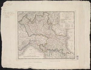
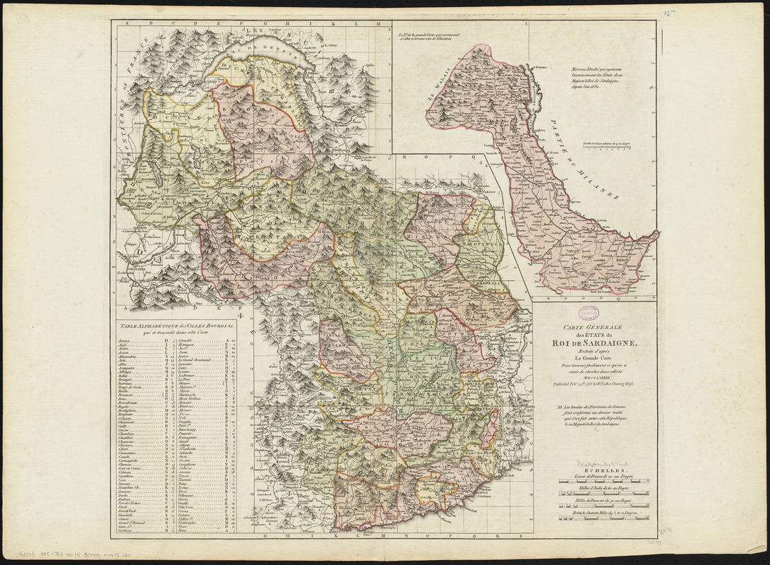
Carte générale des états du Roi de Sardaigne, reduite d'après la grande carte : pour trouver facilement ce qu'on a envie de chercher dans celle-là
Item Information
- Title:
- Carte générale des états du Roi de Sardaigne, reduite d'après la grande carte : pour trouver facilement ce qu'on a envie de chercher dans celle-là
- Publisher:
- Faden, William, 1749-1836
- Date:
-
1783
- Format:
-
Maps/Atlases
- Location:
-
Boston Public Library
Norman B. Leventhal Map & Education Center - Collection (local):
-
Norman B. Leventhal Map & Education Center Collection
- Subjects:
-
Italy--Maps--Early works to 1800
- Places:
-
Italy
- Extent:
- 1 map : hand colored ; 51 x 54 cm
- Terms of Use:
-
No known copyright restrictions.
No known restrictions on use.
- Publisher:
-
[London] :
W. Faden
- Scale:
-
Scale approximately 1:623,000
- Language:
-
French
English
- Notes:
-
Relief shown pictorially.
Includes index.
Inset: Morceau détaché qui représente l'accroissement des états de sa Majesté le Roi de Sardaigne, depuis l'an 1680.
Area of the Kingdom of Sardinia, covering modern North-West Italy and southeastern France.
Map in French except for publication statement and scale of British miles in English.
Conservation of this piece was funded by Alan and Sherry Leventhal in memory of his father, Norman B. Leventhal whose vision to create this Map Center will inspire generations to come.
Map 15 in a composite atlas with the title "Atlas of the world."
- Identifier:
-
06_01_014651
- Call #:
-
G1015 .A85 1783
- Barcode:
-
30000004730211