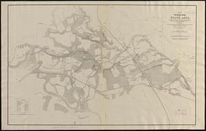
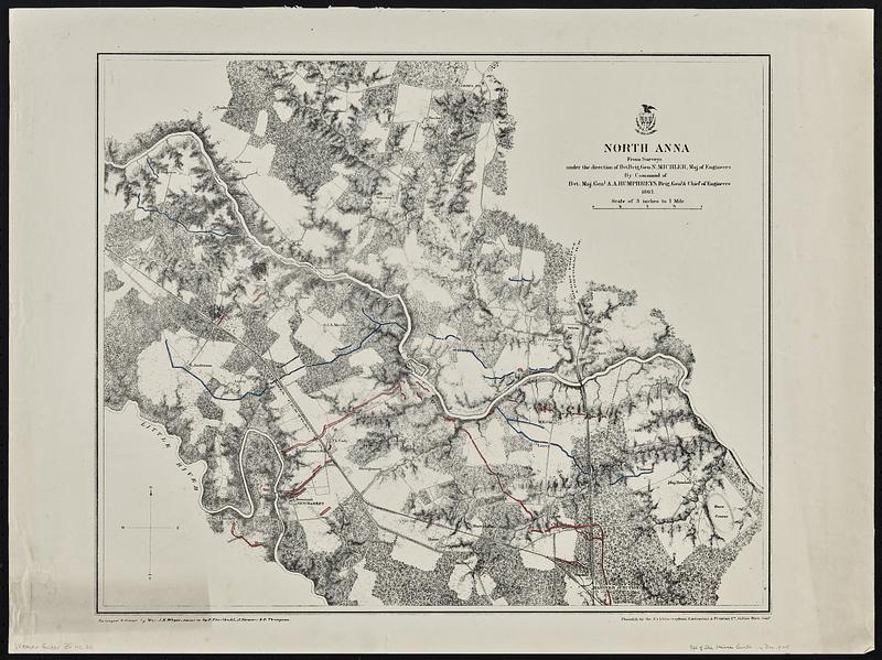
North Anna
Item Information
- Title:
- North Anna
- Cartographer:
- Michler, N. (Nathaniel), 1827-1881
- Cartographer:
- Weyss, J. E.
- Cartographer:
- Theilkuhl, F.
- Cartographer:
- Strasser, J.
- Cartographer:
- Thompson, G. (Gilbert), 1839-1909
- Name on Item:
-
from surveys under the direction of Bvt. Brig. Gen. N. Michler, Maj. of Engineers, by command of Bvt. Maj. Genl. A.A. Humphreys, Brig. Genl. & Chief of Engineers ; surveyed and drawn by Maj: J.E. Weyss, assisted by F. Theilkuhl, J. Strasser & G. Thompson
- Date:
-
[1867]
- Format:
-
Maps/Atlases
- Genre:
-
Military maps
- Location:
-
Boston Public Library
Norman B. Leventhal Map & Education Center - Collection (local):
-
David Judkins Weaver Papers
- Subjects:
-
North Anna River (Va.)--History--Civil War, 1861-1865--Maps
North Anna River, Battle of, Va., 1864--Maps
Landowners--Virginia--North Anna River--Maps
- Places:
-
VirginiaNorth Anna (river)
- Extent:
- 1 map : hand colored ; 39 x 47 cm
- Terms of Use:
-
No known copyright restrictions.
No known restrictions on use.
- Publisher:
-
New York :
N.Y. Lithographing, Engraving & Printing Co.
- Scale:
-
Scale 1:21,120. 3 inches to 1 mile
- Language:
-
English
- Notes:
-
Relief shown by hachures.
Shows landownership.
Union entrenchments are colored in blue ink, Confederate entrenchments are colored in red ink.
Indicates roads, railroads, drainage, vegetation, houses, fences, and names of occupants.
- Notes (date):
-
This date is inferred.
- Notes (citation):
-
LC Civil War maps (2nd ed.), 590.2
- Identifier:
-
06_01_018882
- Call #:
-
Weaver folder 35 no.20