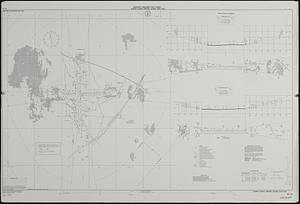
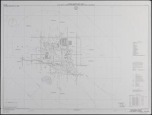
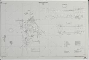
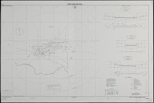
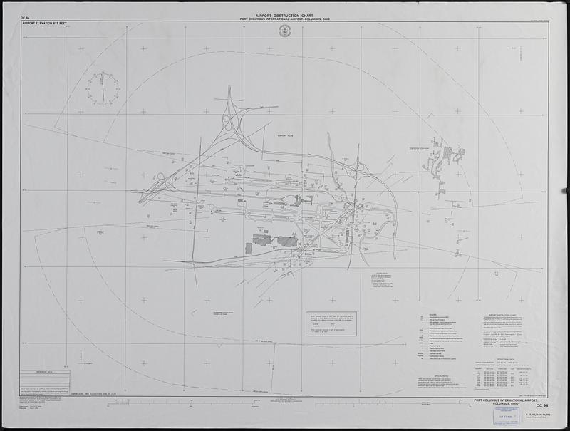
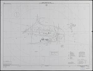
Port Columbus International Airport, Columbus, Ohio
Item Information
- Title:
- Port Columbus International Airport, Columbus, Ohio
- Issuing body:
- United States. National Ocean Service
- Name on Item:
-
surveyed and compiled by the National Ocean Service (NOS)
- Date:
-
1991
- Format:
-
Maps/Atlases
- Location:
-
Boston Public Library
Central Library in Copley Square - Collection (local):
-
U.S. Government Documents Maps Collection
- Subjects:
-
Aeronautical charts--Ohio--Columbus
Runways (Aeronautics)--Ohio--Columbus--Maps
Airports--Ohio--Columbus--Maps
Port Columbus International Airport
- Places:
-
OhioFranklin (county)Columbus
- Extent:
- 1 map ; 121 x 121 cm.
- Terms of Use:
-
No known copyright restrictions.
No known restrictions on use.
- Publisher:
-
Washington, D.C. :
National Ocean Service
- Scale:
-
Scale 1:12,000
- Language:
-
English
- Notes:
-
Field surveys September 1990.
"Published March 1991."
Includes notes, statistical table, and blank amendment table.
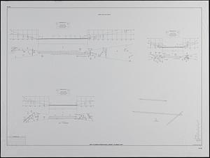
"Runway plan and profile" at scale 1:12,000 on verso.
"Airport elevation 815 feet."
Shipping list no. 91-0365-P.
- Identifier:
-
06_01_019217
- Call #:
-
GOV DOCS MAP C 55.411/3:OC 94/991