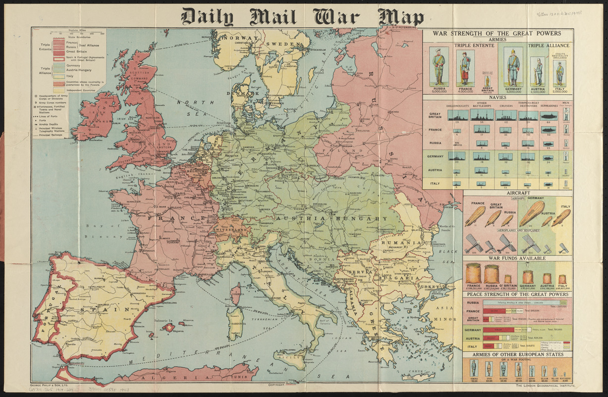
Daily mail war map
Item Information
- Title:
- Daily mail war map
- Title (uniform):
-
Daily mail (London, England)
- Publisher:
- George Philip & Son
- Contributor:
- London Geographical Institute
- Date:
-
1914
- Format:
-
Maps/Atlases
- Location:
-
Boston Public Library
Norman B. Leventhal Map & Education Center - Collection (local):
-
Norman B. Leventhal Map & Education Center Collection
- Subjects:
-
World War, 1914-1918--Maps
Europe--Maps
- Places:
-
Europe
Europe
- Extent:
- 1 map : color ; 57 x 86 cm, folded in cover 19 x 12 cm
- Terms of Use:
-
No known copyright restrictions.
No known restrictions on use.
- Publisher:
-
London :
George Philip & Son, Ltd. ; London Geographical Institute
- Scale:
-
Scale approximately 1:5,400,000
- Language:
-
English
- Notes:
-
Shows political boundaries, army headquarters, army corps numbers, fortified towns or naval stations, lines of forts, forts, airship depots, principal wireless telegraph stations, and principal railways.
Includes pictorial charts showing War strength of the great powers, with statistics on armies, navies, aircraft, war funds available, peace strength of the great powers, and armies of other European states.
- Identifier:
-
06_01_016731
- Call #:
-
G5701.S65 1914 .D34
- Barcode:
-
39999085951943