Toggle navigation
LMEC Home
Exhibitions
Georeferencing
Tools for Teachers
Collections
My Favorites
Sign Up / Log In
Search
Search the map portal
Map Collection
Map Collection
Map Sets
Search
Search
Search for
Search In
All Fields
Creator
Title
Subject
Place
Search All Digital Collections
Advanced Search
87 Results
My Search
Start Over
1920
Remove constraint 1920
Filter your Search
Place
North and Central America
51
United States
47
Essex (county)
8
Europe
6
Hampden (county)
6
Springfield
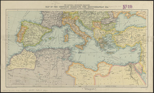
5
Africa
4
Canada
4
more
Place
»
Topic
Fire risk assessment
10
Insurance surveys
10
Textile factories
7
Cotton manufacture
6
United States--Maps
6
Longmeadow (Mass.)--Maps
5
Real property--Massachusetts--Longmeadow--Maps
5
Real property--Massachusetts--Springfield--Maps
5
more
Topic
»
Date
Date range begin
–
Date range end
Current results range from
1831
to
1932
View distribution
Creator
Bartholomew, J. G. (John George), 1860-1920
10
Associated Mutual Insurance Companies
9
Richards Map Company
5
E.P. Dutton (Firm)
4
J.M. Dent & Sons
4
Price & Lee Co.
4
Congdon, Herbert Wheaton, 1876-1965
3
Edinburgh Geographical Institute
3
more
Creator
»
Format
Maps/Atlases
87
Georeferenced
Yes
13
No
74
Collection
Norman B. Leventhal Map Center Collection
73
American Textile History Museum Image Collection
10
Urban Maps
4
Boston and New England Maps
3
Robert E. Diefenbach Map Collection at Phillips Academy
2
Massachusetts Real Estate Atlases
1
Town plans, 1830
1
Available to use
No known restrictions
73
Search Constraints
Sort by relevance
relevance
title
date (asc)
date (desc)
Number of results to display per page
50 per page
10
per page
20
per page
50
per page
100
per page
View results as:
grid view
map view
Search Results
1.
Woman suffrage, 1920
2.
Ziron 1920 political map
3.
Density of population, 1920
4.
Property qualifications for suffrage, 1920
5.
Rand McNally official 1920 auto trails map : District number 6 : New England, eastern New York
6.
Electoral votes for President in 1916 and for Congress in 1918 : make your guess for 1920
7.
Davis Mills (Cotton Mill), Fall River, Mass. [insurance map]
8.
St. Croix Paper Co., Woodland, Me. [insurance map]
9.
Lorraine Mfg. Co. (Cotton & Worsted Mill), Pawtucket, R.I. [insurance map]
10.
Acushnet Mill Corp. (Cotton Mill), New Bedford, Mass. [insurance map]
11.
Eastern Manufacturing Company (Paper Mill), South Brewer, Me. [insurance map]
12.
Prophylactic Brush Co. (Bldg), Landers, Frary & Clark Co. (Tenant), Florence, Mass. [insurance map]
13.
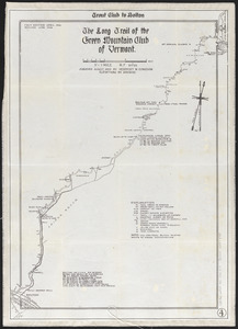
The Long Trail of the Green Mountain Club of Vermont : Trout Club to Bolton
14.
Chicopee Mfg. Corp. (Cotton Mill), Chicopee Falls, Mass. [insurance map]
15.
Nashua Mfg. Co. "Nashua Mills" (Cotton Mill), Nashua, N.H. [insurance map]
16.
Wamsutta Mills (Cotton Mill), New Bedford, Mass. [insurance map]
17.
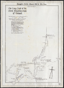
The Long Trail of the Green Mountain Club of Vermont : Smuggler's Notch: Morse's Mill to the Nose
18.
Victory map 1919
19.
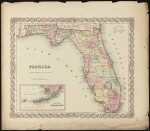
Florida
20.
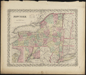
New York
21.
British Isles
22.
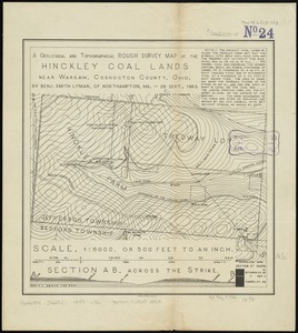
A geological and topographical rough survey map of the Hinckley Coal Lands near Warsaw, Coshocton County, Ohio
23.
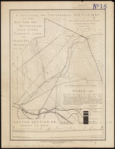
A geological and topographical sketch map of the New York and Westmoreland Gas Coal Company's lands, at Manor Sta., Westm'd...
24.
Worumbo Mfg. Co. (Woolen Mill), Lisbon Falls, Me. [insurance map]
25.
Bird's eye view of Port Townsend, Puget Sound, Washington Territory : from the north-east, 1878
26.
Bird's eye view of the city of Olympia, East Olympia and Tumwater, Puget Sound, Washington Territory, 1879
27.
Maps of the Far East, illustrating Russo-Japanese War
28.
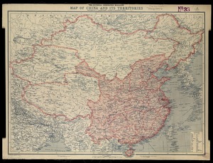
National Geographic Magazine map of China and its territories
29.
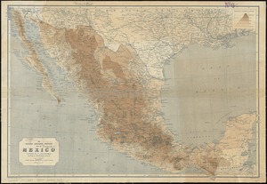
The National Geographic Magazine map of Mexico
30.
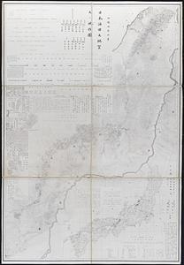
Geological and topographical maps of oil lands of Japan
31.
Africa January rainfall -- Africa July rainfall
32.
Africa vegetation
33.
Egyptian Empire B.C. 1450
34.
Kingdom of the Caliphs
35.
Political map of the Balkan States
36.
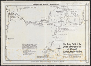
The Long Trail of the Green Mountain Club of Vermont : Monroe Skyline section: Couching Lion to Burnt Rock Mountain
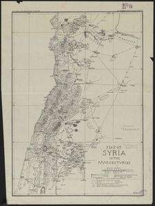
37.
Map of Syria in the IV-V-VI centuries
38.
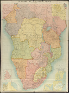
Central and South Africa
39.
City atlas of Lawrence, Massachusetts : from official records, private plans and actual surveys, based upon plans deposited in...
40.
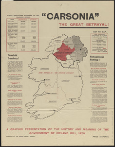
Carsonia the great betrayal!
41.
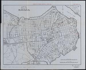
Map of the city of Havana : [casos de fiebre amarilla, muertes de niños menores, y muertes de tuberculosis]
42.
The National Geographic magazine map of the countries bordering the Mediterranean Sea
43.
Geologic map of Kentucky : showing oil and gas pools and pipelines and the eastern and western coalfields
44.
Map of Cleveland and vicinity
45.
Ipswich and Annisquam harbors, Massachusetts [archaeology in 1874]
46.
The Indian Empire and Ceylon
47.
Hammond's enlarged map of Europe of to-day showing boundaries of the new states as determined by the peace conference
48.
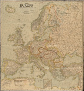
Map of Europe showing countries as established by the Peace Conference at Paris
49.
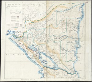
Nicaragua
50.
Philips' new commercial map of Europe
‹ Prev
Next ›
1
2


![Davis Mills (Cotton Mill), Fall River, Mass. [insurance map]](https://bpldcassets.blob.core.windows.net/derivatives/images/commonwealth:2r36vc48g/image_thumbnail_300.jpg)
![St. Croix Paper Co., Woodland, Me. [insurance map]](https://bpldcassets.blob.core.windows.net/derivatives/images/commonwealth:4j03df479/image_thumbnail_300.jpg)
![Lorraine Mfg. Co. (Cotton & Worsted Mill), Pawtucket, R.I. [insurance map]](https://bpldcassets.blob.core.windows.net/derivatives/images/commonwealth:2r36vc298/image_thumbnail_300.jpg)
![Acushnet Mill Corp. (Cotton Mill), New Bedford, Mass. [insurance map]](https://bpldcassets.blob.core.windows.net/derivatives/images/commonwealth:ww72bz30x/image_thumbnail_300.jpg)
![Eastern Manufacturing Company (Paper Mill), South Brewer, Me. [insurance map]](https://bpldcassets.blob.core.windows.net/derivatives/images/commonwealth:ww72bx30q/image_thumbnail_300.jpg)
![Prophylactic Brush Co. (Bldg), Landers, Frary & Clark Co. (Tenant), Florence, Mass. [insurance map]](https://bpldcassets.blob.core.windows.net/derivatives/images/commonwealth:ww72bx884/image_thumbnail_300.jpg)
![Chicopee Mfg. Corp. (Cotton Mill), Chicopee Falls, Mass. [insurance map]](https://bpldcassets.blob.core.windows.net/derivatives/images/commonwealth:2r36vc433/image_thumbnail_300.jpg)
![Nashua Mfg. Co. "Nashua Mills" (Cotton Mill), Nashua, N.H. [insurance map]](https://bpldcassets.blob.core.windows.net/derivatives/images/commonwealth:2r36vc27q/image_thumbnail_300.jpg)
![Wamsutta Mills (Cotton Mill), New Bedford, Mass. [insurance map]](https://bpldcassets.blob.core.windows.net/derivatives/images/commonwealth:ww72bz961/image_thumbnail_300.jpg)


![Worumbo Mfg. Co. (Woolen Mill), Lisbon Falls, Me. [insurance map]](https://bpldcassets.blob.core.windows.net/derivatives/images/commonwealth:2r36vc23m/image_thumbnail_300.jpg)


![Ipswich and Annisquam harbors, Massachusetts [archaeology in 1874]](https://bpldcassets.blob.core.windows.net/derivatives/images/commonwealth:2f75vg12c/image_thumbnail_300.jpg)