Toggle navigation
LMEC Home
Exhibitions
Georeferencing
Tools for Teachers
Collections
My Favorites
Sign Up / Log In
Search
Search the map portal
Map Collection
Map Collection
Map Sets
Search
Search
Search for
Search In
All Fields
Creator
Title
Subject
Place
Search All Digital Collections
Advanced Search
187 Results
My Search
Start Over
1900
Remove constraint 1900
Filter your Search
Place
North and Central America
131
United States
102
Boston
26
Suffolk (county)
26
Asia
11
Canada
9
Middlesex (county)
8
France
7
more
Place
»
Topic
Boston (Mass.)--Maps
13
United States--Maps
10
Franco-Prussian War, 1870-1871--Aerial views
7
France--History--1789-1900--Aerial views
6
Germany--History--1789-1900--Aerial views
6
Havana (Cuba)--Maps
6
Luzon (Philippines)--Maps
6
New England--Maps--Early works to 1800--Facsimiles
5
more
Topic
»
Date
Date range begin
–
Date range end
Current results range from
1764
to
2005
View distribution
Creator
United States. War Department
16
United States. Congress (56th, 2nd session : 1900-1901). Senate
10
United States. Congress. Senate. Committee on Foreign Relations
10
United States. Army. Department of Cuba
9
United States. Congress (56th, 2nd session : 1900-1901). House
8
United States. Government Printing Office
8
United States. Army. Corps of Engineers
7
Geo. H. Walker & Co.
6
more
Creator
»
Format
Maps/Atlases
182
Manuscripts
7
Photographs
3
Prints
2
Books
1
Drawings/Illustrations
1
Posters
1
Georeferenced
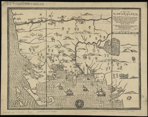
Yes
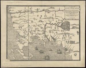
21
No
166
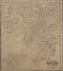
Collection
Norman B. Leventhal Map Center Collection
176
Boston and New England Maps
17
Urban Maps
16
Robert E. Diefenbach Map Collection at Phillips Academy
5
American Revolutionary War-Era Maps
3
Massachusetts Real Estate Atlases
3
Maritime Charts and Atlases
2
Colonial and Revolutionary Boston
1
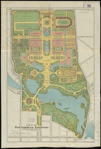
more
Collection
»
Available to use
No known restrictions
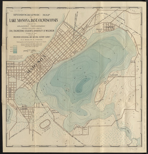
176
Creative Commons license
2
Search Constraints
Sort by relevance
relevance
title
date (asc)
date (desc)
Number of results to display per page
50 per page
10
per page
20
per page
50
per page
100
per page
View results as:
grid view
map view
Search Results
101.
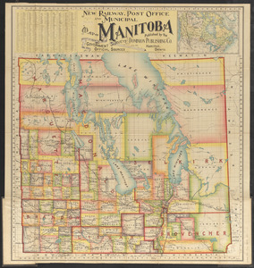
New railway, post office and municipal map of Manitoba : compiled from the latest government surveys and other official sources
102.
Spezialkarte der Samoa-Inseln
103.
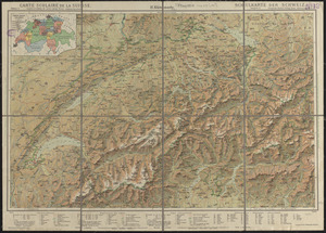
Carte scolaire de la Suisse
104.
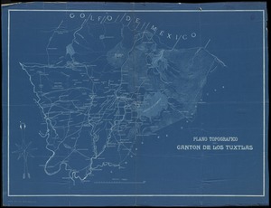
Plano topografico del canton de Los Tuxtlas
105.
Tourist's map of Scotland : reduced by permission from the Ordnance Survey by John Bartholomew, F.R.G.S.
106.
Western part of the United States of America including all its newly acquired territory
107.
Alaska and adjoining region
108.
Atlas of the town of Brookline, Norfolk County, Massachusetts : from actual surveys and official plans
109.
Buy homes of J.W. Wilbur & Co.
110.
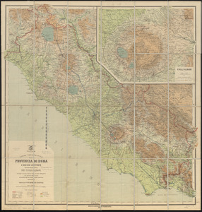
Carta topografica della provincia di Roma e regioni limitrofe con cartina speciale dei Colli Albani secondo i recenti rilievi...
111.
Charles River : carries shown by red lines
112.
[Lake Pleasant, Massachusetts]
113.
Map of Boston
114.
Map of Cape Nome and Golovin [sic] Bay
115.
A map of New-England : being the first that ever was here cut, and done by the best pattern that could be had, which being in...
116.
A map of New-England : being the first that ever was here cut, and done by the best pattern that could be had, which being in...
117.
Map of the central business district city of Boston showing the location of underground conduits
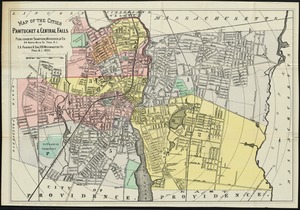
118.
Map of the cities of Pawtucket & Central Falls
119.
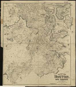
Map of the city of Boston and vicinity
120.
Map of the city of Boston and vicinity
121.
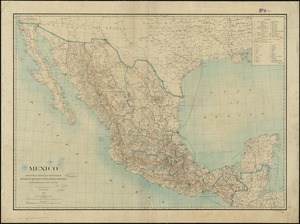
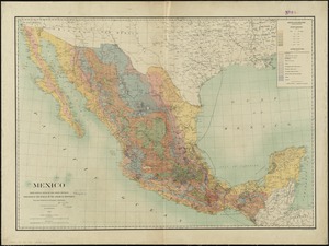
Mexico : from official Mexican and other sources
122.
Mexico : from official Mexican and other sources
123.
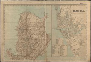
Military map of the isle of Luzon
124.
New Jersey showing forest area and its relation to the principal watersheds
125.
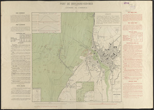
Plan du port et de la ville de Boulogne
126.
Plan of the town of Quebec, the capital of Canada in North America, with the Bason and a part of the adjacent country shewing...
127.
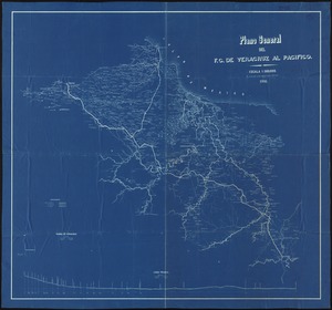
Plano general del f.c. de Veracruz al Pacifico
128.
The railway map of Japan
129.
Relief map of Canada and the United States
130.
Road map of the Boston district showing the metropolitan park system
131.
Guide map of Boston
132.
Map of Cape Nome and adjacent mining dists
133.
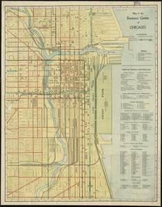
Map of the business center of Chicago
134.
Minerals
135.
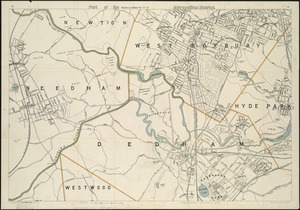
Part of the metropolitan district
136.
Plan of the Pan-American Exposition to be held at Buffalo, New York, May 1-Nov 1, 1901
137.
The south part of New-England, as it is planted this yeare, 1635
138.
To his excellency William Shirley Esqr., Captain General and Commander in Chief, in and over his Majesty's province of the...
139.
Touring road map of Chicago and environs : 6 counties
140.
Trees in Brookline, Massachusetts
141.
Hydrographic map of Lake Monona, Dane Co., Wisconsin and of the adjacent topography
142.
Samuel Thaxter & Son, manufacturers and importers of nautical and optical instruments, charts and nautical books; publishers of...
143.
Boston Inner Harbor Massachusetts
144.
Map of Boston and adjacent country showing that city to be the geographical as well as intellectual and moral centre of one...
145.
Plan of Fall River (Troy), surveyor's name not given, dated August 1831
146.
[Plan showing wharves of Boston from Batterymarch Street to Fleet Street; the "circular line" limit of wharves; and the...
147.
Belvidere Park : Lowell, Mass
148.
A draught of St. John's harbour : with the soundings
149.
A small map of the sea coast of New England together with the outlines of several of the provinces lying thereon, 1738
150.
[Plan of part of Boston bounded by Eliot, Washington, and Pleasant streets showing landownership in the late 17th century]
‹ Prev
Next ›
1
2
3
4


![[Lake Pleasant, Massachusetts]](https://bpldcassets.blob.core.windows.net/derivatives/images/commonwealth:9s161g546/image_thumbnail_300.jpg)

![Map of Cape Nome and Golovin [sic] Bay](https://bpldcassets.blob.core.windows.net/derivatives/images/commonwealth:4m90fc12m/image_thumbnail_300.jpg)


![[Plan showing wharves of Boston from Batterymarch Street to Fleet Street; the "circular line" limit of wharves; and the Barricado, with gaps]](https://bpldcassets.blob.core.windows.net/derivatives/images/commonwealth:9s161j18r/image_thumbnail_300.jpg)


![[Plan of part of Boston bounded by Eliot, Washington, and Pleasant streets showing landownership in the late 17th century]](https://bpldcassets.blob.core.windows.net/derivatives/images/commonwealth:4m90fp141/image_thumbnail_300.jpg)