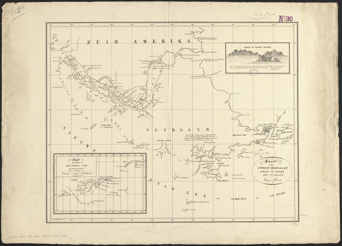
Kaart van Straat Magellaan, Straat Le Maire, het Vuurland en Kaap Hoorn
Item Information
- Title:
- Kaart van Straat Magellaan, Straat Le Maire, het Vuurland en Kaap Hoorn
- Cartographer:
- Bennet, Roelof Gabriel, 1774-1829
- Publisher:
- Wijk Roelanszoon, Jacobus van, 1781-1847
- Date:
-
[1829]
- Format:
-
Maps/Atlases
- Location:
-
Boston Public Library
Norman B. Leventhal Map & Education Center - Collection (local):
-
Norman B. Leventhal Map & Education Center Collection
- Subjects:
-
Magellan, Strait of (Chile and Argentina)--Maps
Tierra del Fuego (Argentina and Chile)--Maps
- Places:
-
Magallanes, Estrecho de (strait)
Tierra del Fuego (archipelago)
- Extent:
- 1 map ; 43 x 55 cm
- Terms of Use:
-
No known copyright restrictions.
No known restrictions on use.
- Publisher:
-
[Dordrecht] :
[J. de Vos & comp.]
- Scale:
-
Scale approximately 1:1,420,000
- Language:
-
Dutch
- Notes:
-
Prime meridian: [Ferro].
From Atlas, behoorende tot de Verhandeling / van R.G. Bennet en J. van Wijk, Roelandsz. Dordrecht : bij J. de Vos & Comp., 1829.
View: Sebald de Weerds Eilanden.
Inset: Kaart van het Dirk Gerrits Land.
- Notes (date):
-
This date is inferred.
- Notes (citation):
-
Phillips, 1134
- Identifier:
-
06_01_011977
- Call #:
-
G5332.M33 1829 .B46
- Barcode:
-
39999065691626