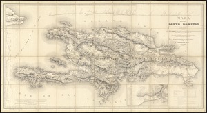
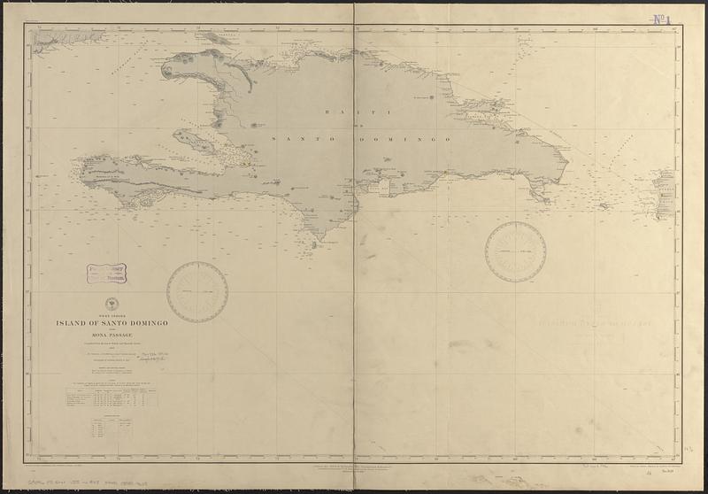
West Indies, Island of Santo Domingo with Mona Passage : compiled from the latest British and Spanish charts, 1886
Item Information
- Title:
- West Indies, Island of Santo Domingo with Mona Passage : compiled from the latest British and Spanish charts, 1886
- Issuing body:
- United States. Hydrographic Office
- Engraver:
- Birch, C. E. (Charles E.)
- Engraver:
- Knight, H. T. (Harry T.)
- Draftsman:
- Mahon, Charles
- Name on Item:
-
drawn by C. Mahon ; engraved by C.E. Birch and H.T. Knight
- Date:
-
[1889]
- Format:
-
Maps/Atlases
- Genre:
-
Nautical charts
- Location:
-
Boston Public Library
Norman B. Leventhal Map & Education Center - Collection (local):
-
Norman B. Leventhal Map & Education Center Collection
- Subjects:
-
Hispaniola--Maps
Haiti--Maps
Dominican Republic--Maps
Nautical charts--Hispaniola
Nautical charts--Haiti
Nautical charts--Dominican Republic
- Places:
-
Haiti
Dominican Republic
Hispaniola (island)
- Extent:
- 1 map ; 61 x 92 cm
- Terms of Use:
-
No known copyright restrictions.
No known restrictions on use.
- Publisher:
-
Washington, D.C. :
Hydrographic Office
- Edition:
- Edition of March 1889
- Scale:
-
Scale approximately 1:960,000
- Language:
-
English
- Notes:
-
Relief shown by hachures and spot heights. Depths shown by soundings and spot heights.
- Notes (date):
-
This date is inferred.
- Identifier:
-
06_01_017083
- Call #:
-
G9096.P5 svar .U55 no. 948
- Barcode:
-
39999085954608