Toggle navigation
LMEC Home
Exhibitions
Georeferencing
Tools for Teachers
Collections
My Favorites
Sign Up / Log In
Search
Search the map portal
Map Collection
Map Collection
Map Sets
Search
Search
Search for
Search In
All Fields
Creator
Title
Subject
Place
Search All Digital Collections
Advanced Search
7 Results
My Search
Start Over
walpole massachusetts
Remove constraint walpole massachusetts
Filter your Search
Place
Norfolk (county)
7
North and Central America
7
United States
7
Walpole
5
Massachusetts
1
Topic
Norfolk County (Mass.)--Maps
2
Landowners--Massachusetts--Norfolk County--Maps
1
Landowners--Massachusetts--Walpole (Town)--Maps
1
Pictorial maps
1
Real property--Massachusetts--Norfolk County--Maps
1
Walpole (Mass. : Town)--Maps
1
Walpole (Mass.)--Aerial views
1
Date
Date range begin
–
Date range end
Current results range from
1794
to
1934
View distribution
Creator
Walling, Henry Francis, 1825-1888
2
Court Square Press
1
Hales, John Groves
1
Hewins, Elijah
1
O.H. Bailey & Co
1
Shepler, Dwight
1
Worthington, E.
1
Format
Maps/Atlases
7
Georeferenced
No
7
Collection
Norman B. Leventhal Map Center Collection
4
Boston and New England Maps
3
Town plans, 1830
2
Urban Maps
2
Town plans, 1794
1
Available to use
No known restrictions
7
Search Constraints
Sort by relevance
relevance
title
date (asc)
date (desc)
Number of results to display per page
20 per page
10
per page
20
per page
50
per page
100
per page
View results as:
grid view
map view
Search Results
1.
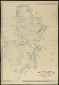
Walpole, Massachusetts : 1882
2.
The townships of Dedham, Westwood, Needham, Dover, Sherborn, Norwood, Medfield, Millis, Walpole, Norfolk, Massachusetts
3.
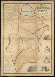
Map of the town of Walpole Norfolk County Mass : surveyed by authority of the town
4.
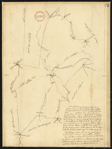
Plan of Walpole, surveyor's name not given, dated October 1794.
5.
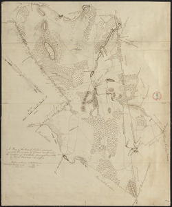
Plan of Walpole made by Elijah Hewins, dated December, 1832
6.
Plan of Walpole made by John G. Hales, dated 1831
7.
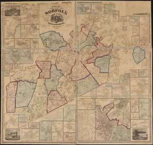
Map of the county of Norfolk, Massachusetts : based upon the trigonometrical survey of the state