Toggle navigation
LMEC Home
Exhibitions
Georeferencing
Tools for Teachers
Collections
My Favorites
Sign Up / Log In
Search
Search the map portal
Map Collection
Map Collection
Map Sets
Search
Search
Search for
Search In
All Fields
Creator
Title
Subject
Place
Search All Digital Collections
Advanced Search
295 Results
My Search
Start Over
north carolina
Remove constraint north carolina
Filter your Search
Place
North and Central America
270
United States
162
South Carolina
100
North Carolina
87
Charleston (county)
81
Charleston
57
Georgia
43
Virginia
32
more
Place
»
Topic
United States--History--Revolution, 1775-1783--Maps
36
North Carolina--Maps
30
Charleston (S.C.)--Maps
21
South Carolina--Maps--Early works to 1800
21
North America--Maps--Early works to 1800
20
South Carolina--Maps
19
North Carolina--Maps--Early works to 1800
18
Southern States--Maps
15
more
Topic
»
Date
Date range begin
–
Date range end
Current results range from
1565
to
1978
View distribution
Creator
George, III, King of Great Britain, 1738-1820
15
George, IV, King of Great Britain, 1762-1830
15
Sauthier, Claude Joseph
14
Faden, William, 1749-1836
11
Des Barres, Joseph F. W. (Joseph Frederick Wallet), 1722-1824
8
Jefferys, Thomas, -1771
8
United States Coast Survey
7
Colton, J. H. (Joseph Hutchins), 1800-1893
6
more
Creator
»
Format
Maps/Atlases
290
Manuscripts
30
Prints
4
Books
1
Georeferenced
Yes
15
No
280
Collection
American Revolutionary War-Era Maps
186
Norman B. Leventhal Map Center Collection
147
William L. Clements Library Collection
48
Maritime Charts and Atlases
26
Richard H. Brown Revolutionary War Map Collection at Mount Vernon
24
British Library Collection
17
American Antiquarian Society Collection
14
Library of Congress Collection
14
more
Collection
»
Available to use
No known restrictions
146
Creative Commons license
82
Search Constraints
Sort by relevance
relevance
title
date (asc)
date (desc)
Number of results to display per page
20 per page
10
per page
20
per page
50
per page
100
per page
View results as:
grid view
map view
Search Results
1.
North Carolina
2.
North Carolina
3.
South & North Carolina : an exact map of the boundary line between the provinces of South & North Carolina agreeable to the...
4.
Colton's North Carolina
5.
North Carolina & South Carolina
6.
Map of North Carolina
7.
Map of North Carolina
8.
Physiographical map of North Carolina
9.
Coast of North Carolina & Virginia
10.
Middle Virginia and North Carolina
11.
North Carolina form the best authorities. 1800
12.
Mountain region of North Carolina and Tennessee
13.
Mountain region of North Carolina and Tennessee
14.
Mountain region of North Carolina and Tennessee
15.
The state of North Carolina from the best authorities
16.
The Rand McNally new commercial atlas map of North Carolina
17.
The state of North Carolina from the best authorities, &c
18.
A compleat map of North-Carolina from an actual survey
19.
A new and accurate map of North Carolina in North America
20.
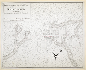
PLAN of the Town of SALISBURY in Rowan County. NORTH CAROLINA
‹ Prev
Next ›
1
2
3
4
5
…
14
15