Toggle navigation
LMEC Home
Exhibitions
Georeferencing
Tools for Teachers
Collections
My Favorites
Sign Up / Log In
Search
Search the map portal
Map Collection
Map Collection
Map Sets
Search
Search
Search for
Search In
All Fields
Creator
Title
Subject
Place
Search All Digital Collections
Advanced Search
12 Results
My Search
Start Over
new zealand
Remove constraint new zealand
Filter your Search
Place
New Zealand
4
Oceania
3
Indian Ocean
2
Pacific Ocean
2
Americas
1
Antarctica
1
Asia
1
Auckland
1
more
Place
»
Topic
Indian Ocean--Maps
2
New Zealand--Maps
2
World maps
2
1666
1
1706
1
Aerial views
1
Antarctica--Maps--Early works to 1800
1
Asia--Maps
1
more
Topic
»
Date
Date range begin
–
Date range end
Current results range from
1666
to
1943
View distribution
Creator
Great Britain. Hydrographic Office
2
J. & C. Walker (Firm)
2
Richards, G. H. (George Henry)
2
Stokes, John Lort, 1811-1885
2
Drury, B. (Byron), 1815-1888
1
Hobbs, J. S. (John Stratton)
1
Imray, James F. (James Frederick), 1829?-1891
1
J.W. Norie & Co.
1
more
Creator
»
Format
Maps/Atlases
12
Georeferenced
No
12
Collection
Norman B. Leventhal Map Center Collection
11
Maritime Charts and Atlases
7
American Revolutionary War-Era Maps
1
William L. Clements Library Collection
1
Available to use
No known restrictions
11
Search Constraints
Sort by relevance
relevance
title
date (asc)
date (desc)
Number of results to display per page
20 per page
10
per page
20
per page
50
per page
100
per page
View results as:
grid view
map view
Search Results
1.
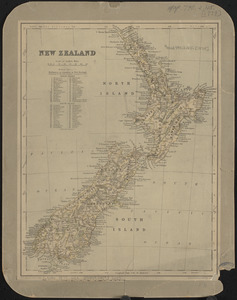
New Zealand
2.
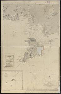
Pacific Ocean, New Zealand : from surveys in H.M. ships Acheron, & Pandora
3.
New Zealand, Middle and South Islands
4.
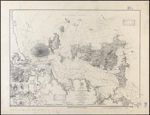
New Zealand, North Island - east coast, Auckland Hr. and approaches : from British surveys in 1849-55 ; republication of Brit....
5.
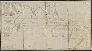
A general chart of the Indian and part of the Pacific Oceans, shewing the various passages to & from China, Australia, New...
6.
A new map of the world according to Wrights alias Mercators projection &c : drawn from the newest and the most exact...
7.
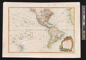
L'Amérique, divisée par grands etats
8.
A chart of the South Sea
9.
Newsmap : week of October 14 to October 21, 215th week of the war, 97th week of U.S. participation. Monday, October 25, 1943
10.
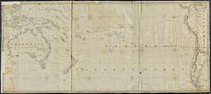
The southern or lower part of the Pacific Ocean
11.
Indian Ocean
12.
[Polus Antarcticus] : Terra Australis Incognita


![[Polus Antarcticus]](https://bpldcassets.blob.core.windows.net/derivatives/images/commonwealth:7h14b184w/image_thumbnail_300.jpg)