Toggle navigation
LMEC Home
Exhibitions
Georeferencing
Tools for Teachers
Collections
My Favorites
Sign Up / Log In
Search
Search the map portal
Map Collection
Map Collection
Map Sets
Search
Search
Search for
Search In
All Fields
Creator
Title
Subject
Place
Search All Digital Collections
Advanced Search
27 Results
My Search
Start Over
arizona
Remove constraint arizona
Filter your Search
Place
North and Central America
25
Arizona
15
United States
5
Southwest
4
California
3
New Mexico
3
Utah
3
Nevada
2
more
Place
»
Topic
Arizona--Maps
11
Railroads--Arizona--Maps
6
Counties--Arizona--Maps
4
Postal service--Arizona--Maps
4
Southwest, New--Maps
4
New Mexico--Maps
3
California--Maps
2
Counties--New Mexico--Maps
2
more
Topic
»
Date
Date range begin
–
Date range end
Current results range from
1777
to
1977
View distribution
Creator
United States. Post Office Dept
7
United States. General Land Office
3
Geological Survey (U.S.)
2
Landon, F. E.
2
Rand McNally and Company
2
United States. Forest Service. Southwestern Region
2
Bloodgood, Don
1
Daves, L. C.
1
more
Creator
»
Format
Maps/Atlases
27
Manuscripts
1
Objects/Artifacts
1
Georeferenced
Yes
14
No
13
Collection
Norman B. Leventhal Map Center Collection
26
American Revolutionary War-Era Maps
1
David Judkins Weaver Papers
1
Library of Congress Collection
1
Available to use
No known restrictions
26
Creative Commons license
1
Search Constraints
Sort by relevance
relevance
title
date (asc)
date (desc)
Number of results to display per page
20 per page
10
per page
20
per page
50
per page
100
per page
View results as:
grid view
map view
Search Results
1.
Arizona
2.
Territory of Arizona
3.
Territory of Arizona
4.
Map of Arizona Territory
5.
Tonto National Forest, Arizona
6.
Sitgreaves National Forest, Arizona
7.
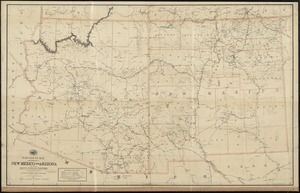
Territories of New Mexico & Arizona
8.
Rand, McNally & Co.'s Arizona
9.
Arizona (Coconino County), Bright Angel quadrangle
10.
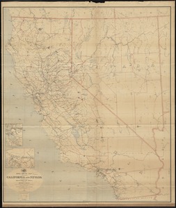
Map of California and Nevada, with parts of Utah & Arizona
11.
Post route map of the states of California and Nevada with adjacent parts of Oregon, Idaho, Utah, Arizona and of the Republic...
12.
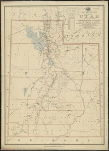
Post route map of the territory of Utah with adjacent parts of the states of Nevada, Idaho, Wyoming and Colorado and the...
13.
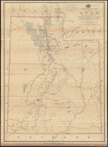
Post route map of the territory of Utah with adjacent parts of the states of Nevada, Idaho, Wyoming and Colorado and the...
14.
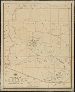
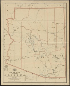
Post route map of the territory of Arizona showing post offices with the intermediate distances and mail routes in operation on...
15.
Post route map of the territory of Arizona showing post offices with the intermediate distances on mail routes in operation on...
16.
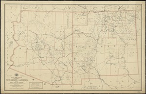
Post route map of the territories of New Mexico and Arizona with parts of adjacent states and territories showing post offices...
17.
Post route map of the territories of New Mexico and Arizona with parts of adjacent states and territories showing post offices...
18.
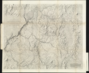
Map of explorations and surveys in New Mexico and Utah made under the direction of the Secretary of War by Capt. J. N. Macomb...
19.
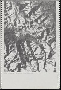
Dot matrix printouts of Landsat satellite images
20.
Navajoland, U.S.A.
‹ Prev
Next ›
1
2