Toggle navigation
LMEC Home
Exhibitions
Georeferencing
Tools for Teachers
Collections
My Favorites
Sign Up / Log In
Search
Search the map portal
Map Collection
Map Collection
Map Sets
Search
Search
Search for
Search In
All Fields
Creator
Title
Subject
Place
Search All Digital Collections
Advanced Search
19 Results
My Search
Start Over
Israel
Remove constraint Israel
Filter your Search
Place
Asia
11
Israel
10
State of Palestine
8
Jordan
4
North and Central America
4
United States
4
Iraq
3
Lebanon
3
more
Place
»
Topic
Israel--Maps--Early works to 1800
6
Palestine--Maps
5
Palestine--Maps--Early works to 1800
4
Geography--Maps
3
Iraq--Maps--Early works to 1800
3
Jordan--Maps--Early works to 1800
3
Lebanon--Maps--Early works to 1800
3
Syria--Maps--Early works to 1800
3
more
Topic
»
Date
Date range begin
–
Date range end
Current results range from
1482
to
1949
View distribution
Creator
Ptolemy, 2nd cent
5
Hol, Lienhart
2
Carter, Matthew
1
Duffield, Thomas W.
1
Foot, Israel
1
Gates, Benjamin
1
Gross, Alexander, 1879-1958
1
Hollister, Alonzo Giles, 1830-1911
1
more
Creator
»
Format
Maps/Atlases
16
Manuscripts
2
Photographs
2
Prints
1
Georeferenced
Yes
1
No
18
Collection
Norman B. Leventhal Map Center Collection
17
American Revolutionary War-Era Maps
1
Library of Congress Collection
1
Town plans, 1794
1
Urban Maps
1
Available to use
No known restrictions
18
Creative Commons license
1
Search Constraints
Sort by relevance
relevance
title
date (asc)
date (desc)
Number of results to display per page
20 per page
10
per page
20
per page
50
per page
100
per page
View results as:
grid view
map view
Search Results
1.
Erez Israel = Erets Yiśraʼel : adamah ʻIvrit
2.
School for newcomers, Temple Kehillath Israel
3.
Plan of Adams surveyed by Israel Jones, dated November 1794.
4.
Perigrinatie ofte veertich-iarige reyse der kindern Israëls, uyt Egypten door de Roode Zee, ende de woestyne, tot in't...
5.
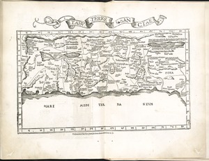
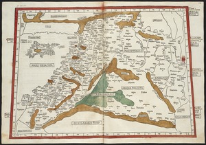
[Palestina]
6.
Tabu. terre Sanctae
7.
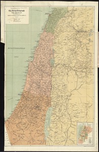
The Daily telegraph war map no. 23
8.
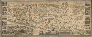
A new map of the Land of Promise and the holy city of Jerusalem describing the most important events in the Old & New Testaments
9.
The Turkish Empire in Europe, Asia and Africa, dividid into all its governments, together with the other territories that are...
10.
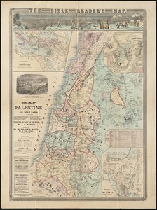
Map of Palestine and all Bible lands, containing the ancient and modern names of all known places, a table of seasons, weather,...
11.
Quarta Asiae tabula
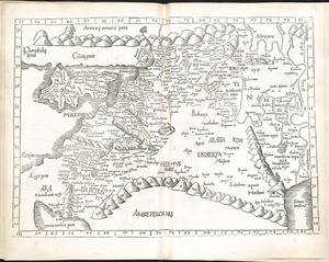
12.
Quarta Asiae taubla continet Cyprum & Syrium & Iudea & vtraq. Arabia petream & deserta ac Mesopotamia & Babilonia
13.
Tabula IIII Asiae
14.
A map of Canaan, Palestine, Judea, or the Holy Land : as divided among the 12 tribes
15.
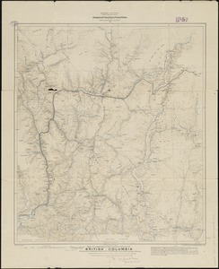
Map of a portion of the southern Interior of British Columbia : embodying the explorations made in 1877 by G.M. Dawson, and in...
16.
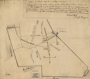
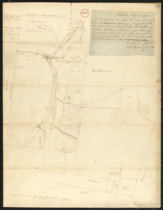
Colchester, May the: 6:th: Day: A.D.: 1765
17.
Age is no bar to studying for American citizenship
18.
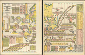
Genealogical, chronological and geographical chart embracing Biblical and profane history of ancient times from Adam to Christ
19.
Palestine or Canaan


![[Palestina]](https://bpldcassets.blob.core.windows.net/derivatives/images/commonwealth:7h14b116r/image_thumbnail_300.jpg)