Toggle navigation
LMEC Home
Exhibitions
Georeferencing
Tools for Teachers
Collections
My Favorites
Sign Up / Log In
Search
Search the map portal
Map Collection
Map Collection
Map Sets
Search
Search
Search for
Search In
All Fields
Creator
Title
Subject
Place
Search All Digital Collections
Advanced Search
133 Results
My Search
Start Over
China, map
Remove constraint China, map
Filter your Search
Place
Asia
59
China
59
North Korea
10
South Korea
10
Japan
9
Manchuria
8
North and Central America
8
United States
8
more
Place
»
Topic
China--Maps
32
Korea--Maps
12
Japan--Maps
7
Manchuria (China)--Maps
7
China--Historical geography--Maps
6
World maps
6
Beijing (China)--Maps
5
India--Maps--Early works to 1800
4
more
Topic
»
Date
Date range begin
–
Date range end
Current results range from
1482
to
2023
View distribution
Creator
United States. Hydrographic Office
13
Herrmann, Albert, 1886-1945
11
Horsburgh, James
8
Ptolemy, 2nd cent
6
Bateman, J. (John)
5
Kellett, Henry, 1806-1875
5
United States. Central Intelligence Agency
5
Collinson, Richard, Sir, 1811-1883
4
more
Creator
»
Format
Maps/Atlases
130
Manuscripts
3
Prints
2
Photographs
1
Georeferenced
Yes
24
No
109
Collection
Norman B. Leventhal Map Center Collection
117
Maritime Charts and Atlases
25
MacLean Collection Map Library
14
Urban Maps
11
Boston and New England Maps
3
Map Collections at Phillips Academy
1
Town plans, 1794
1
Available to use
No known restrictions
103
Creative Commons license
4
Search Constraints
Sort by relevance
relevance
title
date (asc)
date (desc)
Number of results to display per page
20 per page
10
per page
20
per page
50
per page
100
per page
View results as:
grid view
map view
Search Results
1.
Map of China : compiled from original surveys & sketches
2.
Commercial map of China : showing treaty ports, ports of foreign control, railways, telegraphs, waterways, etc., 1899
3.
Map of north eastern China
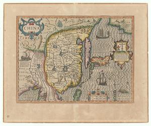
4.
[Universal map of China]
5.
China
6.
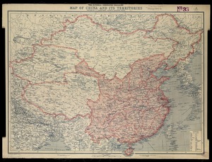
National Geographic Magazine map of China and its territories
7.
China
8.
China
9.
China
10.
China
11.
China : waterways and stage routes
12.
China : sheet IV south coast from Chauan Bay to Port Matheson including the Pescadore Islands
13.
China : sheet V eastern coast from Port Matheson to Ragged Point
14.
China : sheet VIII eastern coast Hieshan Isles to the Yang-Tse-Kiang including the Chusan Islands
15.
China, military regions
16.
Agricultural areas of China
17.
China east coast population density
18.
China's situation in the world
19.
Map of China, Burma, Siam, Annam &c
20.
China
‹ Prev
Next ›
1
2
3
4
5
6
7


![[Universal map of China]](https://bpldcassets.blob.core.windows.net/derivatives/images/commonwealth:qb98n8079/image_thumbnail_300.jpg)