Toggle navigation
LMEC Home
Exhibitions
Georeferencing
Tools for Teachers
Collections
My Favorites
Sign Up / Log In
Search
Search the map portal
Map Collection
Map Collection
Map Sets
Search
Search
Search for
Search In
All Fields
Creator
Title
Subject
Place
Search All Digital Collections
Advanced Search
10 Results
My Search
Start Over
"G1106.P5 N6 1794x"
Remove constraint "G1106.P5 N6 1794x"
Filter your Search
Place
North and Central America
8
Canada
3
United States
2
Belle Isle, Strait of
1
Charleston (county)
1
Charleston Harbor
1
Chesapeake Bay
1
Delaware Bay
1
more
Place
»
Topic
Coasts--South Carolina--Early works to 1800
2
Nautical charts--South Carolina--Early works to 1800
2
South Carolina--Maps--Early works to 1800
2
Atlantic Coast (New England)--Maps--Early works to 1800
1
Belle Isle, Strait of (N.L.)--Maps--Early works to 1800
1
Charleston Harbor (S.C.)--Maps--Early works to 1800
1
Chesapeake Bay (Md. and Va.)--Maps--Early works to 1800
1
Coasts--Delaware--Early works to 1800
1
more
Topic
»
Date
1794
10
Creator
Norman, John, 1748?-1817
9
Carleton, Osgood, 1742-1816
2
Dunbibin, Daniel
1
Pinkham, Paul, 1736-1799
1
Smith, Anthony, pilot of St. Marys
1
Format
Maps/Atlases
10
Georeferenced
No
10
Collection
Maritime Charts and Atlases
10
Norman B. Leventhal Map Center Collection
10
American Revolutionary War-Era Maps
4
Boston and New England Maps
3
Available to use
No known restrictions
10
Search Constraints
Sort by relevance
relevance
title
date (asc)
date (desc)
Number of results to display per page
20 per page
10
per page
20
per page
50
per page
100
per page
View results as:
grid view
map view
Search Results
1.
Chart from New York to Timber Island including Nantucket Shoals
2.
A chart of Nantucket Shoals
3.
A chart of South Carolina and Georgia
4.
A chart of the Banks of Newfoundland
5.
Chart of the Bay of Fundy from Machias Bay to 64°35' west longitude
6.
Chart of the coast of America from Cape Hateras to Cape Roman
7.
A chart of the coast of America from Wood Island to Good Harbour from Hollands surveys
8.
Chart of the Streights of Belle Isle
9.
A new and accurate chart of the Bay of Chesapeak including Delaware Bay with all the shoals, channels, islands, entrances,...
10.
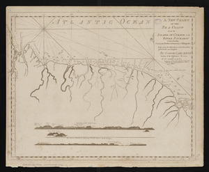
A new chart of the sea coast from the island of Cyenne to the river Poumaron comprehending Surinam Berbice Demerary & Essequebo...