Toggle navigation
LMEC Home
Exhibitions
Georeferencing
Tools for Teachers
Collections
My Favorites
Sign Up / Log In
Search
Search the map portal
Map Collection
Map Collection
Map Sets
Search
Search
Search for
Search In
All Fields
Creator
Title
Subject
Place
Search All Digital Collections
Advanced Search
45 Results
My Search
Start Over
poland/
Remove constraint poland/
Filter your Search
Place
Poland
32
Europe
23
Germany
17
Russia
6
Lithuania
5
Bohemia
4
Ukraine
4
Asia
3
more
Place
»
Topic
Poland--Maps--Early works to 1800
10
Poland--Maps
8
Germany--Maps--Early works to 1800
6
Germany--Maps
5
Czech Republic--Maps--Early works to 1800
4
Swedish-Polish War, 1655-1660--Maps--Early works to 1800
4
Bohemia (Czech Republic)--Maps--Early works to 1800
3
Pomerania (Poland and Germany)--Maps--Early works to 1800
3
more
Topic
»
Date
Date range begin
–
Date range end
Current results range from
1482
to
1920
View distribution
Creator
Dahlbergh, Erik Jönsson, greve, 1625-1703
6
Pufendorf, Samuel, Freiherr von, 1632-1694
6
Riegel, Christoph
6
Wit, Frederik de.
4
Neele, Samuel John, 1758-1824
3
Ptolemy, 2nd cent
3
American Geographical Society of New York
2
La Pointe, François de
2
more
Creator
»
Format
Maps/Atlases
44
Prints
1
Georeferenced
Yes
1
No
44
Collection
Norman B. Leventhal Map Center Collection
43
Town plans, 1794
2
Urban Maps
2
Available to use
No known restrictions
45
Search Constraints
Sort by title
relevance
title
date (asc)
date (desc)
Number of results to display per page
20 per page
10
per page
20
per page
50
per page
100
per page
View results as:
grid view
map view
Search Results
1.
305 Glatz
2.
Battle of Zorndorf
3.
Cannonade at Pass Krug, 3d. October 1758
4.
Carte de la Russie d'Europe, avec l'Empire d'Autriche, la Suede, le Danemark et la Norwege, la Prusse, le Grand Duche ́de...
5.
Charte von den Königreichen Preussen und Polen dem Grosherzogthum Posen nebst dem Gebiete der freien Stadt Krakau : nach dem...
6.
The Daily Telegraph war map no. 17
7.
Delineatio Fortalitij Polonorum ad Lysouiam, quod a serenissimo principe Palatino Adolpho Iohanne Supremo Duce militiae...
8.
Delineatio obsidionis urbis Stetini in Pomerania à Cesareanis et Confoederatis incaeptae d. Septemb. et derelictae d. Novemb....
9.
Delineatio schenographica urbis Thoruniensis in Prussia, exhibens ejusdem obsidionem primam paulo remotius factam a rege...
10.
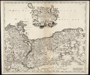
Ducatus Pomeraniae tabula generalis, in qua sunt Ducatus Pomeraniae, Stettinensis, Cassubiae, Vandaliae, et Bardensis,...
11.
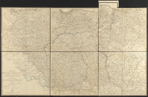
Fortifications of Central Europe : sheet no. 2 containing 16 plans
12.
Geometrica delineatio munitionis, Dantziger Hoeft : uti illud a Gedanensibus et eorum Faederatis d. 2 Octob. obsideri caeptum,...
13.
German military maneuvers near Stettin from September 3 to September 14, 1900
14.
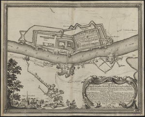
Ichnographia oppidi et castri Marieburgi in Prussia Regali, a foederatis Austriacorum, et Polonorum exercitibus, d. 12. Iulij...
15.
Karta T︠sarstva Pol'skago sluzhashchai︠a︡ k prodolzhenīi︠u︡ podrobnoĭ karty Rossīi sochinena pri sobstvennom" Ego...
16.
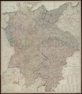
Karte von Deutschland : in IV Blättern entworfen im Jahre 1805, und nach den, durch die Bundesacte der Reinschen...
17.
The kingdom of Poland and Great Dutchy of Lithuania with all their divisions
18.
Large scale map of Russia in Europe
19.
Leaves from Liber chronicarum, with views of de Sarmatia regione Europe, Cracovia, Lubeca and Nissa
20.
Map of the Empire of Germany : including all the states comprehended under that name : with the Kingdom of Prussia, &c
‹ Prev
Next ›
1
2
3


![Delineatio schenographica urbis Thoruniensis in Prussia, exhibens ejusdem obsidionem primam paulo remotius factam a rege poloniae ejus[que]](https://bpldcassets.blob.core.windows.net/derivatives/images/commonwealth:ht2501874/image_thumbnail_300.jpg)