Toggle navigation
LMEC Home
Exhibitions
Georeferencing
Tools for Teachers
Collections
My Favorites
Sign Up / Log In
Search
Search the map portal
Map Collection
Map Collection
Map Sets
Search
Search
Search for
Search In
All Fields
Creator
Title
Subject
Place
Search All Digital Collections
Advanced Search
107 Results
My Search
Start Over
new brunswick
Remove constraint new brunswick
Filter your Search
Place
North and Central America
87
Canada
80
Province of New Brunswick
35
United States
28
Maine
16
Nova Scotia
12
Saint John
9
Fort Beauséjour National Historic Park
8
more
Place
»
Topic
New Brunswick--Maps
9
Maine--Maps
7
Canada--Boundaries--United States--Maps
6
Coasts--New Brunswick--Maps
6
Fort Cumberland (N.B.)--Maps, Manuscript--Early works to 1800
6
New Brunswick--Maps--Early works to 1800
6
New England--Maps
6
Nova Scotia--Maps
6
more
Topic
»
Date
Date range begin
–
Date range end
Current results range from
1662
to
1992
View distribution
Creator
Amherst, Jeffery Amherst, Baron, 1717-1797
9
Royal United Services Institute for Defence and Security Studies
9
Des Barres, Joseph F. W. (Joseph Frederick Wallet), 1722-1824
8
George, III, King of Great Britain, 1738-1820
8
George, IV, King of Great Britain, 1762-1830
8
Bruce, Robert George
7
Parr, John, 1725-1791
6
United States. Hydrographic Office
6
more
Creator
»
Format
Maps/Atlases
107
Manuscripts
16
Objects/Artifacts
1
Georeferenced
Yes
5
No
102
Collection
Norman B. Leventhal Map Center Collection
59
American Revolutionary War-Era Maps
56
British Library Collection
17
Boston and New England Maps
13
Maritime Charts and Atlases
11
Library of Congress Collection
10
Urban Maps
10
William L. Clements Library Collection
9
more
Collection
»
Available to use
No known restrictions
58
Creative Commons license
33
Search Constraints
Sort by date (desc)
relevance
title
date (asc)
date (desc)
Number of results to display per page
20 per page
10
per page
20
per page
50
per page
100
per page
View results as:
grid view
map view
Search Results
1.
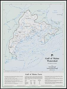
Gulf of Maine watershed : with major river basins
2.
Coal fields of Nova Scotia and New Brunswick
3.
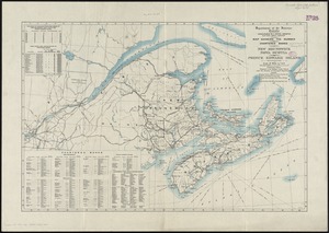
Map showing the number of chartered banks in New Brunswick, Nova Scotia, and Prince Edward Island
4.
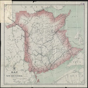
Map of the province of New Brunswick
5.
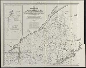
Map of the boundary lines between the United States and the adjacent British provinces from the mouth of the River St. Croix to...
6.
New Brunswick, Nova Scotia, Newfoundland, and Prince Edward Id.
7.
A plan of the rivers Scoodic and Magaguadavic with their principal branches including the Bay of Passamaquoddy and the adjacent...
8.
North America, Dominion of Canada, Gulf of St. Lawrence, Prince Edward Island and adjacent coasts, from Sea Wolf Island to...
9.
St. Stephen, New Brunswick and Calais, Maine : 1889
10.
Woodstock, New Brunswick : 1889
11.
Buctouche, New Brunswick
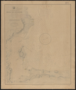
12.
Dominion of Canada, Gulf of Saint Lawrence, Shediac Bay and Harbor (New Brunswick) : from a British survey in 1885
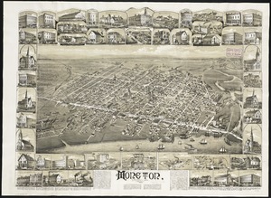
13.
Moncton, New Brunswick
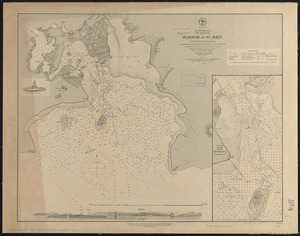
14.
North America, New Brunswick, Harbor of St. John : from the latest British surveys
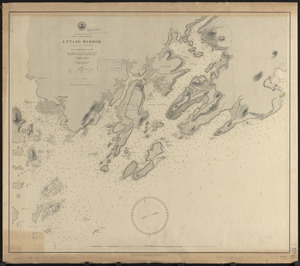
15.
Dominion of Canada, New Brunswick, L'Etang Harbor (Bay of Fundy) : from a British survey in 1847
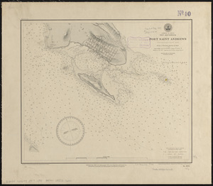
16.
Dominion of Canada, New Brunswick, Port Saint Andrews (Passamaquoddy Bay) : from a British survey in 1844
17.
North America, Bay of Fundy, Grand Manan Island and adjacent coast : from surveys by the British Admiralty in 1855, and by the...
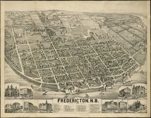
18.
City of Fredericton, N.B
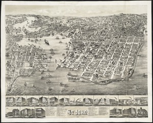
19.
The city of St. John : New Brunswick
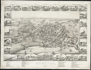
20.
Moncton : New Brunswick
‹ Prev
Next ›
1
2
3
4
5
6