Toggle navigation
LMEC Home
Exhibitions
Georeferencing
Tools for Teachers
Collections
My Favorites
Sign Up / Log In
Search
Search the map portal
Map Collection
Map Collection
Map Sets
Search
Search
Search for
Search In
All Fields
Creator
Title
Subject
Place
Search All Digital Collections
Advanced Search
122 Results
My Search
Start Over
1867
Remove constraint 1867
Filter your Search
Place
North and Central America
99
United States
83
Suffolk (county)
19
Boston
18
Virginia
14
Boston Harbor
8
Europe
7
Michigan
5
more
Place
»
Topic
Boston (Mass.)--Maps
16
United States--History--Civil War, 1861-1865--Maps
10
Virginia--History--Civil War, 1861-1865--Maps
7
Coastlines
6
Boston Bay (Mass.)--Navigation
4
Boston Harbor (Mass.)--Maps
4
Massachusetts--Maps
4
Nautical charts--Massachusetts--Boston Bay
4
more
Topic
»
Date
Date range begin
–
Date range end
Current results range from
1826
to
1932
View distribution
Creator
Bache, A. D. (Alexander Dallas), 1806-1867
22
United States Coast Survey
18
Michler, N. (Nathaniel), 1827-1881
15
New York Lithographing, Engraving and Printing Co.
12
Strasser, J.
12
Theilkuhl, F.
12
Weyss, J. E.
12
United States. Hydrographic Office
11
more
Creator
»
Format
Maps/Atlases
121
Prints
1
Georeferenced
Yes
6
No
116
Collection
Norman B. Leventhal Map Center Collection
110
Boston and New England Maps
34
Maritime Charts and Atlases
29
David Judkins Weaver Papers
15
Urban Maps
15
Mapping Boston Collection
6
Ralph Finos Map Collection at Phillips Academy
4
Robert E. Diefenbach Map Collection at Phillips Academy
4
more
Collection
»
Available to use
No known restrictions
112
Creative Commons license
7
Search Constraints
Sort by relevance
relevance
title
date (asc)
date (desc)
Number of results to display per page
20 per page
10
per page
20
per page
50
per page
100
per page
View results as:
grid view
map view
Search Results
1.
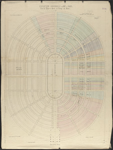
Exposition universelle de 1867 a Paris : plan du palais à élever, au Champ de Mars
2.
McMillan's map of New Brunswick, 1867
3.
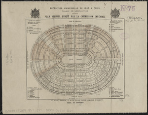
Exposition universelle de 1867 a Paris, palais de l'exposition : plan officiel publié par la Commission Impériale
4.
Reconstruction Act, March 2, 1867, Vote on passage over President's veto
5.
Völker und sprachen-karte von Deutschland und den nachbarländern im j. 1867
6.
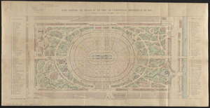
Plan général du palais et du parc de l'Exposition universelle de 1867
7.
Hall and Elvans' subdivision of Meridian Hill, Washington County, D.C : Sept. 1867
8.
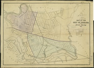
Map of the city of Chelsea : from actual surveys 1867
9.
West Indies, island of Guadeloupe, Basse-Terre Roads : from a French survey in 1867
10.
West Indies, island of Guadeloupe, Sainte Anne anchorage : from a French survey in 1867
11.
West Indies, Island of Guadeloupe, St. François anchorage : from a French survey in 1867
12.
West Indies, port & anchorages on the north east coast of Cuba : from Spanish government surveys in 1867-8
13.
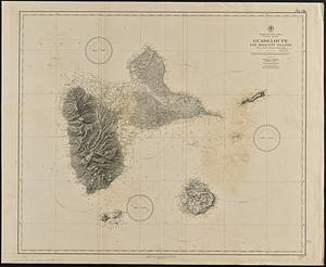
North Atlantic Ocean, Windward Islands, Guadeloupe and adjacent islands : from a French survey of 1867 to 1869
14.
Comparative map of Cape Cod Harbor showing physical changes between the survey of Maj. J.D. Graham in 1835, and the U.S. Coast...
15.
West Indies, Guadeloupe, approaches to Pointe á Pitre : from a French survey in 1867, corrected to 1882
16.
Plan of the property known as Rowe's Wharf : enlarged from a plan made by Alex. Wadsworth in April, 1867
17.
North America, east coast, anchorages on the n.e. coast of Labrador : republication of Brit. Admty. chart no. 225
18.
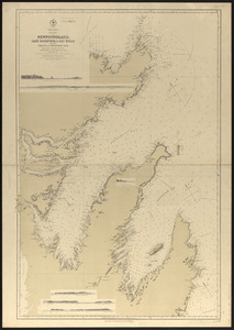
North America, east coast of Newfoundland, Cape Bonavista to Bay Bulls including Trinity, & Conception Bays : from Brit....
19.
Plan of Church St. district, showing estates and buildings : as proposed to be taken by the city of Boston under the Act of the...
20.
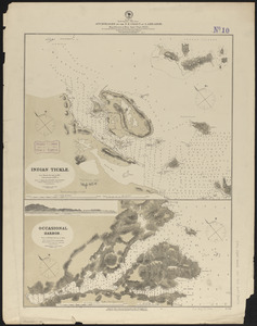
Japan - n.w. coast of Nipon, Nanao Harbors : south harbor, surveyed by Commander C.J. Bullock and the officers of H.M.S....
‹ Prev
Next ›
1
2
3
4
5
6
7