Toggle navigation
LMEC Home
Exhibitions
Georeferencing
Tools for Teachers
Collections
My Favorites
Sign Up / Log In
Search
Search the map portal
Map Collection
Map Collection
Map Sets
Search
Search
Search for
Search In
All Fields
Creator
Title
Subject
Place
Search All Digital Collections
Advanced Search
297 Results
My Search
Start Over
1780
Remove constraint 1780
Filter your Search
Place
North and Central America
251
United States
166
Canada
40
New York
32
Charleston (county)
31
Charleston
27
South Carolina
22
New Jersey
17
more
Place
»
Topic
United States--History--Revolution, 1775-1783--Maps
54
Manuscript maps--Early works to 1800
22
Charleston (S.C.)--Maps
11
Charleston (S.C.)--Siege, 1780--Maps
9
Fortification--Newfoundland and Labrador--St. John's--Maps, Manuscript--Early works to 1800
9
Harbors--Newfoundland and Labrador--St. John's--Maps, Manuscript--Early works to 1800
9
Military art and science--Newfoundland and Labrador--St. John's--Maps, Manuscript--Early works to 1800
9
St. John's (N.L.)--Maps, Manuscript--Early works to 1800
9
more
Topic
»
Date
Date range begin
–
Date range end
Current results range from
1711
to
1909
View distribution
Creator
Skinner, Monier
28
Skinner, William, 1700-1780
28
Des Barres, Joseph F. W. (Joseph Frederick Wallet), 1722-1824
25
Faden, William, 1749-1836
16
André, John, 1751-1780
11
Bonne, Rigobert, 1727-1794
8
Carver, Jonathan, 1710-1780
6
Ferguson, Patrick, 1744-1780
6
more
Creator
»
Format
Maps/Atlases
291
Manuscripts
71
Prints
5
Drawings/Illustrations
1
Georeferenced
Yes
7
No
290
Collection
American Revolutionary War-Era Maps
266
Norman B. Leventhal Map Center Collection
66
William L. Clements Library Collection
65
Library of Congress Collection
63
British Library Collection
33
Maritime Charts and Atlases
27
Richard H. Brown Revolutionary War Map Collection at Mount Vernon
26
Boston and New England Maps
13
more
Collection
»
Available to use
Creative Commons license
142
No known restrictions
66
Search Constraints
Sort by date (desc)
relevance
title
date (asc)
date (desc)
Number of results to display per page
20 per page
10
per page
20
per page
50
per page
100
per page
View results as:
grid view
map view
Search Results
1.
Maps illustrating cruises of John Paul Jones in British waters : [Great Britain and Ireland]
2.
Map of Cambridge in the vicinity of Harvard College 1903-4
3.
F.T. Neely's new commercial map of the United States, Canada, British Columbia, and Northern Mexico, showing all the railroads,...
4.
Carta statistica e postale dell'Italia
5.
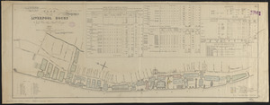
Plan of the Liverpool Docks
6.
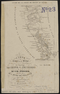
Carte du cours de la Seine pour servir à l'intelligence de l'ouvrage la Seine et ses bords
7.
Plan of the route of pipes from Jamaica Pond, in Roxbury to the reservoir, in Boston
8.
A reconnoissance of the Minnay Sotor Watapāh; or St. Peter's River to its sources : made in the year 1835
9.
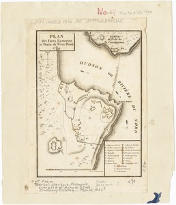
Plan des forts, batteries et poste de West-Point, 1780
10.
The city of New York as laid out by the Commissioners with the surrounding country
11.
A plan of the town of Dracut protracted by a scale of 200 rods to an inch : taken in Octobr. 1791
12.
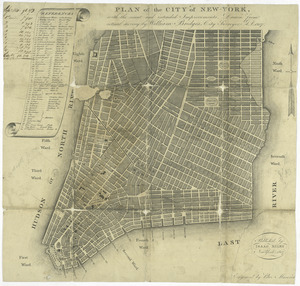
Plan of the city of New York : with the recent and intended improvements
13.
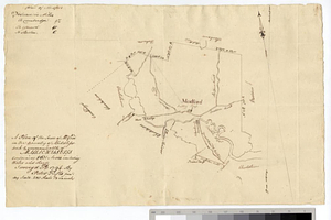
A plan of the town of Medford in the county of Middlesex and commonwealth of Massachusetts containing 5631 acres including...
14.
Course of canal to Charlestown Millpond
15.
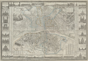
Nouveau plan routier de la ville et faubourgs de Paris avec ses principaux édifices et nouvelles barrières
16.
1. Prise de Newport par d'Estaing, 1778 : 2. Embossage de Ternay à Newport, 1780
17.
[Plan de defense de New-Port] : [dans l'Isle Rhode (Amerique Septentrionalle) par l'escadre du Roy aux ordres de Monsieur le...
18.
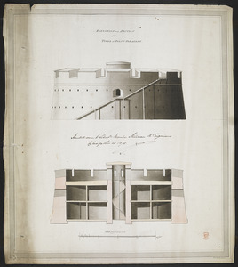
ELEVATION and SECTION of the TOWER at POINT PLEASANT
19.
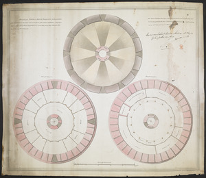
PLAN of the TOWER at POINT PLEASANT for the protection of the Sea Batteries at that place and for the defence of the Harbour of...
20.
A map of the world from the best authorities
‹ Prev
Next ›
1
2
3
4
5
…
14
15


![[Plan de defense de New-Port]](https://bpldcassets.blob.core.windows.net/derivatives/images/commonwealth:z603vn044/image_thumbnail_300.jpg)