Toggle navigation
LMEC Home
Exhibitions
Georeferencing
Tools for Teachers
Collections
My Favorites
Sign Up / Log In
Search
Search the map portal
Map Collection
Map Collection
Map Sets
Search
Search
Search for
Search In
All Fields
Creator
Title
Subject
Place
Search All Digital Collections
Advanced Search
113 Results
My Search
Start Over
g3300
Remove constraint g3300
Filter your Search
Place
North America
100
North and Central America
27
United States
22
Canada
18
Northeastern United States
3
West Indies
3
Atlantic Ocean
2
California
2
more
Place
»
Topic
North America--Maps--Early works to 1800
79
North America--Maps
19
Canada--Maps--Early works to 1800
9
United States--Maps--Early works to 1800
7
Canada--Maps
5
Great Britain--Colonies--America--Maps--Early works to 1800
5
United States--Maps
4
British--America--Maps--Early works to 1800
3
more
Topic
»
Date
Date range begin
–
Date range end
Current results range from
1548
to
1973
View distribution
Creator
Mitchell, John, 1711-1768
6
Moll, Herman, d. 1732
6
Anville, Jean Baptiste Bourguignon d', 1697-1782
5
Kitchin, Thomas, d. 1784
3
L'Isle, Guillaume de, 1675-1726
3
Popple, Henry, d. 1743
3
Sanson, Nicolas, 1600-1667
3
Arrowsmith, Aaron, 1750-1823
2
more
Creator
»
Format
Maps/Atlases
113
Manuscripts
2
Georeferenced
Yes
4
No
109
Collection
Norman B. Leventhal Map Center Collection
113
American Revolutionary War-Era Maps
59
Boston and New England Maps
1
Available to use
No known restrictions
112
Search Constraints
Sort by date (desc)
relevance
title
date (asc)
date (desc)
Number of results to display per page
50 per page
10
per page
20
per page
50
per page
100
per page
View results as:
grid view
map view
Search Results
1.
Carte des Etats-Unis de l'Amerique suivant le Traité de Paix de 1783 : dédiée et présentée a S. Excellence Mr. Benjamin...
2.
North America
3.
Map of North America : reduced from map on scale of 1:5,000,000
4.
Map of North America : showing all routes to Alaska and Klondike country
5.
Nord-Amerika
6.
Il disegno del discoperto della noua Franza : ilquale s'è hauuto ultimamente dalla nouissima nauigatione dè Franzesi in quel...
7.
North America
8.
Amérique du Nord
9.
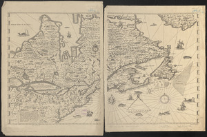
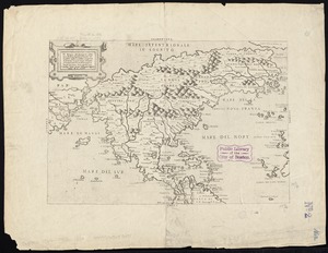
[Manuscript map of New England and eastern Canada, showing the routes of Champlain's voyage]
10.
Nord-America
11.
Nord America
12.
Illustrated Times map of North America
13.
Carte de la Nouvelle-France, augmentée depuis la derniere, servant a la navigation faicte en son vray Meridien par le Sr. de...
14.
Map of North America
15.
Carte de la Nouvelle-France, augmentée depuis la derniere, servant a la navigation faicte en son vray Meridien par le Sr. de...
16.
Map of the United States of America, the British provinces, Mexico, the West Indies and Central America, with part of New...
17.
Map of North America
18.
Map of the United States of America, the British Provinces, Mexico, the West Indies and Central America, with part of New...
19.
Carte de l'Amérique Septentrionale
20.
North America
21.
Map of the provinces of upper & lower Canada with the adjacent parts of the United States of America, &c
22.
North America
23.
A Map exhibiting the frontiers of Canada and the United States : intended to illustrate the operations of the British &...
24.
British possessions in North America
25.
North America
26.
America settle
27.
Amérique Septentrionale
28.
British colonies in North America : drawn from the best authorities
29.
North America, drawn from the best authorities
30.
A New and correct map of the British colonies in North America comprehending eastern Canada with the province of Quebec, New...
31.
A New map of North America with the West India Islands : divided according to the preliminary articles of peace, signed at...
32.
A new map of the United States of North America with the British dominions on that continent &c
33.
The United States of North America : with the British territories and those of Spain according to the treaty of 1784
34.
North America
35.
Generalkarte von Nord America samt den Westindischen inseln
36.
Remarques sur la navigation de terre-neuve à New-York afin d'eviter les courrants et les bas-fonds au sud de Nantuckett et du...
37.
A new and correct map of North America, with the West India Islands : divided according to the last Treaty of Peace, concluded...
38.
Carte du Mexique et des Etats Unis d'Amérique, partie meridionale
39.
Carte de l'Amérique septentrionale, depuis la baye d'Hudson jusqu'au Mississipi : pour servir aux essais historiques et...
40.
Amérique septentrionale
41.
Le Colonie Unite dell' America Settentr'le di nuova projezione a ss. ee. li signori riformatori dello studio di Padova : con...
42.
Amérique septentrionale avec les routes, distances en miles, villages, et etablissements François et Anglois
43.
Carte detaillée des possessions angloises dans l'Amerique Septentrionale : construite d'après les dernieres relations et les...
44.
L'Amérique Septentrionale
45.
Carte générale du Canada, de la Louisiane, de la Floride, de la Caroline, de la Virginie, de la Nouvelle Angleterre etc
46.
Carte nouvelle de l'Amérique Angloise contenant tout ce que les Anglois possédent sur le continent de l'Amérique...
47.
A map of the middle British colonies in North America : first published by Mr. Lewis Evans, of Philadelphia, in 1755; and since...
48.
A new and accurate map of the present seat of war in North America
49.
Partie de l'Amerique Septentrionale, qui comprend le Canada, la Louisiane, le Labrador, le Groenland, la Nouvelle Angleterre,...
50.
An accurate map of North America : describing and distinguishing the British and Spanish dominions of this great continent;...
‹ Prev
Next ›
1
2
3


![[Manuscript map of New England and eastern Canada, showing the routes of Champlain's voyage]](https://bpldcassets.blob.core.windows.net/derivatives/images/commonwealth:qb98n8061/image_thumbnail_300.jpg)