Toggle navigation
LMEC Home
Exhibitions
Georeferencing
Tools for Teachers
Collections
My Favorites
Sign Up / Log In
Search
Search the map portal
Map Collection
Map Collection
Map Sets
Search
Search
Search for
Search In
All Fields
Creator
Title
Subject
Place
Search All Digital Collections
Advanced Search
11 Results
My Search
Start Over
"G2305 .H4 1935"
Remove constraint "G2305 .H4 1935"
Filter your Search
Place
China
7
Asia
2
Central Asia
1
East Asia
1
India
1
Manchuria
1
Tibet
1
World
1
Topic
China--Historical geography--Maps
6
Asia, Central--Historical geography--Maps
1
China--Maps
1
China--Religion--Maps
1
Discovery and exploration--Maps
1
East Asia--Historical geography--Maps
1
Manchuria (China)--Historical geography--Maps
1
Navigation--Maps
1
more
Topic
»
Date
1935
11
Creator
Herrmann, Albert, 1886-1945
11
Format
Maps/Atlases
11
Georeferenced
Yes
2
No
9
Collection
Norman B. Leventhal Map Center Collection
11
Urban Maps
11
Search Constraints
Sort by title
relevance
title
date (asc)
date (desc)
Number of results to display per page
20 per page
10
per page
20
per page
50
per page
100
per page
View results as:
grid view
map view
Search Results
1.
Asia, ca. 100 A.D.
2.
Asia under the Mongols, 1290 A.D.
3.
The beginnings of ancient China, 1900-1300 B.C.
4.
China's situation in the world
5.
The contending states - boundaries of 350 B.C.
6.
Eastern, Central and Southern Asia, 1760 A.D.
7.
Europe in search of new routes to India and China, 1486-1616 A.D.
8.
Foreign religions in Central Asia and China up to the 14th century A.D.
9.
The Manchu Empire and the European powers, 1644-1912, A.D.
10.
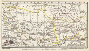
Modern Tibet (Hsi-K'Ang and Hsi-Tsang) - Political and Economic
11.
Physical geography with the boundaries of ancient China