Toggle navigation
LMEC Home
Exhibitions
Georeferencing
Tools for Teachers
Collections
My Favorites
Sign Up / Log In
Search
Search the map portal
Map Collection
Map Collection
Map Sets
Search
Search
Search for
Search In
All Fields
Creator
Title
Subject
Place
Search All Digital Collections
Advanced Search
13385 Results
Filter your Search
Place
North and Central America
9,353
United States
7,078
Suffolk (county)
1,664
Boston
1,621
Europe
1,035
Canada
949
Massachusetts
794
New York
532
more
Place
»
Topic
Boston (Mass.)--Maps
741
City planning--Massachusetts--Boston--Maps
418
United States--History--Revolution, 1775-1783--Maps
329
United States--Maps
315
Urban renewal--Massachusetts--Boston--Maps
254
Real property--Massachusetts--Boston--Maps
252
Massachusetts--Maps
219
Insurance surveys
197
more
Topic
»
Date
Date range begin
–
Date range end
Current results range from
1482
to
2023
View distribution
Creator
United States. Hydrographic Office
595
Boston Redevelopment Authority
403
Des Barres, Joseph F. W. (Joseph Frederick Wallet), 1722-1824
247
Royal United Services Institute for Defence and Security Studies
160
Jefferys, Thomas, -1771
154
George, III, King of Great Britain, 1738-1820
152
George, IV, King of Great Britain, 1762-1830
151
O.H. Bailey & Co
148
more
Creator
»
Format
Maps/Atlases
13,205
Manuscripts
985
Prints
102
Books
49
Drawings/Illustrations
44
Photographs
15
Objects/Artifacts
13
Documents
7
more
Format
»
Georeferenced
Yes
979
No
12,406
Collection
Norman B. Leventhal Map Center Collection
8,891
American Revolutionary War-Era Maps
3,305
Boston and New England Maps
2,804
Urban Maps
2,397
Maritime Charts and Atlases
1,150
William L. Clements Library Collection
910
Library of Congress Collection
618
Boston Redevelopment Authority Collection
475
more
Collection
»
Available to use
No known restrictions
9,952
Creative Commons license
1,677
Search Constraints
Sort by date (desc)
relevance
title
date (asc)
date (desc)
Number of results to display per page
20 per page
10
per page
20
per page
50
per page
100
per page
View results as:
grid view
map view
Search Results
12401.
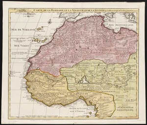
Carte de la Barbarie le la Nigritie et de la Guinée
12402.
Cuba en Iamaica : soo als die door Kolumbus ontdekt, en by de Kastilianen bevolkt sijn = Iles de Cuba et de la Jamaique : ainsi...
12403.
La Bretagne : divisée en ses neuf eveschés qui font aussi l'estendue des receptes de la generalité de Nantes
12404.
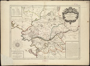
Carte de l'evesché de Nantes
12405.
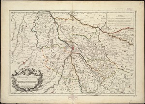
Le Diocese de Toulouse
12406.
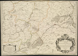
L'Evesché de Blois, divisé en Archidiaconéz et Doyennéz
12407.
A new map of the world according to Wrights alias Mercators projection &c : drawn from the newest and the most exact...
12408.
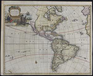
Nouvelle carte de l'Amerique : avec tous ses royaumes, etats, iles, ports, bayes et rivieres, dressée suivant les plus...
12409.
Part of New England
12410.
Virginia, Maryland, Pennsilvania, east & west New Jarsey
12411.
Carte du Gouvernement de l'Amerique
12412.
Les costes aux environs de la Riviere de Misisipi : decouvertes par Mr. de la Salle en 1683 et reconnues par Mr. le Chevallier...
12413.
Evesché de Luçon : dedié a Monseigneur ... Henry de Barrillon Evesque et Baron de Luçon etc
12414.
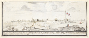
Fort William & Mary on Piscataqua River in the Province of New Hampshire on the Continent of America
12415.
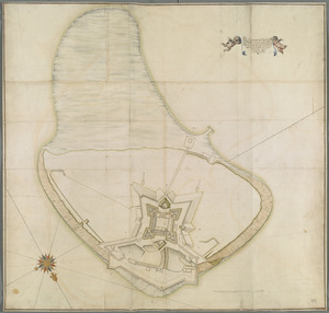
[Fort William and Mary on Piscataqua River]
12416.
The Icqnographical draft of Castle Island where upon is built Her Maj.ties Castle and by Her Maj.ties Special Command named...
12417.
Mappmonde ou description generale du globe terrestre
12418.
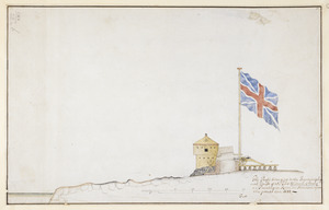
The Profil belonging to the Iconographycal Draft of the Fort William & Mary on Piscataqua River in America
12419.
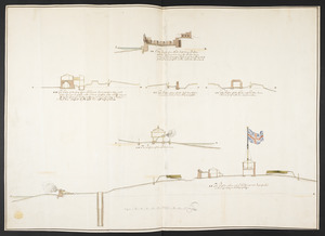
The Respective Profiles belonging to the great Iconografical Draughts of Castle Island in the Bay of Boston
12420.
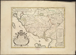
S.R.I. Sueviae Circulus atq[ue] Ducatus una cum insertis et adjacentibus Regionibus, accuratissime in earundem particulares...
‹ Prev
Next ›
1
2
…
617
618
619
620
621
622
623
624
625
…
669
670


![[Fort William and Mary on Piscataqua River]](https://bpldcassets.blob.core.windows.net/derivatives/images/commonwealth:6108vv71t/image_thumbnail_300.jpg)

![S.R.I. Sueviae Circulus atq[ue] Ducatus una cum insertis et adjacentibus Regionibus, accuratissime in earundem particulares provincias divisum](https://bpldcassets.blob.core.windows.net/derivatives/images/commonwealth:cj82kw70k/image_thumbnail_300.jpg)