Toggle navigation
LMEC Home
Exhibitions
Georeferencing
Tools for Teachers
Collections
My Favorites
Sign Up / Log In
Search
Search the map portal
Map Collection
Map Collection
Map Sets
Search
Search
Search for
Search In
All Fields
Creator
Title
Subject
Place
Search All Digital Collections
Advanced Search
13385 Results
Filter your Search
Place
North and Central America
9,353
United States
7,078
Suffolk (county)
1,664
Boston
1,621
Europe
1,035
Canada
949
Massachusetts
794
New York
532
more
Place
»
Topic
Boston (Mass.)--Maps
741
City planning--Massachusetts--Boston--Maps
418
United States--History--Revolution, 1775-1783--Maps
329
United States--Maps
315
Urban renewal--Massachusetts--Boston--Maps
254
Real property--Massachusetts--Boston--Maps
252
Massachusetts--Maps
219
Insurance surveys
197
more
Topic
»
Date
Date range begin
–
Date range end
Current results range from
1482
to
2023
View distribution
Creator
United States. Hydrographic Office
595
Boston Redevelopment Authority
403
Des Barres, Joseph F. W. (Joseph Frederick Wallet), 1722-1824
247
Royal United Services Institute for Defence and Security Studies
160
Jefferys, Thomas, -1771
154
George, III, King of Great Britain, 1738-1820
152
George, IV, King of Great Britain, 1762-1830
151
O.H. Bailey & Co
148
more
Creator
»
Format
Maps/Atlases
13,205
Manuscripts
985
Prints
102
Books
49
Drawings/Illustrations
44
Photographs
15
Objects/Artifacts
13
Documents
7
more
Format
»
Georeferenced
Yes
979
No
12,406
Collection
Norman B. Leventhal Map Center Collection
8,891
American Revolutionary War-Era Maps
3,305
Boston and New England Maps
2,804
Urban Maps
2,397
Maritime Charts and Atlases
1,150
William L. Clements Library Collection
910
Library of Congress Collection
618
Boston Redevelopment Authority Collection
475
more
Collection
»
Available to use
No known restrictions
9,952
Creative Commons license
1,677
Search Constraints
Sort by relevance
relevance
title
date (asc)
date (desc)
Number of results to display per page
20 per page
10
per page
20
per page
50
per page
100
per page
View results as:
grid view
map view
Search Results
12321.
Théatre de la guerre en Amerique, avec les Isles Antilles : projetté et assujettie aux observations
12322.
Théatre de la guerre en Amerique, avec les Isles Antilles : projetté et assujettie aux observations
12323.
Théatre de la guerre en Amerique, avec les Isles Antilles : projetté et assujettie aux observations
12324.
The theatre of war in North America, with the roads and a table of the distances
12325.
The theatre of war in North America, with the roads, and tables, of the superficial contents, distances, &ca
12326.
Theatro del mondo di Abrahamo Ortelio : da lui poco inanzi la sua morte riueduto, & di tauole nuoue, et commenti adorno, &...
12327.
Theatrum belli in America Septentrionali
12328.
Theodolite's pattern, shewing the provinces in North America which were in the respective possessions of England, France &...
12329.
Thermal map of North America, delineating the isothermal zodiac, the isothermal axis of intensity, and its expansions up and...
12330.
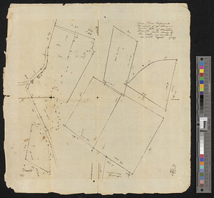
These plans represent the land of Capt Ebenezer Brook, late of Medford
12331.
These United States : products & industries
12332.
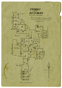
Thibou's and Blizards
12333.
Thirteenth Amendment, January 31, 1865, Vote on passage of resolution submitting
12334.
Thirty-miles round Boston
12335.
Thirty-miles round Boston
12336.
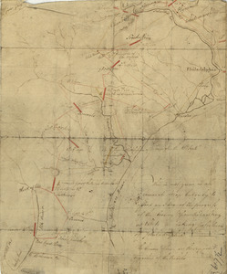
This discription and [?] of the South Line of the Massachusetts Province which divides between the said Province and the Colony...
12337.
This harbour of Boston
12338.
This harbour of Boston
12339.
This is not given as an accurate map, but only to afford an idea of the progress of the army from the landing at Elk to the...
12340.
This map of Kentucke
‹ Prev
Next ›
1
2
…
613
614
615
616
617
618
619
620
621
…
669
670


![This discription and [?] of the South Line of the Massachusetts Province which divides between the said Province and the Colony of Connecticut was made and Taken the Twenty Sixth day of October 1713 In Presence of Col. Samuel Partridge, Col. John Pynchon and [?] William Dudley Commissioners for the Massachusetts, and William Pithkin and William Whiting Esqrs for Connecticut wherein is discribed and Set down the Sain Line from Woodward and Saffery Station [?] to Connecticut River with the Several Towns farms and grants adjacent and Lying near the Same](https://bpldcassets.blob.core.windows.net/derivatives/images/commonwealth:hx11z566k/image_thumbnail_300.jpg)