Toggle navigation
LMEC Home
Exhibitions
Georeferencing
Tools for Teachers
Collections
My Favorites
Sign Up / Log In
Search
Search the map portal
Map Collection
Map Collection
Map Sets
Search
Search
Search for
Search In
All Fields
Creator
Title
Subject
Place
Search All Digital Collections
Advanced Search
13385 Results
Filter your Search
Place
North and Central America
9,353
United States
7,078
Suffolk (county)
1,664
Boston
1,621
Europe
1,035
Canada
949
Massachusetts
794
New York
532
more
Place
»
Topic
Boston (Mass.)--Maps
741
City planning--Massachusetts--Boston--Maps
418
United States--History--Revolution, 1775-1783--Maps
329
United States--Maps
315
Urban renewal--Massachusetts--Boston--Maps
254
Real property--Massachusetts--Boston--Maps
252
Massachusetts--Maps
219
Insurance surveys
197
more
Topic
»
Date
Date range begin
–
Date range end
Current results range from
1482
to
2023
View distribution
Creator
United States. Hydrographic Office
595
Boston Redevelopment Authority
403
Des Barres, Joseph F. W. (Joseph Frederick Wallet), 1722-1824
247
Royal United Services Institute for Defence and Security Studies
160
Jefferys, Thomas, -1771
154
George, III, King of Great Britain, 1738-1820
152
George, IV, King of Great Britain, 1762-1830
151
O.H. Bailey & Co
148
more
Creator
»
Format
Maps/Atlases
13,205
Manuscripts
985
Prints
102
Books
49
Drawings/Illustrations
44
Photographs
15
Objects/Artifacts
13
Documents
7
more
Format
»
Georeferenced
Yes
979
No
12,406
Collection
Norman B. Leventhal Map Center Collection
8,891
American Revolutionary War-Era Maps
3,305
Boston and New England Maps
2,804
Urban Maps
2,397
Maritime Charts and Atlases
1,150
William L. Clements Library Collection
910
Library of Congress Collection
618
Boston Redevelopment Authority Collection
475
more
Collection
»
Available to use
No known restrictions
9,952
Creative Commons license
1,677
Search Constraints
Sort by date (desc)
relevance
title
date (asc)
date (desc)
Number of results to display per page
20 per page
10
per page
20
per page
50
per page
100
per page
View results as:
grid view
map view
Search Results
11861.
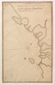
A Plan of George's Bay & Islands Call'd by the French I. du quinto
11862.
A plan of the City of New York from an actual survey anno domini MDCCLV
11863.
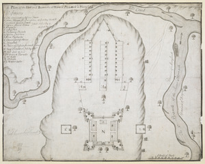
A Plan of the Fort and Barracks at Mount Pleasant in Maryland
11864.
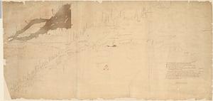
Plan of the river St. Lawrence from the Island of Anticosta to Quebec ... from a manuscript found on board of the Alcide taken...
11865.
Plan of the Town and Harbour of Louisbourg
11866.
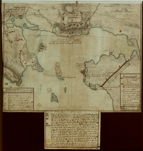
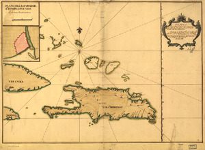
Plano de la Ysla de Santo Domingo, parte de las Cuba, Jamaica y otras contiguas a ellas, del seno mexicano
11867.
Port Royal appellé aujourd. par les Anglois Annapolis Royal
11868.
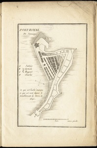
Port-Royal de Jamaique
11869.
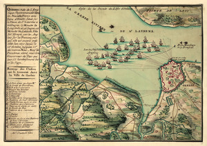
A prospective plan of the battle fought near Lake George on the 8th of September, 1755 between 2000 English with 250 Mohawks...
11870.
Qubbec, ville de l'Amerique septentrionale dans la Nouvelle France avec titre d'Eveché située sur le fleuve de St. Laurens a...
11871.
Sault du Niagara de 135 pieds de haut
11872.
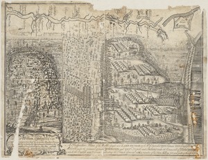
S[i]r: This is minuts of the fort at Crown Point and of the redouts built round it; which I took on the mountain to the west of...
11873.
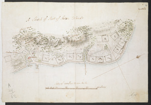
A Sketch of Part of Staten Island
11874.
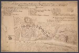
A sketch of the field of battle with the disposition of the troops in the beginning of the engagement of the 9th of July on the...
11875.
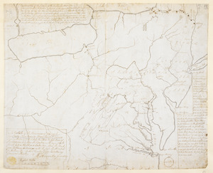
A Sketch of the Provinces of New York, New Jersey, Pensilvania, Maryland & Virginia shewing the line of forts lately built on...
11876.
Theatrum belli in America Septentrionali
11877.
Vera-Cruz dans le Golfe du Méxique [and] Isle St. Juan, Fort de St. Jean d'Ulloa
11878.
Vue de Quebec, capitale du Canada
11879.
An accurate map of the English colonies in North America, bordering on the river Ohio
11880.
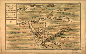
Captain Snow's scetch of the country by himself, and the best accounts he could receive from the Indian traders
‹ Prev
Next ›
1
2
…
590
591
592
593
594
595
596
597
598
…
669
670


![S[i]r: This is minuts of the fort at Crown Point and of the redouts built round it; which I took on the mountain to the west of Crown Point abt. a miles distance](https://bpldcassets.blob.core.windows.net/derivatives/images/commonwealth:q524nd85w/image_thumbnail_300.jpg)

![Vera-Cruz dans le Golfe du Méxique [and] Isle St. Juan, Fort de St. Jean d'Ulloa](https://bpldcassets.blob.core.windows.net/derivatives/images/commonwealth:cj82kx24p/image_thumbnail_300.jpg)