Toggle navigation
LMEC Home
Exhibitions
Georeferencing
Tools for Teachers
Collections
My Favorites
Sign Up / Log In
Search
Search the map portal
Map Collection
Map Collection
Map Sets
Search
Search
Search for
Search In
All Fields
Creator
Title
Subject
Place
Search All Digital Collections
Advanced Search
13385 Results
Filter your Search
Place
North and Central America
9,353
United States
7,078
Suffolk (county)
1,664
Boston
1,621
Europe
1,035
Canada
949
Massachusetts
794
New York
532
more
Place
»
Topic
Boston (Mass.)--Maps
741
City planning--Massachusetts--Boston--Maps
418
United States--History--Revolution, 1775-1783--Maps
329
United States--Maps
315
Urban renewal--Massachusetts--Boston--Maps
254
Real property--Massachusetts--Boston--Maps
252
Massachusetts--Maps
219
Insurance surveys
197
more
Topic
»
Date
Date range begin
–
Date range end
Current results range from
1482
to
2023
View distribution
Creator
United States. Hydrographic Office
595
Boston Redevelopment Authority
403
Des Barres, Joseph F. W. (Joseph Frederick Wallet), 1722-1824
247
Royal United Services Institute for Defence and Security Studies
160
Jefferys, Thomas, -1771
154
George, III, King of Great Britain, 1738-1820
152
George, IV, King of Great Britain, 1762-1830
151
O.H. Bailey & Co
148
more
Creator
»
Format
Maps/Atlases
13,205
Manuscripts
985
Prints
102
Books
49
Drawings/Illustrations
44
Photographs
15
Objects/Artifacts
13
Documents
7
more
Format
»
Georeferenced
Yes
979
No
12,406
Collection
Norman B. Leventhal Map Center Collection
8,891
American Revolutionary War-Era Maps
3,305
Boston and New England Maps
2,804
Urban Maps
2,397
Maritime Charts and Atlases
1,150
William L. Clements Library Collection
910
Library of Congress Collection
618
Boston Redevelopment Authority Collection
475
more
Collection
»
Available to use
No known restrictions
9,952
Creative Commons license
1,677
Search Constraints
Sort by relevance
relevance
title
date (asc)
date (desc)
Number of results to display per page
20 per page
10
per page
20
per page
50
per page
100
per page
View results as:
grid view
map view
Search Results
11801.
South Pacific Ocean
11802.
South Pacific Ocean, Caroline Island
11803.
South Pacific Ocean, Easter Island (Te Pito te Henua Island)
11804.
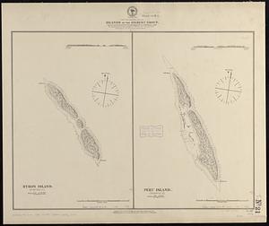
South Pacific Ocean, Islands in the Gilbert Group : from an examination by the U.S.S. "Narragansett", Comdr. R.W. Meade, in 1872
11805.
South Pacific Ocean, Paumotu Group - Rairoa (Rangiroa) Island, Avatoru Pass and anchorage
11806.
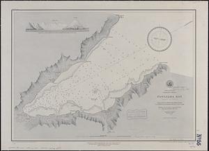
South Pacific Ocean, Samoan Group, Fangaloa Bay (Island of Upolu)
11807.
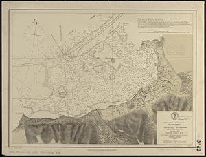
South Pacific Ocean, Solomon Islands, Guadalcanal and Florida Is. with a portion of Malaita I. : from British surveys to 1912
11808.
South Pacific--Society Islands, n.w. coast of Tahiti, Papiete Harbor : from a French survey in 1869 ; corrected 1889
11809.
The south part of Africa, and the island of Madagascar : here the Portugueze have many settlements and all the trade
11810.
The south part of Great Britain, called England and Wales
11811.
The south part of New England as it planted this yeare, 1634
11812.
The south part of New England, as it planted this yeare, 1639
11813.
The south part of New-England, as it is planted this yeare, 1635
11814.
South Perry, [Ohio]
11815.
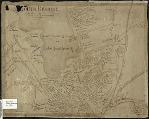
South Reading
11816.
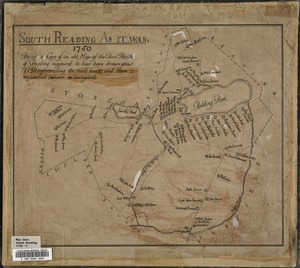
South Reading as it was : being a copy of an old map of the First Parish of Reading, supposed to have been drawn about the year...
11817.
[South Reading Common area] : copied from an old plan formerly in the possession of Burrage Yale
11818.
The South Shore and Norfolk County, Mass
11819.
South Station development study : access plan
11820.
South Station development study : site location and functional areas
‹ Prev
Next ›
1
2
…
587
588
589
590
591
592
593
594
595
…
669
670


![South Perry, [Ohio]](https://bpldcassets.blob.core.windows.net/derivatives/images/commonwealth:w9505r98t/image_thumbnail_300.jpg)
![[South Reading Common area]](https://bpldcassets.blob.core.windows.net/derivatives/images/commonwealth:c534g422v/image_thumbnail_300.jpg)


