Toggle navigation
LMEC Home
Exhibitions
Georeferencing
Tools for Teachers
Collections
My Favorites
Sign Up / Log In
Search
Search the map portal
Map Collection
Map Collection
Map Sets
Search
Search
Search for
Search In
All Fields
Creator
Title
Subject
Place
Search All Digital Collections
Advanced Search
13385 Results
Filter your Search
Place
North and Central America
9,353
United States
7,078
Suffolk (county)
1,664
Boston
1,621
Europe
1,035
Canada
949
Massachusetts
794
New York
532
more
Place
»
Topic
Boston (Mass.)--Maps
741
City planning--Massachusetts--Boston--Maps
418
United States--History--Revolution, 1775-1783--Maps
329
United States--Maps
315
Urban renewal--Massachusetts--Boston--Maps
254
Real property--Massachusetts--Boston--Maps
252
Massachusetts--Maps
219
Insurance surveys
197
more
Topic
»
Date
Date range begin
–
Date range end
Current results range from
1482
to
2023
View distribution
Creator
United States. Hydrographic Office
595
Boston Redevelopment Authority
403
Des Barres, Joseph F. W. (Joseph Frederick Wallet), 1722-1824
247
Royal United Services Institute for Defence and Security Studies
160
Jefferys, Thomas, -1771
154
George, III, King of Great Britain, 1738-1820
152
George, IV, King of Great Britain, 1762-1830
151
O.H. Bailey & Co
148
more
Creator
»
Format
Maps/Atlases
13,205
Manuscripts
985
Prints
102
Books
49
Drawings/Illustrations
44
Photographs
15
Objects/Artifacts
13
Documents
7
more
Format
»
Georeferenced
Yes
979
No
12,406
Collection
Norman B. Leventhal Map Center Collection
8,891
American Revolutionary War-Era Maps
3,305
Boston and New England Maps
2,804
Urban Maps
2,397
Maritime Charts and Atlases
1,150
William L. Clements Library Collection
910
Library of Congress Collection
618
Boston Redevelopment Authority Collection
475
more
Collection
»
Available to use
No known restrictions
9,952
Creative Commons license
1,677
Search Constraints
Sort by relevance
relevance
title
date (asc)
date (desc)
Number of results to display per page
20 per page
10
per page
20
per page
50
per page
100
per page
View results as:
grid view
map view
Search Results
11601.
Skirmish at Richmond Jan. 5th. 1781
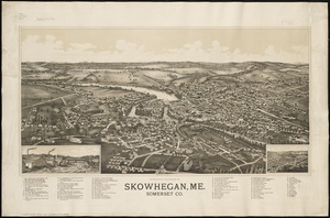
11602.
Skowhegan, Me : Somerset Co
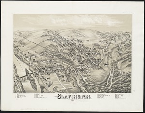
11603.
Slatington : Pennsylvania
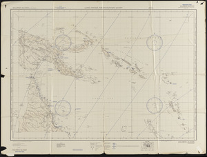
11604.
Small circular world map
11605.
A SMALL MAP of the SEA COAST of NEW ENGLAND Together with the out Lines of Several of the Provinces Lying theron. 1738
11606.
A small map of the sea coast of New England together with the outlines of several of the provinces lying thereon, 1738
11607.
Smitherman Cotton Mills, Inc., New Bedford, Mass. [insurance map]
11608.
Smith's topographical map of Virginia and Maryland
11609.
Smyrna, Delaware : 1885
11610.
Society Islands, the n.w. coast of Tahiti from Papeete to Point Venus, embracing the harbors of Papeete, Tau-noa and Papawa and...
11611.
Soil reconnoissance, Montana 1925 : Chouteau County
11612.
Solar and lunar eclipse diagrams
11613.
Solomon Islands long range air navigation chart
11614.
Somerset Co., Penn'a
11615.
Sooke sheet, Vancouver Island, British Columbia
11616.
Soule Mill (Cotton Mill), New Bedford, Mass.
11617.
Soundings of the bar of Sandy Hook at low water & the marks made use of for the best water
11618.
South & North Carolina : an exact map of the boundary line between the provinces of South & North Carolina agreeable to the...
11619.
South Acton, Mass : 1886
11620.
South Africa
‹ Prev
Next ›
1
2
…
577
578
579
580
581
582
583
584
585
…
669
670