Toggle navigation
LMEC Home
Exhibitions
Georeferencing
Tools for Teachers
Collections
My Favorites
Sign Up / Log In
Search
Search the map portal
Map Collection
Map Collection
Map Sets
Search
Search
Search for
Search In
All Fields
Creator
Title
Subject
Place
Search All Digital Collections
Advanced Search
13385 Results
Filter your Search
Place
North and Central America
9,353
United States
7,078
Suffolk (county)
1,664
Boston
1,621
Europe
1,035
Canada
949
Massachusetts
794
New York
532
more
Place
»
Topic
Boston (Mass.)--Maps
741
City planning--Massachusetts--Boston--Maps
418
United States--History--Revolution, 1775-1783--Maps
329
United States--Maps
315
Urban renewal--Massachusetts--Boston--Maps
254
Real property--Massachusetts--Boston--Maps
252
Massachusetts--Maps
219
Insurance surveys
197
more
Topic
»
Date
Date range begin
–
Date range end
Current results range from
1482
to
2023
View distribution
Creator
United States. Hydrographic Office
595
Boston Redevelopment Authority
403
Des Barres, Joseph F. W. (Joseph Frederick Wallet), 1722-1824
247
Royal United Services Institute for Defence and Security Studies
160
Jefferys, Thomas, -1771
154
George, III, King of Great Britain, 1738-1820
152
George, IV, King of Great Britain, 1762-1830
151
O.H. Bailey & Co
148
more
Creator
»
Format
Maps/Atlases
13,205
Manuscripts
985
Prints
102
Books
49
Drawings/Illustrations
44
Photographs
15
Objects/Artifacts
13
Documents
7
more
Format
»
Georeferenced
Yes
979
No
12,406
Collection
Norman B. Leventhal Map Center Collection
8,891
American Revolutionary War-Era Maps
3,305
Boston and New England Maps
2,804
Urban Maps
2,397
Maritime Charts and Atlases
1,150
William L. Clements Library Collection
910
Library of Congress Collection
618
Boston Redevelopment Authority Collection
475
more
Collection
»
Available to use
No known restrictions
9,952
Creative Commons license
1,677
Search Constraints
Sort by relevance
relevance
title
date (asc)
date (desc)
Number of results to display per page
20 per page
10
per page
20
per page
50
per page
100
per page
View results as:
grid view
map view
Search Results
11101.
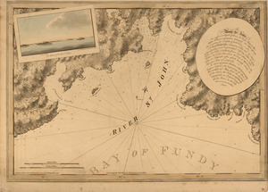
[River St. John]
11102.
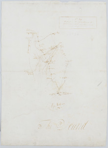
The river St. John
11103.
The River St. John
11104.
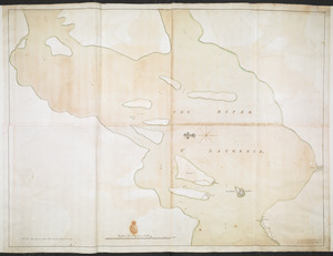
THE RIVER S.T LAURENCE
11105.
The River St. Lawrence from Mal Bay to the Basin of Quebec
11106.
The River St. Lawrence from the Basin of Quebec to the Falls of Richeu
11107.
River valley with several foothills and swamp
11108.
Riverside & Dan River Cotton Mills, Inc. "Dan River Division," Schoolfield, Va. [insurance map]
11109.
Riverside & Dan River Cotton Mills, Inc. "Riverside Division, Mill No. 8" (Cotton Mill), Danville, Va. [insurance map]
11110.
The Riverway master plan
11111.
La Riviere de la Garomne et la Dordogne et le pays aux environs de Bordeaux
11112.
La rivière du Détroit depuis le Lac Sainte Claire jusqu'au Lac Erié
11113.
R.L. Polk & Co.'s map of Bay City, and Essexville Mich
11114.
R.L. Polk & Co's map of greater Battle Creek and suburbs
11115.
R.L. Polk & Co's map of Memphis, Tenn : from official records and original plats
11116.
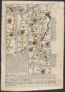
The road from London to Buckingham
11117.
The road from New Bridge and Hackinsack to Burlington
11118.
Road from the White Plains to Bloomer's Mill at Rye Neck, and Cross Roads : no 20
11119.
Road map, drawn & engraved expressly for Road book of Boston & vicinity
11120.
Road map of the Albany-Troy district
‹ Prev
Next ›
1
2
…
552
553
554
555
556
557
558
559
560
…
669
670
![[River St. John]](https://bpldcassets.blob.core.windows.net/derivatives/images/commonwealth:dz010t93f/image_thumbnail_300.jpg)


![Riverside & Dan River Cotton Mills, Inc. "Dan River Division," Schoolfield, Va. [insurance map]](https://bpldcassets.blob.core.windows.net/derivatives/images/commonwealth:2r36vc39h/image_thumbnail_300.jpg)
![Riverside & Dan River Cotton Mills, Inc. "Riverside Division, Mill No. 8" (Cotton Mill), Danville, Va. [insurance map]](https://bpldcassets.blob.core.windows.net/derivatives/images/commonwealth:2r36vc37z/image_thumbnail_300.jpg)