Toggle navigation
LMEC Home
Exhibitions
Georeferencing
Tools for Teachers
Collections
My Favorites
Sign Up / Log In
Search
Search the map portal
Map Collection
Map Collection
Map Sets
Search
Search
Search for
Search In
All Fields
Creator
Title
Subject
Place
Search All Digital Collections
Advanced Search
13385 Results
Filter your Search
Place
North and Central America
9,353
United States
7,078
Suffolk (county)
1,664
Boston
1,621
Europe
1,035
Canada
949
Massachusetts
794
New York
532
more
Place
»
Topic
Boston (Mass.)--Maps
741
City planning--Massachusetts--Boston--Maps
418
United States--History--Revolution, 1775-1783--Maps
329
United States--Maps
315
Urban renewal--Massachusetts--Boston--Maps
254
Real property--Massachusetts--Boston--Maps
252
Massachusetts--Maps
219
Insurance surveys
197
more
Topic
»
Date
Date range begin
–
Date range end
Current results range from
1482
to
2023
View distribution
Creator
United States. Hydrographic Office
595
Boston Redevelopment Authority
403
Des Barres, Joseph F. W. (Joseph Frederick Wallet), 1722-1824
247
Royal United Services Institute for Defence and Security Studies
160
Jefferys, Thomas, -1771
154
George, III, King of Great Britain, 1738-1820
152
George, IV, King of Great Britain, 1762-1830
151
O.H. Bailey & Co
148
more
Creator
»
Format
Maps/Atlases
13,205
Manuscripts
985
Prints
102
Books
49
Drawings/Illustrations
44
Photographs
15
Objects/Artifacts
13
Documents
7
more
Format
»
Georeferenced
Yes
979
No
12,406
Collection
Norman B. Leventhal Map Center Collection
8,891
American Revolutionary War-Era Maps
3,305
Boston and New England Maps
2,804
Urban Maps
2,397
Maritime Charts and Atlases
1,150
William L. Clements Library Collection
910
Library of Congress Collection
618
Boston Redevelopment Authority Collection
475
more
Collection
»
Available to use
No known restrictions
9,952
Creative Commons license
1,677
Search Constraints
Sort by date (asc)
relevance
title
date (asc)
date (desc)
Number of results to display per page
20 per page
10
per page
20
per page
50
per page
100
per page
View results as:
grid view
map view
Search Results
10221.
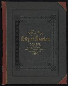
Atlas of the city of Newton, Massachusetts
10222.
Atlas of the city of Northampton and the town of Easthampton, Hampshire County, Massachusetts
10223.
Atlas of the city of Somerville, Massachusetts : from actual surveys and official plans
10224.
Atlas of the town of Hull, Plymouth County, and part of the Jerusalem Road, Norfolk County, Massachussetts, from actual surveys...
10225.
Atlas of the town of Leominster, Worcester County, Massachusetts
10226.
A bird's-eye view of Providence : showing the new railroad station and State House
10227.
British Columbia : Kamloops sheet, topography, economic minerals, & glacial striae
10228.
British Columbia : Kamloops sheet, geologically coloured
10229.
Caerte van de voornaemste reysen ende ontdeckingen door de Hollanders gedaen, alsook vande landen, plaetsen ende factoriën in...
10230.
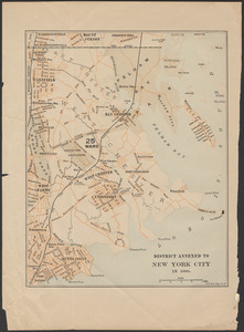
District annexed to New York City in 1895
10231.
Dominion of Canada
10232.
Eldridge's new chart no. 4 Boston Harbor : compiled from the latest surveys
10233.
Forest Hills Cemetery : consecrated June 28th, 1848 : area 203 acres
10234.
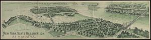
Guide of the New York State Reservation at Niagara
10235.
A guide to Boston
10236.
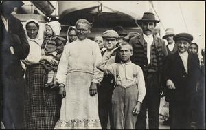
Immigrant boy salutes flag on ship in Boston harbor
10237.
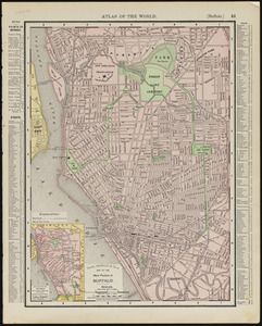
Main portion of Buffalo
10238.
Map of Boston
10239.
Map of Boston
10240.
Map of Boston and vicinity : 1895
‹ Prev
Next ›
1
2
…
508
509
510
511
512
513
514
515
516
…
669
670