Toggle navigation
LMEC Home
Exhibitions
Georeferencing
Tools for Teachers
Collections
My Favorites
Sign Up / Log In
Search
Search the map portal
Map Collection
Map Collection
Map Sets
Search
Search
Search for
Search In
All Fields
Creator
Title
Subject
Place
Search All Digital Collections
Advanced Search
13385 Results
Filter your Search
Place
North and Central America
9,353
United States
7,078
Suffolk (county)
1,664
Boston
1,621
Europe
1,035
Canada
949
Massachusetts
794
New York
532
more
Place
»
Topic
Boston (Mass.)--Maps
741
City planning--Massachusetts--Boston--Maps
418
United States--History--Revolution, 1775-1783--Maps
329
United States--Maps
315
Urban renewal--Massachusetts--Boston--Maps
254
Real property--Massachusetts--Boston--Maps
252
Massachusetts--Maps
219
Insurance surveys
197
more
Topic
»
Date
Date range begin
–
Date range end
Current results range from
1482
to
2023
View distribution
Creator
United States. Hydrographic Office
595
Boston Redevelopment Authority
403
Des Barres, Joseph F. W. (Joseph Frederick Wallet), 1722-1824
247
Royal United Services Institute for Defence and Security Studies
160
Jefferys, Thomas, -1771
154
George, III, King of Great Britain, 1738-1820
152
George, IV, King of Great Britain, 1762-1830
151
O.H. Bailey & Co
148
more
Creator
»
Format
Maps/Atlases
13,205
Manuscripts
985
Prints
102
Books
49
Drawings/Illustrations
44
Photographs
15
Objects/Artifacts
13
Documents
7
more
Format
»
Georeferenced
Yes
979
No
12,406
Collection
Norman B. Leventhal Map Center Collection
8,891
American Revolutionary War-Era Maps
3,305
Boston and New England Maps
2,804
Urban Maps
2,397
Maritime Charts and Atlases
1,150
William L. Clements Library Collection
910
Library of Congress Collection
618
Boston Redevelopment Authority Collection
475
more
Collection
»
Available to use
No known restrictions
9,952
Creative Commons license
1,677
Search Constraints
Sort by title
relevance
title
date (asc)
date (desc)
Number of results to display per page
20 per page
10
per page
20
per page
50
per page
100
per page
View results as:
grid view
map view
Search Results
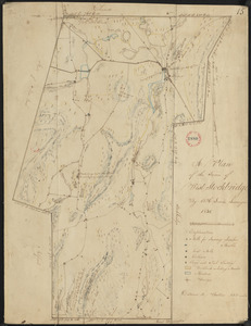
10201.
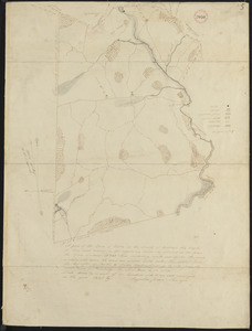
Plan of West Stockbridge made by B. H. Lewis, dated 1831
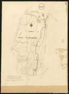
10202.
Plan of West Stockbridge surveyed by David Fairchild, dated October, 1794.
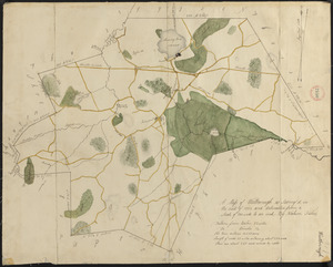
10203.
Plan of Westborough made by Nahum Fisher, dated 1830
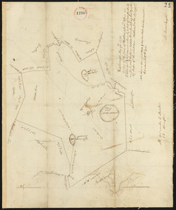
10204.
Plan of Westborough surveyed by Nathan Fisher, dated October, 1794.
10205.
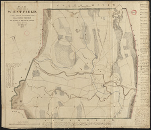
Plan of Westfield made by Allen, D. E., dated 1831
10206.
Plan of Westfield, surveyor's name not given, dated November 1794.
10207.
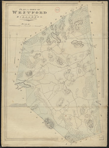
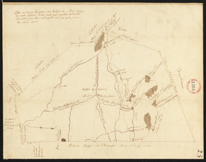
Plan of Westford made by John G. Hales, dated 1831
10208.
Plan of Westford, surveyor's name not given, dated May 1795.
10209.
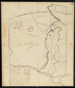
Plan of Westhampton surveyed by Jonathan Clark, dated June 1, 1795.
10210.
Plan of Westhampton, surveyor's name not given, dated 1831
10211.
Plan of Westminster (No Town) made by Caleb Dana, dated 1838
10212.
Plan of Westminster, surveyor's name not given, dated June 1831
10213.
Plan of Westminster, surveyor's name not given, dated May 6, 1795.
10214.
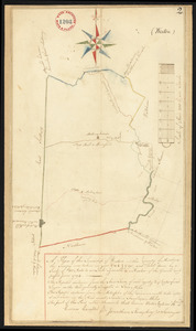
Plan of Weston made by Augustus Tower, dated 1830
10215.
Plan of Weston surveyed by Jonathan Kingsbury, dated 1794-5.
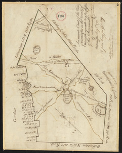
10216.
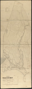
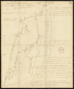
Plan of Westport made by Silvanus Bourne dated 1831
10217.
Plan of Westport surveyed by Zadock Maxfeld, dated November 1795.
10218.
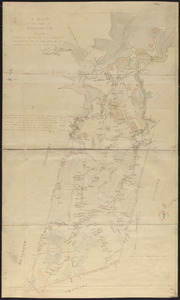
Plan of Weymouth made by Lemuel Humphrey and Noah Torrey, dated 1830
10219.
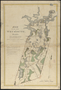
Plan of Weymouth made by Lemuel Humphrey and Noah Torrey, dated 1830
10220.
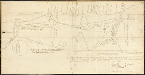
Plan of Weymouth surveyed by James Humphreys, dated May 27, 1795.
‹ Prev
Next ›
1
2
…
507
508
509
510
511
512
513
514
515
…
669
670