Toggle navigation
LMEC Home
Exhibitions
Georeferencing
Tools for Teachers
Collections
My Favorites
Sign Up / Log In
Search
Search the map portal
Map Collection
Map Collection
Map Sets
Search
Search
Search for
Search In
All Fields
Creator
Title
Subject
Place
Search All Digital Collections
Advanced Search
13385 Results
Filter your Search
Place
North and Central America
9,353
United States
7,078
Suffolk (county)
1,664
Boston
1,621
Europe
1,035
Canada
949
Massachusetts
794
New York
532
more
Place
»
Topic
Boston (Mass.)--Maps
741
City planning--Massachusetts--Boston--Maps
418
United States--History--Revolution, 1775-1783--Maps
329
United States--Maps
315
Urban renewal--Massachusetts--Boston--Maps
254
Real property--Massachusetts--Boston--Maps
252
Massachusetts--Maps
219
Insurance surveys
197
more
Topic
»
Date
Date range begin
–
Date range end
Current results range from
1482
to
2023
View distribution
Creator
United States. Hydrographic Office
595
Boston Redevelopment Authority
403
Des Barres, Joseph F. W. (Joseph Frederick Wallet), 1722-1824
247
Royal United Services Institute for Defence and Security Studies
160
Jefferys, Thomas, -1771
154
George, III, King of Great Britain, 1738-1820
152
George, IV, King of Great Britain, 1762-1830
151
O.H. Bailey & Co
148
more
Creator
»
Format
Maps/Atlases
13,205
Manuscripts
985
Prints
102
Books
49
Drawings/Illustrations
44
Photographs
15
Objects/Artifacts
13
Documents
7
more
Format
»
Georeferenced
Yes
979
No
12,406
Collection
Norman B. Leventhal Map Center Collection
8,891
American Revolutionary War-Era Maps
3,305
Boston and New England Maps
2,804
Urban Maps
2,397
Maritime Charts and Atlases
1,150
William L. Clements Library Collection
910
Library of Congress Collection
618
Boston Redevelopment Authority Collection
475
more
Collection
»
Available to use
No known restrictions
9,952
Creative Commons license
1,677
Search Constraints
Sort by date (asc)
relevance
title
date (asc)
date (desc)
Number of results to display per page
20 per page
10
per page
20
per page
50
per page
100
per page
View results as:
grid view
map view
Search Results
9521.
The harbor of Hakodadi, Yessi Id. Japan
9522.
Harbor of Sagua La Grande, north coast of cuba : from a Spanish survey in 1858
9523.
Harbors and anchorages on the eastern coast of Newfoundland : republication of British Admty. charts no. 279 & 295
9524.
Harbour of Muthuata, north side of Vanua Levu ; Tibethe & Vicuna Harbours on the north side of Vanua Levu
9525.
Harbour of Muthuata, north side of Vanua Levu ; Tibethe & Vicuna Harbour's on the north side of Vanua Levu
9526.
Le Havre agrandissement du port : plan des travaux projetés
9527.
Hawaiian Islands, Hawaii, Hilo Bay : from a Hawaiian government survey in 1882
9528.
Hereheretue or St. Pablo, Paumotu Group ; Nukutipipi or Margaret Island, Paumotu Group ; Anu-Anuraro, Heretua or Archangel of...
9529.
The Indian Ocean : compiled from the latest authorities, 1880
9530.
Innocence abroad
9531.
Island of Yendua, Feejee Group ; Nucumurry Harbour, west end of Vanua Levu ; Wailea Bay, north side of Vanua Levu
9532.
Japan - n.w. coast of Nipon, Nanao Harbors : south harbor, surveyed by Commander C.J. Bullock and the officers of H.M.S....
9533.
Japan, anchorages on the coasts of Yezo Id
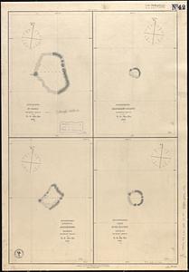
9534.
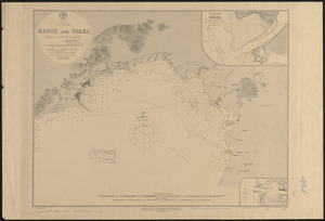
Japan, Gulf of Ösaka, Hiogo and Ösaka : compiled from British and French surveys to 1878
9535.
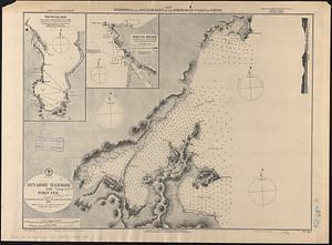
Japan, harbors and anchorages on the north-west coast of Nipon
9536.
Latii veteris et finitarum regionum
9537.
Limits under fishery treaties, 1818 and 1888
9538.
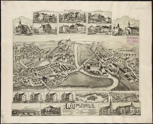
Lonsdale, Rhode Island : 1888
9539.
Low Archipelago or Paumotu Group
9540.
Mansfield, Massachusetts : 1888
‹ Prev
Next ›
1
2
…
473
474
475
476
477
478
479
480
481
…
669
670