Toggle navigation
LMEC Home
Exhibitions
Georeferencing
Tools for Teachers
Collections
My Favorites
Sign Up / Log In
Search
Search the map portal
Map Collection
Map Collection
Map Sets
Search
Search
Search for
Search In
All Fields
Creator
Title
Subject
Place
Search All Digital Collections
Advanced Search
14021 Results
Filter your Search
Place
North and Central America
10,683
United States
8,692
Massachusetts
2,808
Suffolk (county)
1,682
Boston
1,638
Europe
1,420
Canada
1,009
New York
674
more
Place
»
Topic
Boston (Mass.)--Maps
748
City planning--Massachusetts--Boston--Maps
418
United States--History--Revolution, 1775-1783--Maps
331
United States--Maps
328
Real property--Massachusetts--Boston--Maps
254
Urban renewal--Massachusetts--Boston--Maps
254
North America--Maps--Early works to 1800
240
Massachusetts--Maps
234
more
Topic
»
Date
Date range begin
–
Date range end
Current results range from
1482
to
2023
View distribution
Creator
United States. Hydrographic Office
597
Boston Redevelopment Authority
404
Des Barres, Joseph F. W. (Joseph Frederick Wallet), 1722-1824
247
Jefferys, Thomas, -1771
172
Royal United Services Institute for Defence and Security Studies
160
George, III, King of Great Britain, 1738-1820
152
George, IV, King of Great Britain, 1762-1830
151
O.H. Bailey & Co
148
more
Creator
»
Format
Maps/Atlases
13,839
Manuscripts
985
Prints
102
Books
49
Drawings/Illustrations
44
Photographs
15
Objects/Artifacts
13
Documents
7
more
Format
»
Georeferenced
Yes
979
No
13,042
Collection
Norman B. Leventhal Map & Education Center Collection
9,110
American Revolutionary War-Era Maps
3,627
Boston and New England Maps
2,921
Urban Maps
2,480
Maritime Charts and Atlases
1,169
William L. Clements Library Collection
910
Library of Congress Collection
618
Boston Redevelopment Authority Collection
475
more
Collection
»
Available to use
No known restrictions
10,268
Creative Commons license
1,678
Search Constraints
Sort by relevance
relevance
title
date (asc)
date (desc)
Number of results to display per page
20 per page
10
per page
20
per page
50
per page
100
per page
View results as:
grid view
map view
Search Results
9301.
Plan of Edgecomb surveyed by Joseph Beath, dated December 6, 1794.
9302.
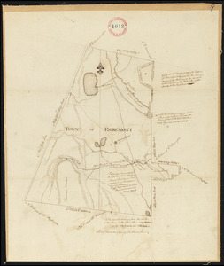
Plan of Egremont made by David Fairchild, dated December, 1794.
9303.
Plan of Egremont made by Moses Loomis, dated 1831
9304.
Plan of Elizabeth Islands, etc. (Chilmark), surveyor's name not given, dated May 27, 1795.
9305.
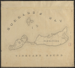
Plan of Elizabeth Islands (Nashawena, Cuttyhunk, and Peniquese), surveyor's name not given, dated 1830
9306.
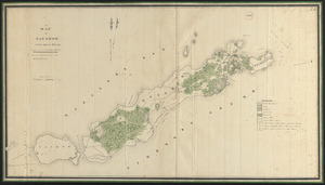
Plan of Elizabeth Islands (Naushon, Pasque, and the Wepeckalt Islands) made by Henry H. Crapo, dated 1837
9307.
Plan of Elizbth Town
9308.
Plan of Enfield made by E. S. Darling, dated August, 1830
9309.
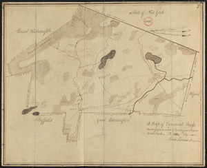
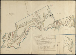
[Plan of engagement with British ships near Red Bank, New Jersey, October 22 and 23, 1777]
9310.
Plan of Erving's Grant (Erving), surveyor's name not given, dated October 1830
9311.
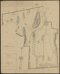
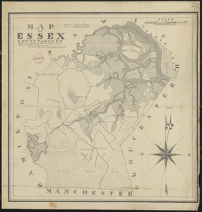
Plan of Essex made by Philander Anderson, dated November, 1830
9312.
Plan of estate, nos 1043 to 1059 Washington Street, Boston, belonging to the heirs of the late William Brigham : to be sold by...
9313.
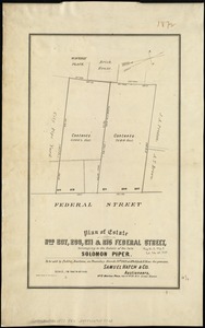
Plan of estate nos 207, 209, 211 & 215 Federal Street, belonging to the estate of the late Solomon Piper : to be sold at public...
9314.
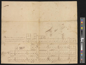
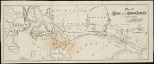
Plan of estate of the Boston Land Co. and surroundings
9315.
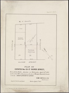
Plan of estates nos. 13-17 Oliver Street, to be sold by public auction on Wednesday April 12th 1871 at 12 o'clock m. on the...
9316.
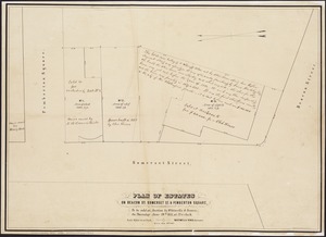
Plan of estates on Beacon St., Somerset St. & Pemberton Square : to be sold at auction by Whitwells & Seaver, on Thursday June...
9317.
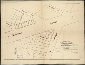
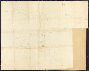
[Plan of estates on Charles River bridge, Prince Street, Lynn Court, and Snow Hill Street]
9318.
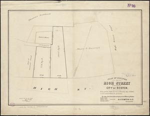
Plan of estates on High Street belonging to the City of Boston : to be sold by public auction on Thursday May 21st 1868, at 12...
9319.
Plan of estates on Suffolk St. District : belonging to the City of Boston : to be sold at public auction, Dec. 23rd 1871
9320.
Plan of estates on Suffolk St. district : belonging to the City of Boston : to be sold at public auction on Saturday Dec. 16th...
‹ Prev
Next ›
1
2
…
462
463
464
465
466
467
468
469
470
…
701
702
![[Plan of engagement with British ships near Red Bank, New Jersey, October 22 and 23, 1777]](https://bpldcassets.blob.core.windows.net/derivatives/images/commonwealth:9s161d76t/image_thumbnail_300.jpg)

![[Plan of estates on Charles River bridge, Prince Street, Lynn Court, and Snow Hill Street]](https://bpldcassets.blob.core.windows.net/derivatives/images/commonwealth:x059c9615/image_thumbnail_300.jpg)