Toggle navigation
LMEC Home
Exhibitions
Georeferencing
Tools for Teachers
Collections
My Favorites
Sign Up / Log In
Search
Search the map portal
Map Collection
Map Collection
Map Sets
Search
Search
Search for
Search In
All Fields
Creator
Title
Subject
Place
Search All Digital Collections
Advanced Search
13385 Results
Filter your Search
Place
North and Central America
9,353
United States
7,078
Suffolk (county)
1,664
Boston
1,621
Europe
1,035
Canada
949
Massachusetts
794
New York
532
more
Place
»
Topic
Boston (Mass.)--Maps
741
City planning--Massachusetts--Boston--Maps
418
United States--History--Revolution, 1775-1783--Maps
329
United States--Maps
315
Urban renewal--Massachusetts--Boston--Maps
254
Real property--Massachusetts--Boston--Maps
252
Massachusetts--Maps
219
Insurance surveys
197
more
Topic
»
Date
Date range begin
–
Date range end
Current results range from
1482
to
2023
View distribution
Creator
United States. Hydrographic Office
595
Boston Redevelopment Authority
403
Des Barres, Joseph F. W. (Joseph Frederick Wallet), 1722-1824
247
Royal United Services Institute for Defence and Security Studies
160
Jefferys, Thomas, -1771
154
George, III, King of Great Britain, 1738-1820
152
George, IV, King of Great Britain, 1762-1830
151
O.H. Bailey & Co
148
more
Creator
»
Format
Maps/Atlases
13,205
Manuscripts
985
Prints
102
Books
49
Drawings/Illustrations
44
Photographs
15
Objects/Artifacts
13
Documents
7
more
Format
»
Georeferenced
Yes
979
No
12,406
Collection
Norman B. Leventhal Map Center Collection
8,891
American Revolutionary War-Era Maps
3,305
Boston and New England Maps
2,804
Urban Maps
2,397
Maritime Charts and Atlases
1,150
William L. Clements Library Collection
910
Library of Congress Collection
618
Boston Redevelopment Authority Collection
475
more
Collection
»
Available to use
No known restrictions
9,952
Creative Commons license
1,677
Search Constraints
Sort by date (desc)
relevance
title
date (asc)
date (desc)
Number of results to display per page
20 per page
10
per page
20
per page
50
per page
100
per page
View results as:
grid view
map view
Search Results
9281.
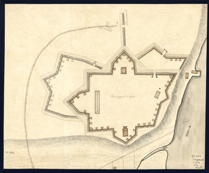
Fort Provost in 1782
9282.
Hindoostan
9283.
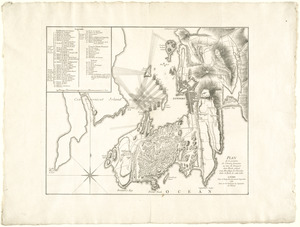
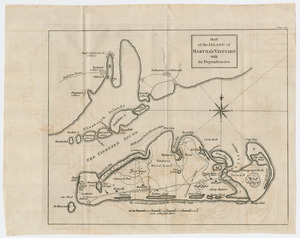
Map of the island of Martha's Vineyard with its dependencies
9284.
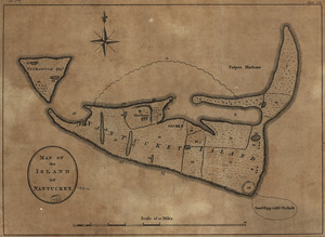
Map of the island of Nantucket
9285.
A map of the province of Massachusets Bay and colony of Rhode Island, with part of Connecticut, New Hampshire, and Vermont
9286.
A map of the province of Massachusets Bay and colony of Rhode Island, with part of Connecticut, New Hampshire, and Vermont
9287.
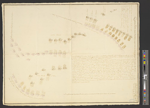
[Map showing the attack of the French upon York in Virginia, June 1782]
9288.
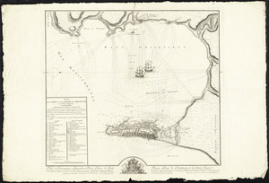
A new and accurate chart of the harbour of Boston in New England in North America
9289.
A new and exact plan of the cities of London and Westminster & the borough of Southwark to this present year, exhibiting in a...
9290.
A new map of the British empire in Nth. America
9291.
Orbis Romani pars orientalis : auspiciis serenissimi principis Ludovici Philippi Aurelianorum ducis publici juris facta
9292.
Plan de Gibraltar
9293.
Plan de la bataille de Montmouth où le Gl. Washington commandait l'Armée Américaine et le Gl. Clinton l'Armée Anglaise, le...
9294.
Plan de la bataille de Montmouth où le Gl. Washington commandait l'armeé Americaine et le Gl. Clinton l'armeé Anglaise, le 28...
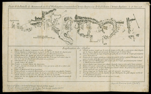
9295.
Plan de la position de l'armée française au tour de Newport dans Rhode Island et du mouillage de l'escadre dans la rade de...
9296.
Plan de la ville et des forts de Gibraltar, avec la Baye d'Algesiras
9297.
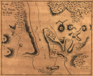
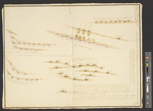
Plan de West-Pointe du nord levé a vue
9298.
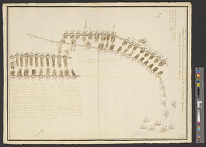
Plan du combat du 12 Avril 1782 présenté par le chr. Dethy capne. du vass. de roy le Citoyen : quatrième position depuis dix...
9299.
Plan du combat du 12 Avril 1782 présenté par le chr. Dethy capne. du vass. de roy le Citoyen : cinquième position des deux...
9300.
Plan du combat du 12 Avril 1782 présenté par le chr. Dethy capne. du vass. de roy le Citoyen : troisième position des deux...
‹ Prev
Next ›
1
2
…
461
462
463
464
465
466
467
468
469
…
669
670


![[Map showing the attack of the French upon York in Virginia, June 1782]](https://bpldcassets.blob.core.windows.net/derivatives/images/commonwealth:hx11xz51j/image_thumbnail_300.jpg)