Toggle navigation
LMEC Home
Exhibitions
Georeferencing
Tools for Teachers
Collections
My Favorites
Sign Up / Log In
Search
Search the map portal
Map Collection
Map Collection
Map Sets
Search
Search
Search for
Search In
All Fields
Creator
Title
Subject
Place
Search All Digital Collections
Advanced Search
146 Results
My Search
Start Over
1883
Remove constraint 1883
Filter your Search
Place
North and Central America
105
United States
84
Boston
22
Suffolk (county)
22
Chile
15
Magallanes y de la Antártica Chilena
14
Asia
10
China
5
more
Place
»
Topic
Boston (Mass.)--Maps
12
Real property--Massachusetts--Boston--Maps
12
Fire risk assessment--Massachusetts--Boston--Maps
8
Coasts--Chile--Maps
6
Landowners--Massachusetts--Boston--Maps
6
Roxbury (Boston, Mass.)--Maps
5
East Boston (Boston, Mass.)--Maps
4
South Boston (Boston, Mass.)--Maps
4
more
Topic
»
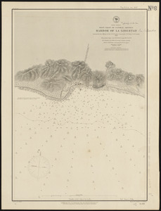
Date
Date range begin
–
Date range end
Current results range from
1711
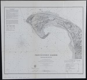
to
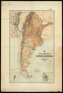
1935
View distribution
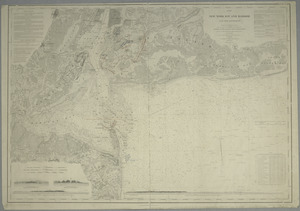
Creator
United States. Hydrographic Office
37
O.H. Bailey & Co
11
Sanborn, D. A. (Daniel Alfred), -1883
9
Humphreys, A. A. (Andrew Atkinson), 1810-1883
8
G.W. Bromley & Co.
6
United States. Army. Corps of Engineers
5
Collinson, Richard, Sir, 1811-1883
4
Kellett, Henry, 1806-1875
4
more
Creator
»
Format
Maps/Atlases
146
Manuscripts
2
Georeferenced
Yes
7
No
139
Collection
Norman B. Leventhal Map Center Collection
139
Urban Maps
49
Maritime Charts and Atlases
45
Boston and New England Maps
42
David Judkins Weaver Papers
4
Mapping Boston Collection
3
American Revolutionary War-Era Maps
2
New York Public Library Collection
2
more
Collection
»
Available to use
No known restrictions
138
Creative Commons license
6
Search Constraints
Sort by relevance
relevance
title
date (asc)
date (desc)
Number of results to display per page
20 per page
10
per page
20
per page
50
per page
100
per page
View results as:
grid view
map view
Search Results
61.
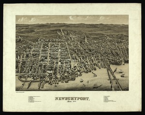
Newburyport, Mass
62.
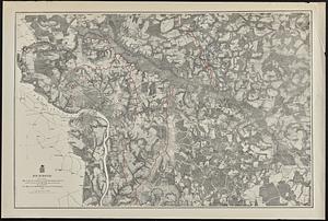
Richmond
63.
Atlas of Fall River City, Massachusetts
64.
Ohio boundary no. 1 South Bend of Lake Michigan : map, exhibiting the position occupied in the determination of the latitude of...
65.
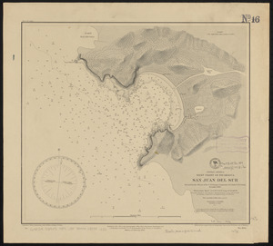
Central America, west coast of Nicaragua, San Juan del Sur
66.
Chart of the west coast of Sumatra between Rigas and Diah from actual survey
67.
China : sheet VIII eastern coast Hieshan Isles to the Yang-Tse-Kiang including the Chusan Islands
68.
New map of Boston giving all points of interest : with every railway & steamboat terminus, prominent hotels, theatres & public...
69.
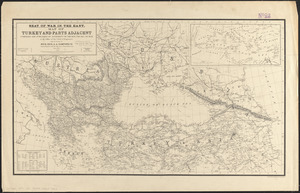
Seat of war in the east : map of Turkey and parts adjacent
70.
North America, west coast of Central America, harbor of La Libertad
71.
China
72.
Railway and highway map of the famous Berkshire Hills region, showing also villages and points of interest : from official...
73.
Ohio boundary no. 2 : map exhibiting the positions occupied on the Maumee Bay and river: viz: Turtle Island, the North Cape,...
74.
Campaign maps : Army of the Potomac : Map no. 3. White House to Harrison's Landing
75.
Campaign maps : Army of the Potomac : Map no. 2. Williamsburg to White House
76.
Provincetown Harbor, Massachusetts : from a trigonometrical survey under the direction of A.D. Bache Superintendent of the...
77.
Mapa geográfico de la Republica Argentina : compilado sobre la base de los datos mas recientes
78.
Sandy-Bay, Mass
79.
Map of New-York Bay and Harbor and the environs : [with colored manuscript additions to show positions of troops and fleets at...
80.
Washington and Marion counties
‹ Prev
Next ›
1
2
3
4
5
6
7
8