Search Constraints
Search Results
![The American Pilot [title page]](https://bpldcassets.blob.core.windows.net/derivatives/images/commonwealth:3f462z36r/image_thumbnail_300.jpg)

![American Twine & Fabric Corporation, Bldg., Salmon Falls, N.H. [insurance map]](https://bpldcassets.blob.core.windows.net/derivatives/images/commonwealth:ww72c034d/image_thumbnail_300.jpg)
![American Woolen Company and Textile Realty Company and the Pocono Company "Oil and Soap Plant," Medford, Mass. [insurance map]](https://bpldcassets.blob.core.windows.net/derivatives/images/commonwealth:ww72bz10f/image_thumbnail_300.jpg)
![American Woolen Company et al, "Anderson Mill No. 4 & Arms Mill," Skowhegan, Me. [insurance map]](https://bpldcassets.blob.core.windows.net/derivatives/images/commonwealth:4j03df372/image_thumbnail_300.jpg)
![American Woolen Company et al, "Arden Mills," Fitchburg, Mass. [insurance map]](https://bpldcassets.blob.core.windows.net/derivatives/images/commonwealth:ww72bx52r/image_thumbnail_300.jpg)
![American Woolen Company et al, "Foxcroft Division," Dover-Foxcroft, Maine [insurance map]](https://bpldcassets.blob.core.windows.net/derivatives/images/commonwealth:4j03df07b/image_thumbnail_300.jpg)
![American Woolen Company et al, "Kennebec Mills," Fairfield, Maine [insurance map]](https://bpldcassets.blob.core.windows.net/derivatives/images/commonwealth:4j03df11x/image_thumbnail_300.jpg)
![American Woolen Company et al, "Vassalboro Mills," North Vassalboro, Maine [insurance map]](https://bpldcassets.blob.core.windows.net/derivatives/images/commonwealth:4j03df35h/image_thumbnail_300.jpg)
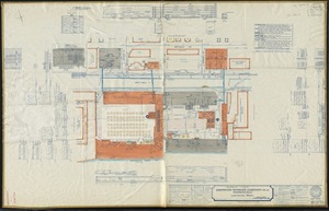
![American Woolen Company, et al, "Washington Mills," Lawrence, Mass. [insurance map]](https://bpldcassets.blob.core.windows.net/derivatives/images/commonwealth:ww72bz049/image_thumbnail_300.jpg)
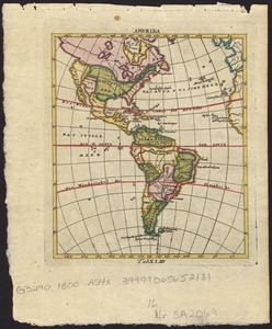
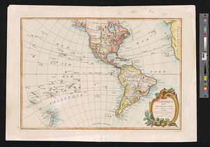
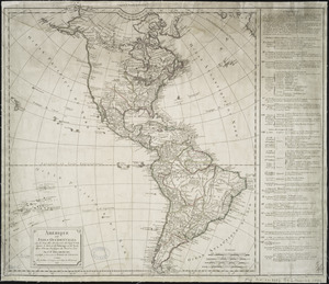
312. Amerika


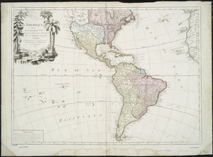
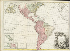
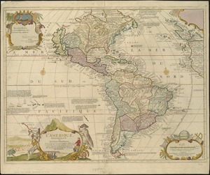
314. L'Amérique
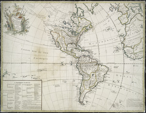


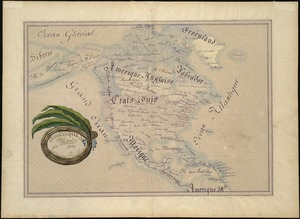
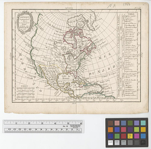
322. Amérique du Nord
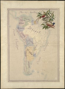
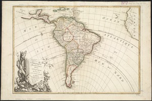
323. Amérique du Sud


![[Amerique septentrionale]](https://bpldcassets.blob.core.windows.net/derivatives/images/commonwealth:8336h2955/image_thumbnail_300.jpg)


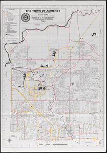
363. Amherst map & guide

364. Amherst, Mass


![[An outline plan of the harbour and fortifications of Louisbourg]](https://bpldcassets.blob.core.windows.net/derivatives/images/commonwealth:hx11z5128/image_thumbnail_300.jpg)
![[An unfinished chart of the Saint Lawrence River from Perrot Island to the Island of Orleans]](https://bpldcassets.blob.core.windows.net/derivatives/images/commonwealth:hx11z0836/image_thumbnail_300.jpg)
![[An unfinished tracing of Joshua Fisher's copy on parchment of Oliver's paper plat of land in Dorchester, made in 1661]](https://bpldcassets.blob.core.windows.net/derivatives/images/commonwealth:wd376179d/image_thumbnail_300.jpg)

372. Anatolia and Armenia


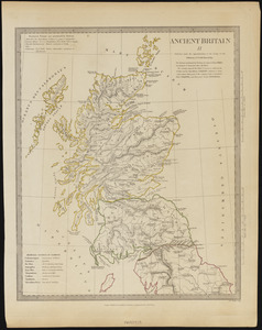
375. Ancient Britain II


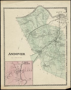
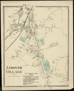
382. Andover

![Androscoggin Mills (Cotton Mill), Lewiston, Me. [insurance map]](https://bpldcassets.blob.core.windows.net/derivatives/images/commonwealth:4j03df194/image_thumbnail_300.jpg)
![Androscoggin Mills "No. 5 Mill" formerly Avon Mfg. Co., Lewiston, Me. [insurance map]](https://bpldcassets.blob.core.windows.net/derivatives/images/commonwealth:2r36vc17g/image_thumbnail_300.jpg)


388. Anglia Regnum


391. Annapolis Royal


396. Annexation map


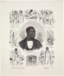
399. Anthony Burns
