Toggle navigation
LMEC Home
Exhibitions
Georeferencing
Tools for Teachers
Collections
My Favorites
Sign Up / Log In
Search
Search the map portal
Map Collection
Map Collection
Map Sets
Search
Search
Search for
Search In
All Fields
Creator
Title
Subject
Place
Search All Digital Collections
Advanced Search
104 Results
My Search
Start Over
g3700
Remove constraint g3700
Filter your Search
Place
United States
93
North and Central America
17
Mexico
6
North America
6
West Indies
5
Mesoamerica
3
Canada
2
Louisiana
2
more
Place
»
Topic
United States--Maps
74
United States--Maps--Early works to 1800
15
Mexico--Maps
6
North America--Maps
6
Railroads--United States--Maps
6
West Indies--Maps
6
Advertising cards--Specimens
4
Advertising--Coffee
4
more
Topic
»
Date
Date range begin
–
Date range end
Current results range from
1707
to
1923
View distribution
Creator
Geological Survey (U.S.)
8
Arbuckle Bros.
4
Young, J. H. (James Hamilton)
4
Colton, G. Woolworth (George Woolworth), 1827-1901
3
Arrowsmith, Aaron, 1750-1823
2
Bradley, Abraham, 1767-1838
2
Brightly, Joseph H., 1818-1901
2
Chapin, William, 1802-1888
2
more
Creator
»
Format
Maps/Atlases
104
Manuscripts
2
Georeferenced
Yes
25
No
79
Collection
Norman B. Leventhal Map Center Collection
104
American Revolutionary War-Era Maps
14
Boston and New England Maps
4
Available to use
No known restrictions
104
Search Constraints
Sort by relevance
relevance
title
date (asc)
date (desc)
Number of results to display per page
20 per page
10
per page
20
per page
50
per page
100
per page
View results as:
grid view
map view
Search Results
41.
Map of the United States, constructed from the latest authorities
42.
Map of the United States exhibiting the post-roads, the situations, connections & distances of the post-offices, stage roads,...
43.
Map of the United States exhibiting the several collection districts
44.
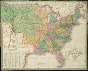
Map of the United States, from the latest surveys : with the heights of mountains and length of the principle rivers
45.
Map of the United States in North America : with the British, French and Spanish dominions adjoining, according to the treaty...
46.
Map of the United States including Oregon, Texas and the Californias
47.
Map of the United States of America
48.
Map of the United States of America
49.
Map of the United States of America, Mexico, Central America, and the West India Islands
50.
Map of the United States of America, the British provinces, Mexico, the West Indies and Central America, with part of New...
51.
A map of the United States of North America : drawn from a number of critical researches
52.
Map of the United States of North America
53.
Map of the United States of North America, upper & lower Canada, New Brunswick, Nova Scotia & British Columbia, Mexico, Cuba,...
54.
Map of the United States, the British provinces, Mexico, &c : showing the routes of the U.S. Mail steam packets to California,...
55.
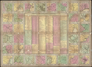
Maps of the vicinities of thirty-two of the principal cities and towns in the Union
56.
Massachusetts
57.
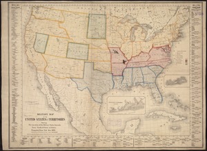
Military map of the United States
58.
Military map of the United States & territories showing the location of the military posts, arsenals, Navy Yards, & ports of...
59.
Mitchell's national map of the American Republic or United States of North America : together with maps of the vicinities of...
60.
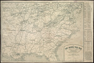
The model war map giving the southern & middle states, with all their water & railroad connections
‹ Prev
Next ›
1
2
3
4
5
6