Toggle navigation
LMEC Home
Exhibitions
Georeferencing
Tools for Teachers
Collections
My Favorites
Sign Up / Log In
Search
Search the map portal
Map Collection
Map Collection
Map Sets
Search
Search
Search for
Search In
All Fields
Creator
Title
Subject
Place
Search All Digital Collections
Advanced Search
13385 Results
Filter your Search
Place
North and Central America
9,353
United States
7,078
Suffolk (county)
1,664
Boston
1,621
Europe
1,035
Canada
949
Massachusetts
794
New York
532
more
Place
»
Topic
Boston (Mass.)--Maps
741
City planning--Massachusetts--Boston--Maps
418
United States--History--Revolution, 1775-1783--Maps
329
United States--Maps
315
Urban renewal--Massachusetts--Boston--Maps
254
Real property--Massachusetts--Boston--Maps
252
Massachusetts--Maps
219
Insurance surveys
197
more
Topic
»
Date
Date range begin
–
Date range end
Current results range from
1482
to
2023
View distribution
Creator
United States. Hydrographic Office
595
Boston Redevelopment Authority
403
Des Barres, Joseph F. W. (Joseph Frederick Wallet), 1722-1824
247
Royal United Services Institute for Defence and Security Studies
160
Jefferys, Thomas, -1771
154
George, III, King of Great Britain, 1738-1820
152
George, IV, King of Great Britain, 1762-1830
151
O.H. Bailey & Co
148
more
Creator
»
Format
Maps/Atlases
13,205
Manuscripts
985
Prints
102
Books
49
Drawings/Illustrations
44
Photographs
15
Objects/Artifacts
13
Documents
7
more
Format
»
Georeferenced
Yes
979
No
12,406
Collection
Norman B. Leventhal Map Center Collection
8,891
American Revolutionary War-Era Maps
3,305
Boston and New England Maps
2,804
Urban Maps
2,397
Maritime Charts and Atlases
1,150
William L. Clements Library Collection
910
Library of Congress Collection
618
Boston Redevelopment Authority Collection
475
more
Collection
»
Available to use
No known restrictions
9,952
Creative Commons license
1,677
Search Constraints
Sort by relevance
relevance
title
date (asc)
date (desc)
Number of results to display per page
50 per page
10
per page
20
per page
50
per page
100
per page
View results as:
grid view
map view
Search Results
12401.
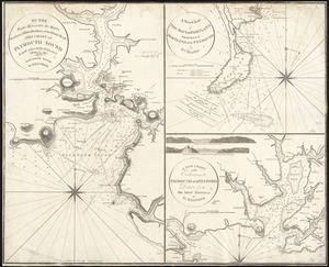
To the Right Honorable the Master, Wardens & Elder Brethren of the Trinity House, this Chart of Plymouth Sound is ... dedicated
12402.
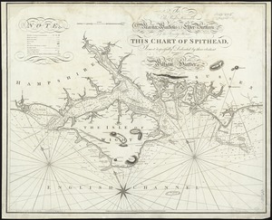
To the right honorable the master, wardens & elder brethren of the Trinity House, this chart of Spithead is ... dedicated
12403.
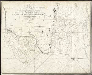
To the Right Honorable the Master, Wardens, and Elder Brethren, of the Trinity House, this chart of the Downs and Margate Roads...
12404.
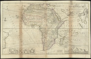
To the Right Honourable Charles, Earl of Peterborow, and Monmouth, &c. this map of Africa, according to ye newest and most...
12405.
To the Right Honourable, Charles Earl of Sunderland, and Baron Spencer of Wormleighton, one of Her Majesty's principal...
12406.
To the Right Honourable John Lord Sommers, Baron of Evesham in ye county of Worcester, president of Her Majesty's most...
12407.
To the right honourable, the Earl of Shelbourne, His Majesty's principal Secretary of State for the Southern Department : this...
12408.
To the Right Honourable the Master, Wardens, & Elder Bretham of the Trinity House, this chart of the entrances to The River...
12409.
To the Right Honourable William, Lord Cowper, Lord High Chancellor of Great Britain, this map of Asia : according to ye newest...
12410.
To the rt. honble. the Earl of Halifax, first lord commissioner of trade & plantations, &c &c this chart of Chibucto Harbour,...
12411.
To the Rt. Honble. the Earl of Hillsborough & the rest of the Lords, Commissioners for Trade & Plantations. This Plan is most...
12412.
To the select-men of the town of Boston, in the Commonwealth of Massachusetts; ever distinguished for their zeal for the good...
12413.
Tobago
12414.
Tobago from actual surveys and observations
12415.
Tomlinsons map of Petersburg : showing the scene of Genl. Grants operations
12416.
Tonto National Forest, Arizona
12417.
Topographia aug. Turon. ducatus et confinium Galliae celticae sinu complectitur cuius latitudo ab aequinoctiali versus...
12418.
Topographic & detail sheets of Rainy Lake & upper boundary waters
12419.
Topographic map of Boston, Mass.
12420.
Topographic map of Brighton and Allston
12421.
Topographic map of Clinton County, Illinois
12422.
Topographic map of Gallatin County, Illinois
12423.
Topographic map of Hardin County, Illinois
12424.
Topographic map of Lawrence County, Illinois
12425.
The topographic map of Manchoukuo
12426.
Topographic map of Massachusetts and Rhode Island
12427.
Topographic map of McDonough County, Illinois
12428.
Topographic map of Monroe County, Illinois
12429.
Topographic map of Randolph County, Illinois
12430.
Topographic map of the Island of Niihau, Kauai County, Hawaii
12431.
Topographic map of the Plattsburg Training Camp, New York
12432.
Topographic map, Washington Park project r-24
12433.
A topographical chart of the bay of Narraganset in the province of New England : with all the isles contained therein, among...
12434.
A topographical chart of the bay of Narraganset in the province of New England : with all the isles contained therein, among...
12435.
A topographical chart of the bay of Narraganset in the province of New England, with all the isles contained therein, among...
12436.
Topographical map, Gettysburg-Antietam
12437.
Topographical map of Blue Hills Reservation
12438.
Topographical map of Cedar Square, Roxbury
12439.
A topographical map of Essex County, Massachusetts : based upon the trigonometrical survey of the state
12440.
Topographical map of Fairmount Park, Philadelphia : excepting Wissahickon Valley
12441.
A topographical map of Hampshire County Massachusetts : based upon the trigonometrical survey of the state
12442.
Topographical map of Meekatharra
12443.
Topographical map of Middlesex Fells Reservation
12444.
Topographical map of Pittsfield, Berkshire Co., Mass : from actual surveys and records
12445.
A topographical map of Steuben Co., New York : from actual surveys
12446.
Topographical map of the approaches and defences of Knoxville, E. Tennessee, shewing the positions occupied by the United...
12447.
Topographical map of the City and County of New-York, and the adjacent country : with views in the border of the principal...
12448.
Topographical map of the counties of St. John and Kings, New Brunswick
12449.
Topographical map of the District of Columbia
12450.
Topographical map of the District of Columbia and a portion of Virginia
‹ Prev
Next ›
1
2
…
245
246
247
248
249
250
251
252
253
…
267
268