Search Constraints
Search Results

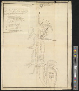
![[Rough draft of Charlestown, in water colour]](https://bpldcassets.blob.core.windows.net/derivatives/images/commonwealth:z603vj49v/image_thumbnail_300.jpg)
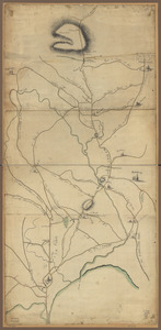
![[Rough draught of Boston and harbour]](https://bpldcassets.blob.core.windows.net/derivatives/images/commonwealth:z603vj39m/image_thumbnail_300.jpg)
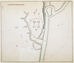
11156. Rough PLAN of FORT LIGONIER

11159. Roumania


11163. Route map of Massachusetts


11170. Roxbury


11185. Ruatan or Rattan


11190. Rumänien und Bulgarien


11192. Russell


11197. Russia


