Toggle navigation
LMEC Home
Exhibitions
Georeferencing
Tools for Teachers
Collections
My Favorites
Sign Up / Log In
Search
Search the map portal
Map Collection
Map Collection
Map Sets
Search
Search
Search for
Search In
All Fields
Creator
Title
Subject
Place
Search All Digital Collections
Advanced Search
104 Results
My Search
Start Over
g3700
Remove constraint g3700
Filter your Search
Place
United States
93
North and Central America
17
Mexico
6
North America
6
West Indies
5
Mesoamerica
3
Canada
2
Louisiana
2
more
Place
»
Topic
United States--Maps
74
United States--Maps--Early works to 1800
15
Mexico--Maps
6
North America--Maps
6
Railroads--United States--Maps
6
West Indies--Maps
6
Advertising cards--Specimens
4
Advertising--Coffee
4
more
Topic
»
Date
Date range begin
–
Date range end
Current results range from
1707
to
1923
View distribution
Creator
Geological Survey (U.S.)
8
Arbuckle Bros.
4
Young, J. H. (James Hamilton)
4
Colton, G. Woolworth (George Woolworth), 1827-1901
3
Arrowsmith, Aaron, 1750-1823
2
Bradley, Abraham, 1767-1838
2
Brightly, Joseph H., 1818-1901
2
Chapin, William, 1802-1888
2
more
Creator
»
Format
Maps/Atlases
104
Manuscripts
2
Georeferenced
Yes
25
No
79
Collection
Norman B. Leventhal Map Center Collection
104
American Revolutionary War-Era Maps
14
Boston and New England Maps
4
Available to use
No known restrictions
104
Search Constraints
Sort by relevance
relevance
title
date (asc)
date (desc)
Number of results to display per page
20 per page
10
per page
20
per page
50
per page
100
per page
View results as:
grid view
map view
Search Results
21.
F.T. Neely's new commercial map of the United States, Canada, British Columbia, and Northern Mexico, showing all the railroads,...
22.
G. Woolworth Colton's new guide map of the United States & Canada : with railroads, counties etc
23.
An improved map of the United States
24.
Karte von Nord-America für den schul- und privatgebrauch
25.
Lloyd's new county map of the United States and Canadas showing battle fields, railroads, &c., compiled from the latest...
26.
Manuscript map of the United States
27.
Manuscript maps of U.S. states
28.
Manuscript maps of U.S. states, possibly drawn by a schoolchild
29.
A Map of the British American plantations, extending from Boston in New England to Georgia : including all the back settlements...
30.
A map of the northern and middle states : comprehending the western territory & the British dominions in North America : from...
31.
Map of the public land states and territories : constructed from the Public Surveys and other official sources in the General...
32.
Map of the United States
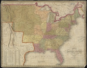
33.
Map of the United States
34.
Map of the United States : intending chiefly to exhibit the post roads & distances
35.
Map of the United States
36.
A map of the United States
37.
A map of the United States and Canada, New-Scotland, New-Brunswick and New-Foundland = Carte des Etats-Unis avec le Canada, la...
38.
Map of the United States and territories with adjacent parts of Canada and Mexico, also part of the West India Islands :...
39.
Map of the United States, British & Central America : from state documents & unpublished materials
40.
Map of the United States, constructed from the latest authorities
‹ Prev
Next ›
1
2
3
4
5
6