Toggle navigation
LMEC Home
Exhibitions
Georeferencing
Tools for Teachers
Collections
My Favorites
Sign Up / Log In
Search
Search the map portal
Map Collection
Map Collection
Map Sets
Search
Search
Search for
Search In
All Fields
Creator
Title
Subject
Place
Search All Digital Collections
Advanced Search
70 Results
My Search
Start Over
"G1201.S1 P3 1932"
Remove constraint "G1201.S1 P3 1932"
Filter your Search
Place
United States
70
Topic
United States--Maps
70
Elections--United States--Maps
33
Population density--United States--Maps
14
Suffrage--United States--Maps
6
Voting--United States--Maps
6
Public Lands--United States--Maps
4
Women--Suffrage--United States--Maps
4
Acquisition of territory--United States--Maps
1
more
Topic
»
Date
1932
70
Creator
Paullin, Charles Oscar, 1868 or 1869-1944
70
Wright, John Kirtland, 1891-1969
70
Format
Maps/Atlases
70
Georeferenced
Yes
23
No
47
Collection
Norman B. Leventhal Map Center Collection
70
Search Constraints
Sort by relevance
relevance
title
date (asc)
date (desc)
Number of results to display per page
20 per page
10
per page
20
per page
50
per page
100
per page
View results as:
grid view
map view
Search Results
21.
Electoral vote for President, 1796
22.
Kansas-Nebraska Act, May 22, 1854, Vote on passage
23.
Missouri Compromise, March 20, 1820, Vote on striking out provisions restricting slavery
24.
Presidential and other elections, 1800
25.
Presidential and other elections, 1804
26.
Presidential and other elections, 1808
27.
Presidential and other elections, 1812
28.
Presidential and other elections, 1816
29.
Presidential election 1820
30.
Presidential election 1824
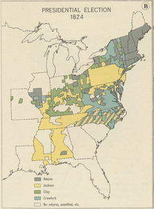
31.
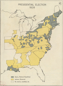
Presidential election 1828
32.
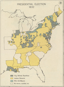
Presidential election 1832
33.
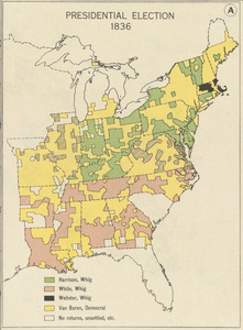
Presidential election 1836
34.
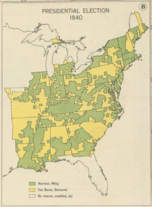
Presidential election 1840
35.
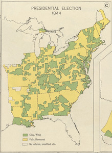
Presidential election 1844
36.
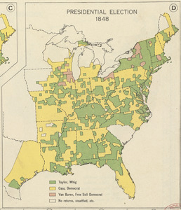
Presidential election 1848
37.
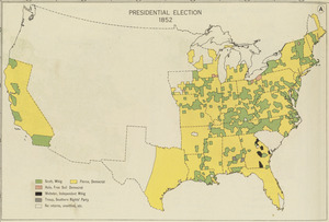
Presidential election 1852
38.
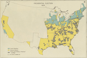
Presidential election 1856
39.
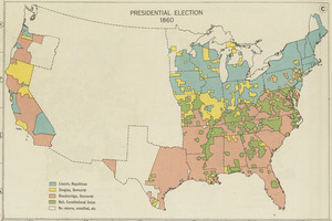
Presidential election 1860
40.
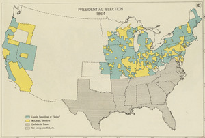
Presidential election 1864
‹ Prev
Next ›
1
2
3
4