Toggle navigation
LMEC Home
Exhibitions
Georeferencing
Tools for Teachers
Collections
My Favorites
Sign Up / Log In
Search
Search the map portal
Map Collection
Map Collection
Map Sets
Search
Search
Search for
Search In
All Fields
Creator
Title
Subject
Place
Search All Digital Collections
Advanced Search
13385 Results
Filter your Search
Place
North and Central America
9,353
United States
7,078
Suffolk (county)
1,664
Boston
1,621
Europe
1,035
Canada
949
Massachusetts
794
New York
532
more
Place
»
Topic
Boston (Mass.)--Maps
741
City planning--Massachusetts--Boston--Maps
418
United States--History--Revolution, 1775-1783--Maps
329
United States--Maps
315
Urban renewal--Massachusetts--Boston--Maps
254
Real property--Massachusetts--Boston--Maps
252
Massachusetts--Maps
219
Insurance surveys
197
more
Topic
»
Date
Date range begin
–
Date range end
Current results range from
1482
to
2023
View distribution
Creator
United States. Hydrographic Office
595
Boston Redevelopment Authority
403
Des Barres, Joseph F. W. (Joseph Frederick Wallet), 1722-1824
247
Royal United Services Institute for Defence and Security Studies
160
Jefferys, Thomas, -1771
154
George, III, King of Great Britain, 1738-1820
152
George, IV, King of Great Britain, 1762-1830
151
O.H. Bailey & Co
148
more
Creator
»
Format
Maps/Atlases
13,205
Manuscripts
985
Prints
102
Books
49
Drawings/Illustrations
44
Photographs
15
Objects/Artifacts
13
Documents
7
more
Format
»
Georeferenced
Yes
979
No
12,406
Collection
Norman B. Leventhal Map Center Collection
8,891
American Revolutionary War-Era Maps
3,305
Boston and New England Maps
2,804
Urban Maps
2,397
Maritime Charts and Atlases
1,150
William L. Clements Library Collection
910
Library of Congress Collection
618
Boston Redevelopment Authority Collection
475
more
Collection
»
Available to use
No known restrictions
9,952
Creative Commons license
1,677
Search Constraints
Sort by date (asc)
relevance
title
date (asc)
date (desc)
Number of results to display per page
50 per page
10
per page
20
per page
50
per page
100
per page
View results as:
grid view
map view
Search Results
9551.
Map showing the comparative merits, and benefits to Massachusetts, of the proposed extension of the New York and Massachusetts...
9552.
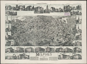
Milford, Massachusetts : 1888
9553.
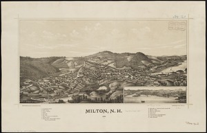
Milton, N.H : 1888
9554.
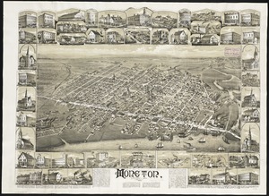
Moncton, New Brunswick
9555.
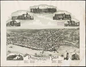
Narragansett Pier, Rhode Island : 1888
9556.
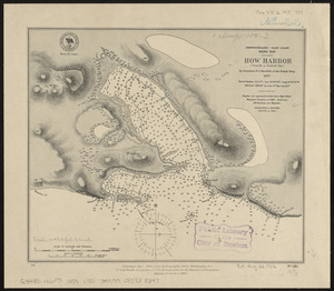
Newfoundland - east coast, Hare Bay, How Harbor (Outarde or Bustard Bay)
9557.
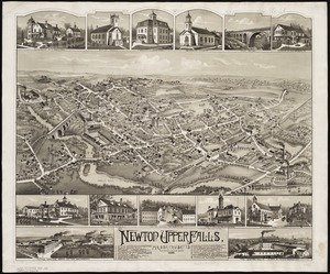
Newton Upper Falls, Massachusetts, 1888
9558.
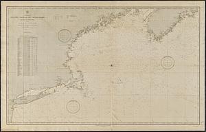
North America, Atlantic coast of the United States Halifax to New York with southern part of Nova Scotia : compiled from the...
9559.
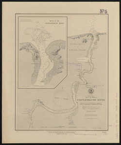
North America, Dominion of Canada, Gulf of Saint Lawrence, south coast of Quebec from Washtawooka Bay to Cape Mackinnon :...
9560.
North America, Dominion of Canada, Gulf of St. Lawrence, Magdalen Islands : from a British survey in 1833
9561.
North America, east coast, Gulf of Mexico, the Gulf coast of Mexico, sheet 1 : from the Rio Grande to Cape Roxo
9562.
North America, east coast, Gulf of Mexico, the Gulf coast of Mexico, sheet 2 : from Tampico to Campeche Bank
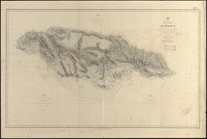
9563.
North America, east coast, West Indies, Jamaica : from British surveys from 1873 to 1881
9564.
North America, Gulf of Mexico, Coatzacoalcos River : from a survey by the U.S. Tehuantepec Expedition, in 1870-71, Captain...
9565.
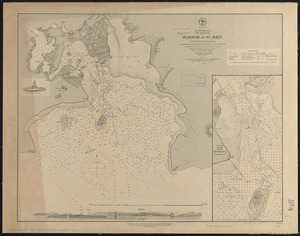
North America, New Brunswick, Harbor of St. John : from the latest British surveys
9566.
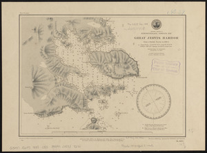
North America, Newfoundland, Despair Bay, Great Jervis Harbor : from a British survey in 1884-5
9567.
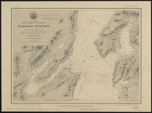
North America, Newfoundland, Fortune Bay, Harbor Breton from a British survey in 1882
9568.
North America, Newfoundland, Hermitage Bay, Gaultois and Picarre Harbors : from a British survey in 1883
9569.
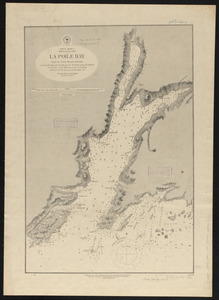
North America, Newfoundland, La Poile Bay : from the latest British surveys
9570.
North America, Newfoundland, Saint John's Harbor : from a British survey in 1885
9571.
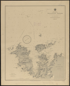
North America, Newfoundland, Twillingate Harbors (Toulinguet Harbors) : from a British survey in 1877
9572.
North America, Pacific coast of the United States and Mexico, San Francisco to San Blas : compiled from the latest United...
9573.
North America, south coast of Newfoundland from the Burgeo Islands to Cape St. Mary : compiled from the latest information
9574.
North America, south coast of Newfoundland, Lamalin anchorages : from a British survey in 1884
9575.
North America, south coast of Newfoundland, Miquelon Islands : from a French survey in 1841
9576.
North America, west and south coasts of Newfoundland, from Bonne Bay to the Burgeo Islands : compiled from the latest information
9577.
North America, west coast, anchorages on the west coast of Mexico : from a survey by Commander J.W. Philip, U.S.N. and the...
9578.
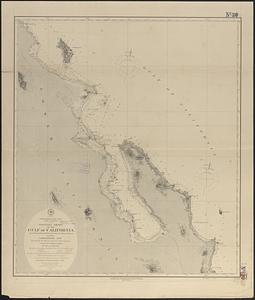
North America, west coast, Gulf of California, mouth of the Colorado River
9579.
North America, west coast, harbors on the west coast of Mexico : from a survey by Commander J.W. Philip, U.S.N. and the...
9580.
North America, west coast, lower California, western shore of the Gulf of California, from Pulpito Point (San Basilio Bay) to...
9581.
North America, west coast, lower California, western shore of the Gulf of California, from Sn. Marcial Pt. to Sn. Basilio Bay
9582.
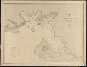
North America, west coast of Central America, Gulf of Fonseca
9583.
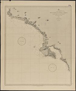
North America, west coast of Central America, Judas Point to Burica Point
9584.
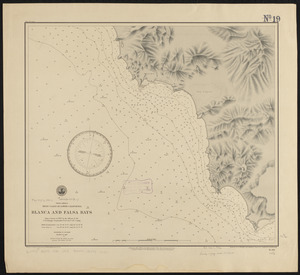
North America, west coast of lower California, Blanca and Falsa Bays : from a survey in 1887 by the officers of the U.S.S....
9585.
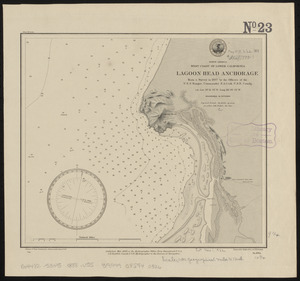
North America, west coast of lower California, Lagoon Head Anchorage : from a survey in 1887 by the officers of the U.S.S....
9586.
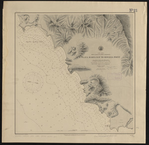
North America, west coast of lower California, Playa Maria Bay to Rosalia Point : from a survey in 1887 by the officers of the...
9587.
North America, west coast of lower California, Rosario Bay and Sacramento Reef : from a survey in 1887 by the officers of the...
9588.
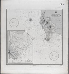
North America, west coast of lower California, San Quentin Bay : from a survey in 1886 by the officers of the U.S.S. Ranger,...
9589.
North America, west coast of lower California, Santa Rosalia Bay : from a survey in 1887 by the officers of the U.S.S. Ranger,...
9590.
North America, west coast of lower California, Soledad Bay and Santo Tomas Anchorage : from a survey in 1886 by the officers of...
9591.
North America, west coast of lower California, Todos Santos Bay : from a survey in 1886 by the officers of the U.S.S. Ranger,...
9592.
North America, west coast of Mexico, Chamela Bay to Maldonado : surveyed by the officers of the U.S.S. Tuscarora in 1878-9 and...
9593.
North America, west coast of Mexico, eastern shore of the Gulf of California, harbor of Altata
9594.
North America, west coast of Mexico, harbor of Mazatlan : from British surveys in 1828 & 1863 corrected for the latest information
9595.
North America, west coast of Newfoundland, Cow Head Harbor and White Rock Bay : from French surveys in 1857 & 1881
9596.
North America, west coast, west coast of lower California, Abreojos Point and Ballenas Bay
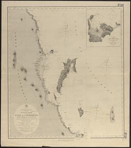
9597.
North America, west coast, west coast of Mexico and the Gulf of California : from a survey by Comdr. Geo. Dewey U.S.N., and the...
9598.
North America, west coast, west coast of Mexico from Mazatlan to Tenacatita Bay : from a survey made by Comdr. Geo. Dewey...
9599.
North America, west coast, west coast of Mexico, Manzanilla and Santiago Bays : from a survey by Commander J.W. Philip U.S.N.,...
9600.
North America--north east coast, north and east coasts of Newfoundland, from Ste. Geneviève Bay to Orange Bay and Strait of...
‹ Prev
Next ›
1
2
…
188
189
190
191
192
193
194
195
196
…
267
268